


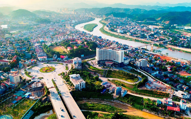
The entire province of Lao Cai with a total natural area of 6,364.03 km2, including 9 administrative units: Lao Cai City, Sa Pa Town, and 7 districts. It borders Ha Giang province to the east, Yen Bai province to the south, Lai Chau province to the west, and Yunnan province, China to the north.
Lao Cai province is one of the few mountainous areas in northern Vietnam with varying high and low terrains. It is also the only place in our country with many mountains over 2,800m, of which the most famous is Fansipan Peak, which is 3,143m high and is known as the “Roof of Vietnam” and the “Roof of Indochina”.
According to the 2021-2030 provincial plan for Lao Cai, with a vision to 2050 approved by the Prime Minister, by 2030, the province will become a high-growth area and a trade hub connecting Vietnam and ASEAN countries with the Southwest China region.
Notably, in terms of roads, by 2025, the province will complete the construction of the Nội Bài – Lào Cai expressway; complete the construction and upgrade of National Highways 70, 4, 4D, 4E, and 279 to at least Grade IV-III. The province will also study the construction of bypass roads, mountain tunnels, overpasses, or underpasses suitable for each plan.
In terms of railways, a plan will be implemented to connect and construct a railway line between Lao Cai station (Lao Cai province, Vietnam) and Hekou North station (Yunnan province, China). The province will invest in the standard gauge 1,435 mm Lào Cai – Hanoi – Hai Phong railway line by 2030. The Pho Lu – Cam Duong railway line will be renovated, and the Cam Duong – Dong Ho ore transport railway line will be relocated outside the urban center.
For aviation, Lao Cai will complete the construction of Sa Pa Airport to meet 4C standards, aiming to become an international airport. In addition, the province will study the construction of heliports in Bac Ha district, Bat Xat district, Sa Pa town, and Lao Cai City to serve tourism development and search and rescue activities.
In terms of waterways, the province will invest in the construction of ports along the Chay River from Bao Nhai to Coc Ly and the Bac Ha lake area. It will also call for investment and construction of an inland waterway route along the Hong River from Yen Bai province to the Nậm Thi junction (Lao Cai City), reaching Grade III to promote tourism and cargo transportation. Ports such as Luc Cau (Kim Thanh), Pho Moi, Pho Lu, Bao Ha, and other ports will be built…
For dry ports, the province will develop a dry port system, the Lao Cai dry port cluster, with a total cargo clearance capacity of over 1,500,000 TEUs by 2030, located in Lao Cai City, the Kim Thanh – Ban Vuoc area, the Sa Pa Airport area, and other ports as needed.
Details of Lao Cai’s transportation network by 2030
In the period 2021-2030, Lao Cai’s transportation network will consist of 42 roads and bridges, 6 railway lines, 1 Sa Pa airport. Specifically:
– National roads include: National Highway 70, National Highway 4D, National Highway 4, National Highway 4E, National Highway 279.
– Expressways: Hanoi-Lao Cai expressway with 6 lanes.
– Provincial roads: DT.151, DT.151B, DT.151C, DT.152, DT.152B, DT.153.
– Bypass roads: DT.154, DT.155, DT.156, DT.156B, DT.157, DT.158, DT.159, DT.160, DT.161, DT.162.
– Other transportation works: Trinh Tuong – Phin Ho – Y Ty Road, Sa Pa – Hau Thao Road, Lang Giang – National Highway 70 Road, Vo Lao – Sa Pa Airport Intersection, Connecting Road from QL.4D Bypass – Sa Pa, Connecting Road from Sa Pa Airport – DT.161 – QL.70 – QL.279, Coc My – Y Ty Road, Tang Loong – IC17 – Tran Hung Dao, Sa Pa – Ban Den – Thanh Kim – Ban Phung – Ta Thang – DT.152 – Pho Lu Intersection, Lao Cai City – Ta Phoi – U Si Sung – Ban Phung – Thanh Kim and connecting with DT.152 at Ban Den;
Connecting route from Sa Pa to Bat Xat via Sa Pa – Ta Phin – Ngoi San – Phin Ngan – Quang Kim – Provincial Road 156 and connecting to the golf course; Connecting road from Sa Pa Airport to Sa Pa town center; Connecting road from Sa Pa Airport to Lao Cai Border Economic Zone; Construct a connecting road from Den Sang commune (Bat Xat district, Lao Cai province) to Sin Sui Ho (Phong Tho district, Lai Chau province);
Build a road bridge across the Hong River in the Bat Xat (Vietnam) – Ba Sai (China) area; Build the Phu Thinh bridge; Build other bridges across the Hong River; Build a road bridge across the Lung Po stream from A Mu Sung commune, Bat Xat district to Kim Binh district, Yunnan province, China; bridge across the Chay River at Hua Thuong, Si Ma Cai district; Other interprovincial and interdistrict roads to serve economic and social development in the province.
– Railways: Lao Cai – Hekou North (China) railway line (4.8km); Lao Cai – Hanoi – Hai Phong standard gauge railway line (392km), Yen Vien – Lao Cai railway line (296km), Pho Lu – Cam Duong railway line (25km), Relocation of the Cam Duong – Dong Ho ore transport railway line out of the urban center (25km), Pho Lu – Xuan Giao port railway line – Apatit Lao Cai mine (15km), Lao Cai dry port – Lao Cai railway station (3km).


