As you step out onto the streets today, you may witness an unfamiliar sight: people wearing large, modern backpacks, moving through the streets. This is not the usual scene we see every day. These individuals are not tourists or long-distance walkers, but are actually part of a new project that Apple is implementing in Vietnam: ground surveying to improve Apple Maps.
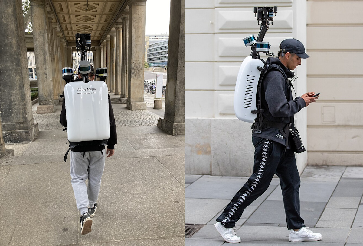
Apple backpackers on the streets – Photo: soyacincau
This ground survey project is part of Apple’s global effort to improve the quality of their map data. Starting from February 16th, advanced technology-equipped survey teams will begin ground surveying in Vietnam. The goal of this project is to create a more vibrant, accurate, and comprehensive map experience for Apple Maps users. From main roads to small alleys, every detail is recorded to provide accurate directions and real-life imagery to users.
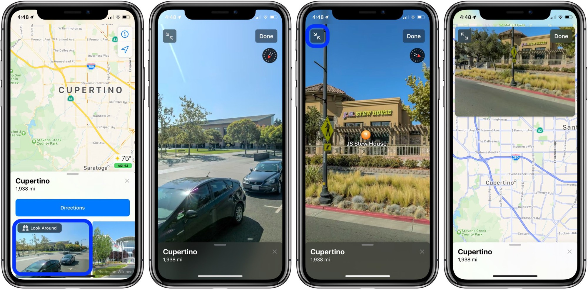
This data collection will serve the Look Around feature on Apple Maps, similar to Google’s Street View.
The technology behind the backpack
Those backpacks you see on the street are not ordinary backpacks carrying personal belongings. They are equipped with LiDAR technology along with advanced sensors and cameras. This technology allows for the collection of highly detailed and accurate 3D spatial data, which helps build high-resolution digital maps. As a result, Apple Maps will be able to display street images and locations with an unprecedented level of realism. This not only makes it easy for users to find their way, but also provides an immersive virtual travel experience.
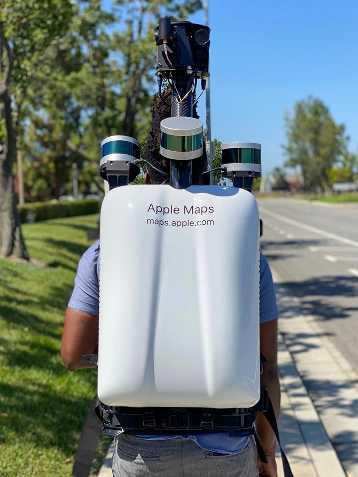
A close-up of Apple’s “high-tech” backpack for surveyors – Photo: mothership
Improving Apple Maps brings tangible benefits to users. Vietnamese people will experience more accurate navigation features and richer, more detailed location information. This accuracy and diversity will make Apple Maps more appealing than competitors like Google Maps, especially in the context of Vietnamese people’s current preference for Google Maps due to its rich data and familiarity with the service.
Apple pays special attention to privacy and data security during the survey process. It is known that Apple guarantees that all collected images will be processed to blur faces and license plates before being published on the system. This ensures the privacy of individuals and avoids potential legal issues in the future.
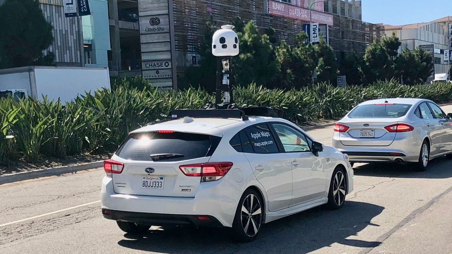
Apple’s image-collecting car used for similar purposes as the backpackers – Photo: 9to5Mac
The presence of Apple Maps survey teams in Vietnam is evidence of Apple’s investment and commitment to providing high-quality map data for Vietnamese users. This project not only enhances the user experience but also opens up new directions for map technology development in Vietnam. With these improvements, Apple Maps is not just a navigation tool but also a window for users to explore the world realistically and vividly, while competing with Google Maps, which is currently the leading route search tool in the S-shaped country.

On the official Apple Maps website, users can provide feedback or request blurring of faces, license plates, private houses, etc. by contacting them directly via email.


