


 Dominates Solo in Two Wind Power Projects with a Combined Investment of Nearly VND 14,700 Billion")
 Announces Dividend Payment Date: Chairman Co Gia Tho’s Family Group Set to Receive 5.15 Million New Shares and VND 51.5 Billion in Cash")


The People’s Committee of Bac Giang Province recently issued a Decision approving the Master Plan for Sub-area 8, Bac Giang City, Bac Giang Province, with a scale of 1/2,000.
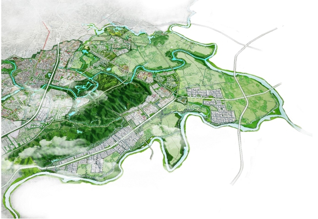
Master Plan for Sub-area 8, Bac Giang City, Bac Giang Province.
Specifically, the planning area is located within the administrative boundaries of Nham Bien town and the communes of Yen Lu, Canh Thuy, and Tien Dung. The boundaries are limited to the north by the Nham Bien mountain and the Thuong River; to the west and south by the Cau River and Que Vo town, Bac Ninh province; to the east by the communes of Duc Giang and Tu Mai.
The planning area covers approximately 4,378 hectares; the estimated population by 2030 is about 60,000 people, and by 2045 it is about 90,000 people. In terms of nature, this is a southern gateway urban area, an important transportation hub connecting Bac Ninh, Hai Duong, and Quang Ninh provinces. It is a creative and productive urban area, a new economic development center of Bac Giang City with an attractive and modern urban ecological space.
The planning area has a strategic location of the province, surrounded by many industrial zones, and connected to many important transportation routes. In terms of research content requirements, it is necessary to well exploit the strategic location, utilize the advantages of industrial development with technology-driven industries to promote strong urban economic growth, and increase the attractiveness of experts and labor forces to live and work in Bac Giang.
According to urban design, landscape design of key and focal areas, along main roads, open spaces, and landmark buildings. The key and focal areas are identified as education and training centers, high-tech industrial production centers, port areas for trade with neighboring provinces by waterways, which are characteristic spaces and powerhouses for development in the southern part of the city.
The main roads are identified as provincial road 398, North-South axis 1 and 2 (according to the Master Plan), which are both interregional transportation routes and the main urban axis, prioritizing the development of high-rise buildings, connecting the main functional areas, focal areas,…


