


At the recent 15th session of the People’s Council (May 19), the Ho Chi Minh City People’s Committee presented the “Adjusted Master Plan for Ho Chi Minh City by 2040, with a vision towards 2060”
According to the People’s Committee, the previous Master Plan lacked a clear vision for urban development. It did not explicitly mention the model for urban exploitation and development oriented towards high-capacity public transport (known as TOD) – a trend that the world has been embracing.
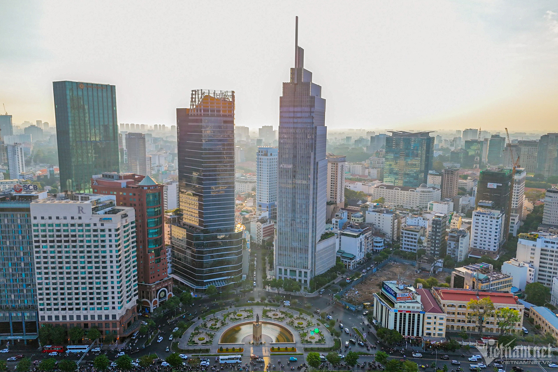 Developing TOD models will help Ho Chi Minh City decongest the overloaded urban center. Photo: Nguyen Hue |
Therefore, in this plan, the city has oriented and identified areas for development following the TOD model.
These TOD cities will prioritize being attached to new development centers, combining urban renovation in some potential areas, in line with the plan and progress of metro line construction.
Additionally, the plan also proposes a TOD model for the vicinity of transport hubs along the Ring Road 3 under the National Assembly’s Resolution 98.
Specifically, within the scope of the Ring Road 3 project, respecting the current development status, rearranging to increase density in metro stations and adjacent areas to key transport hubs following the TOD model; reducing density in the remaining areas to renovate and upgrade the urban area, creating land funds for supplementing greenery, building social infrastructure, and technical infrastructure gradually ensuring national standards and towards higher goals: “forming urban centers and dynamic areas for specialized urban development.”
The Trend of Megacities
Previously, at a workshop on the development of Ho Chi Minh City’s TOD, Prof. Dr. Dang Hung Vo (consultant, World Bank) shared that in the last 15 years, Vietnam has paid great attention to urban planning and spatial organization in the form of TOD. According to him, this trend is suitable for a megacity like Ho Chi Minh City.
Mr. Shige Sakaki (Transport Program Coordinator, World Bank in Vietnam) opined that TOD is a model of urban development based on the use of public transport.
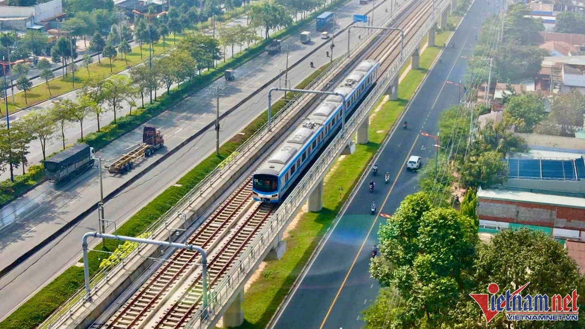
The focus of TOD models is a closed public transport system, making it accessible to residents. Photo: Nguyen Hue |
In such a model, the community lives and works within a 5- to 10-minute walking distance from public transport access points to schools, hospitals, workplaces, or commercial shopping areas…
At the workshop, Prof. Vu Anh Tuan (Vietnam-Germany Transport Research Center) stated that TOD aims to support and restructure urban areas and public transport systems to create a good, efficient, and sustainable urban environment.
This model will reduce private vehicles and mitigate environmental issues such as traffic jams, pollution, and congestion, which are common problems in megacities.
The experts shared the view that developing TOD creates satellite cities, helping to decongest urban spaces and population density in the city’s central areas, which are currently overloaded.
Pilot along the Metro System
In an interview, Architect Ngo Viet Nam Son affirmed that successfully implementing the TOD model would be an urban revolution not only for Ho Chi Minh City but also for the whole country.
According to him, for now, Ho Chi Minh City can pilot the model along the metro lines.
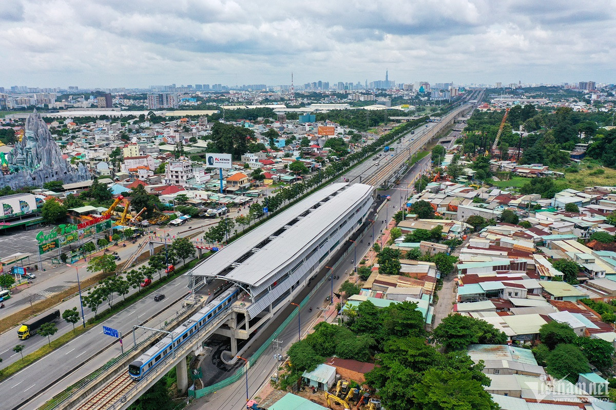
Ho Chi Minh City will prioritize TOD development along metro lines and stations. Photo: Nguyen Hue |
Specifically, the core impact area of TOD along the metro line needs to be planned with a radius of 50-200m (calculated from the road axis). As for the metro stations, the impact radius will be 400-800m.
Regarding implementation, Prof. Dang Hung Vo emphasized the need for consensus from the community living in the development area.
Additionally, two issues need attention: land for developing public transport connections between “grid cities” and land use transformation to reorganize urban spaces.
For land development for transport, the mechanism of state land recovery is reasonable as these are infrastructure projects serving the public interest.
The most suitable mechanism for “land use transformation” in “grid cities” is the “land use right contribution and adjustment” mechanism successfully implemented in many countries.
On this issue, according to Architect Nam Son, implementing TOD must accept the market mechanism. That is, land compensation must be at market prices (actual buying and selling prices).
The benefit of this mechanism is that it significantly reduces complaints and petitions (like in the Thu Thiem and Hi-Tech Park projects). The state will soon have clean land, conduct auctions, and attract strategic investors to implement TOD.
Architect Nam Son affirmed that after the auction, the state would have a substantial revenue source, usually at least recovering the money spent on infrastructure projects, after deducting all costs. Implementing this mechanism also establishes a new value baseline for the real estate market in these urban areas.
According to the experts, to develop TOD along the metro lines, it is necessary to synchronize various tasks simultaneously.
Along with the implementation of the metro lines, the bus system connecting the stations must also be deployed synchronously, forming a closed public transport network.
Additionally, land recovery, compensation, clearance, and auctions must be implemented concurrently. This demonstrates the need for close coordination between departments, between investors, the state, and the people (within the TOD’s impact area).
Moreover, while Resolution 98 allows for piloting, a more specific legal framework is necessary, including decrees and circulars, to serve as a legal basis for implementation.
With such a framework, leaders can rest assured of acting within legal boundaries. In addition, implementing TOD requires public-private cooperation due to limited state budget.
|
According to Prof. Dr. Dang Hung Vo, the goal of TOD is to create urban areas easily accessible by public transport, reduce dependence on private vehicles, promote a sustainable and environmentally friendly lifestyle, and organize them in a network connected by public transport. Each city at the grid points usually has a high population density and combines diverse functions such as housing, workplaces, commercial – service – entertainment facilities… |
Ho Van


