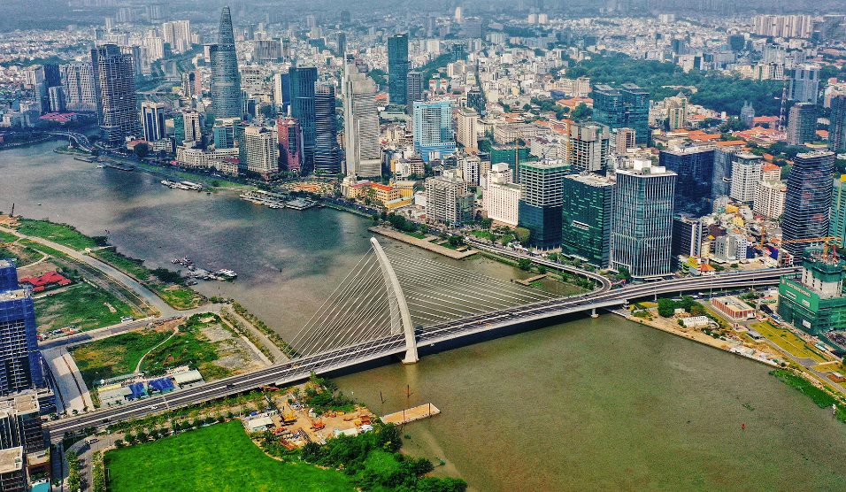
The Ho Chi Minh City government has announced a plan to develop a new road along the Saigon River, stretching from Ba Son Bridge to Saigon Bridge. This nearly 2km-long and over 30m-wide road, with a total investment of VND 1,800 billion, will provide four lanes and improve connectivity between District 1 and Binh Thanh District.
The project starts at Ton Duc Thang Street and ends at the Tan Cang boundary, passing through two upscale residential areas: Saigon Pearl and Vinhomes.
According to the Ho Chi Minh City Department of Transport, this stretch of the Saigon River, from Ba Son Bridge (formerly Thu Thiem 2 Bridge) to Saigon Bridge, runs through a series of projects and urban areas with some of the city’s most expensive real estate.
While the riverside road from Saigon Bridge to Thu Thiem Bridge (in Binh Thanh District) has already been developed by investors in the area, the road’s width varies, with some sections being narrower than others. This inconsistency in road width can make navigation difficult for drivers and may cause traffic bottlenecks and safety hazards.
Additionally, the current connection from the riverside road to Nguyen Huu Canh Street via the small and narrow Thu Thiem Bridge (approximately 7m wide) is inadequate for smooth traffic flow and may lead to congestion at the roundabout at the base of Thu Thiem Bridge on Nguyen Huu Canh Street (in Binh Thanh District). Overall, the existing Saigon River road is not a continuous and seamless route from Saigon Bridge to Ton Duc Thang Street.

Saigon River Road Development Plan: Improving Connectivity and Accessibility in Ho Chi Minh City
To address these issues, the Ho Chi Minh City Department of Transport has proposed the investment in the road from Ba Son Bridge to Saigon Bridge, which will enhance transportation in the area and create a seamless connection between new urban areas along the Saigon River. This new route will provide an alternative entry point into the city center from Saigon Bridge.
Ho Chi Minh City is currently adjusting its master plan until 2040, with a vision towards 2060. As part of this plan, the city will include a riverside road along the Saigon River, connecting Cu Chi to Can Gio, with a minimum of four lanes, dedicated bicycle lanes, and light rail transit (from the city center to Cu Chi).
According to the Department of Transport, the Saigon River road will establish a new transportation corridor along the city’s north-south axis, improving connectivity between District 12, Hoc Mon, and Cu Chi with the city center. This route will also link to the Ring Roads 2, 3, and 4, as well as highways, helping to reduce traffic pressure on existing roads.


