
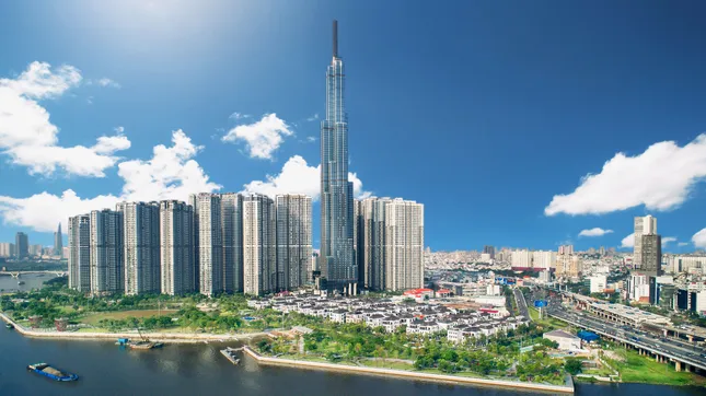
Vietnam’s Prime Minister has recently approved and issued Decision 1125, which endorses the master plan for Ho Chi Minh City’s development until 2040, with a vision towards 2060. This plan was meticulously crafted by a consortium of consulting firms, including the National Institute of Urban and Rural Planning, the Southern Institute of Planning, and the Green Space Private Enterprise.
The planning scope encompasses a total area of approximately 2,123.29 square kilometers. This includes the entirety of Ho Chi Minh City’s current administrative area, spanning 2,095.5 square kilometers and comprising of Thu Duc city, 16 districts, and 5 rural districts. The city’s expansion strategy focuses on harnessing the potential of its coastal areas, with key projects such as the Can Gio sea reclamation urban area and the internationally acclaimed Can Gio International Transit Port.
Ho Chi Minh City aims to establish a high-quality living environment, fostering harmonious economic and cultural development.
By 2060, Ho Chi Minh City envisions itself as a modern, civilized, and compassionate metropolis, boasting a level of advancement on par with the world’s leading cities. It is poised to become Asia’s economic, financial, and service hub, serving as a pivotal driver of growth for both the Southeast region and the entire nation.
The city aspires to create a high-quality living environment, attracting multinational corporations and global financial institutions. The urban model will foster innovation, knowledge-based and high-tech economic growth, and enhance socio-economic value through flexible and efficient spatial organization.
6 Urban Regions
According to the new plan, Ho Chi Minh City will embrace a polycentric urban development model, structured into 6 distinct regions: Central, East, West, North, South, and Southeast. Each region will encompass comprehensive functions, linking to vital national and international development areas. The goal is to establish high-quality environments for living, working, and creativity.
Ho Chi Minh City is designated as a special-class urban area directly under the Central Government. It serves as the nation’s premier hub for economics, culture, education, science and technology, and innovation. The city is also a prominent financial, commercial, tourism, and logistics center within Southeast Asia, holding strategic significance for national defense and security. It further acts as a pivotal digital infrastructure hub for the country.
Additionally, the city is a vital transportation hub within the Southeast region, nationally and internationally. It serves as a regional linkage center and a multimodal transportation connector for Southern Vietnam’s key areas. Ho Chi Minh City also occupies a strategically important position for national defense and security in the Southeast region and across Vietnam.
The city’s development will integrate a public transportation system, seamlessly connecting to national and international transportation networks, thereby creating economic growth corridors. The Can Gio Mangrove Forest and the network of rivers and canals (including the Saigon, Dong Nai, Can Giuoc, and Xang rivers, as well as the Thầy Cai canal) form a natural structural framework. This framework is complemented by green spaces and parks, establishing an ecological network and drainage system to manage flooding.
The new plan envisions Ho Chi Minh City’s development as a polycentric urban model, organized into 6 distinct regions.
The project emphasizes the development of apartment buildings as the predominant form of new housing construction. It encourages a compact urban model, integrating social and technical infrastructure with areas of high labor demand, such as industrial parks, service centers, and universities. This approach aims to provide on-site accommodation for workers and optimize commuting distances.
The plan also prioritizes the development of concentrated social housing, worker housing, and student accommodation. These initiatives are synchronized with the expansion of training centers, industrial parks, and export processing zones in the city’s growth areas, urban functional zones, transit-oriented development (TOD) zones, and key development areas. By 2040, the total land area allocated for this purpose is expected to reach approximately 1,400 hectares. There is a particular focus on promoting low-cost and rental housing, as well as constructing accommodation for students and implementing housing policies for families of revolutionaries and individuals with meritorious services.
Redefining Transportation
In terms of transportation, the plan involves continuing the upgrade, completion, and development of an inter-regional transportation system that adheres to the 2021-2030 road network planning, with a vision towards 2050. This includes expressways connecting Ho Chi Minh City with Long Thanh – Dau Giay, Moc Bai (Tay Ninh), and Tien Giang – Ben Tre – Tra Vinh – Soc Trang. Efforts will be made to expedite the completion of Ring Road 3 and invest in the construction of Ring Road 4. Additionally, there are plans to continue upgrading and expanding national highways, including National Highway 1, National Highway 13, National Highway 22, National Highway 22C, National Highway 50, National Highway 50B, and the coastal road from Ben Luc – Long Thanh Expressway to the end of the Tien Giang provincial boundary.
The upgrade, completion, and development of expressway connectors will also be prioritized, including the Long Thanh – Dau Giay Expressway connector, the Trung Luong – Ho Chi Minh City Expressway connector, and the Chơn Thành – Hoa Lư (Bình Phước) Expressway connector.
The plan proposes a new connection to Long Thanh International Airport from the center of Ho Chi Minh City via Phu My Bridge 2. An additional connection to the east with Dong Nai via Dong Nai Bridge 2 will help reduce traffic on National Highway 1A and the Ho Chi Minh City – Long Thanh – Dau Giay Expressway. A new Cat Lai Bridge will connect Thu Duc city with Nhon Trach – Dong Nai, enhancing inter-urban connectivity and improving road access from Thu Thiem station and central Ho Chi Minh City to Long Thanh International Airport.
A coastal road from Go Cong (Tien Giang) via Soai Rap estuary to Can Gio, extending to the Ben Luc – Long Thanh Expressway (Dong Nai) through the Phuoc An port access road, will support the anticipated cluster of seaports in Can Gio and facilitate other road connections to the provinces of Dong Nai, Long An, Binh Duong, and Tien Giang.
The plan includes the upgrade of the existing Hanoi – Ho Chi Minh City railway and the construction of high-speed rail lines along the North-South corridor, as well as the Trảng Bom – Hòa Hưng – Tân Kiên route. Potential additions include the Thu Thiem – Tan Kien railway, the Ho Chi Minh City – Can Tho railway, the Bien Hoa – Vung Tau railway, the Ho Chi Minh City – Loc Ninh railway, the Thu Thiem – Long Thanh railway, the Ho Chi Minh City – Tay Ninh railway, and a dedicated railway connecting to Hiep Phuoc port.

The plan includes the upgrade of the Hanoi – Ho Chi Minh City railway and the development of high-speed rail lines along the North-South corridor.
Notably, the new plan proposes the formation of new high-tech parks spanning an area of approximately 2,200-2,600 hectares. It focuses on developing industrial functions, encompassing 33 industrial parks, 3 export processing zones, and 7 industrial clusters, with a total area of around 9,200-10,200 hectares. These will be strategically located along Ring Road 3, the National Highway 22 bypass, Hiep Phuoc port, and areas with favorable transportation connections, as well as areas undergoing functional transformation in Binh Chanh, Cu Chi, and Northern Can Gio.
The plan identifies 10 logistics centers in key areas such as Cat Lai, Long Binh, Linh Trung, the high-tech park (Thu Duc City), Tan Kien (Binh Chanh), Hiep Phuoc ( Nha Be), Cu Chi, Hoc Mon, and Binh Khanh (Can Gio). These centers will be integrated with Tan Son Nhat International Airport, seaports, dry ports, and major railway hubs, covering a total area of approximately 490-600 hectares. They will serve as catalysts for growth within the city’s vital development areas.
The plan also envisions the establishment of technology-oriented agricultural areas, organic farming zones, and urban agricultural spaces in Cu Chi, Nha Be, Can Gio, and Binh Chanh, combined with tourism, resort, and agricultural experience models.
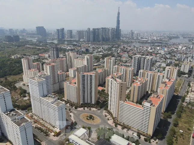
Transforming Ho Chi Minh City: A Vision for High-Rise Apartment Dominance

The master plan for Ho Chi Minh City’s development until 2040, with a vision towards 2060, emphasizes the prominence of apartment construction in new housing developments. This plan encourages a compact urban model, integrating social and technical infrastructure with areas of high labor demand, such as industrial parks, service centers, and universities.
The City of Ho Chi Minh Unveils Plans for 14 New Industrial Parks

“Ho Chi Minh City embarks on a transformative journey, revolutionizing land use efficiency and reshaping its industrial landscape. With a visionary approach, the city aspires to embrace a greener, more digital and circular future. This dynamic shift paves the way for innovative practices, fostering sustainable growth and a thriving, resilient economy.”
“Maximizing the Impact: Leveraging Every Dollar of the Budget to Attract Ten-Fold Social Investment”

“According to Dr. Tran Du Lich, Ho Chi Minh City needs to strive for development akin to the period of 2006-2010, where every dollar allocated from the government budget would attract ten dollars’ worth of social investment.”
The Tech Hub’s Advantageous Policy Framework

The newly amended Capital Law, passed by the National Assembly, introduces a host of new provisions for the development of high-tech parks, including the Hoa Lac High-Tech Park.


