
The Prime Minister has recently approved and issued Decision 1125, which endorses the adjusted master plan for Ho Chi Minh City’s development towards 2040, with a vision extending to 2060. This plan was meticulously crafted by a consortium of consulting firms, including the National Institute of Urban and Rural Planning, the Southern Institute of Planning, and the Green Space Limited Liability One-Member Company.
The planning scope encompasses a total area of approximately 2,123.29 square kilometers. It covers the entirety of Ho Chi Minh City’s existing administrative area, spanning 2,095.5 square kilometers and encompassing Thu Duc City, 16 districts, and five rural districts. The city’s expansion strategy focuses on harnessing the potential of its coastal space, with key projects such as the Can Gio Seafront Urban Area and the internationally acclaimed Can Gio International Transit Port.
 Ho Chi Minh City aims to establish a high-quality living environment, fostering harmonious economic and cultural development. |
By 2060, Ho Chi Minh City envisions itself as a modern, civilized, and compassionate metropolis, attaining a level of development on par with leading global cities. It is poised to become Asia’s economic, financial, and service hub, driving progress in Southeast Asia and Vietnam. The city aims to attract multinational corporations and global financial institutions, fostering a dynamic and innovative urban model that promotes economic and social value creation through flexible and efficient spatial organization.
Six Urban Regions
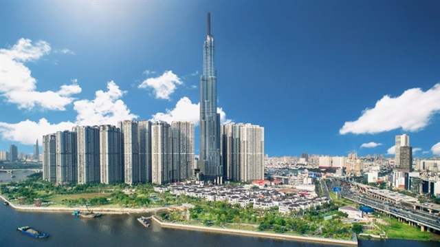
The new plan outlines a multi-center urban development model, dividing Ho Chi Minh City into six distinct regions: Central, East, West, North, South, and Southeast. Each region will serve comprehensive functions, integrating with national and international growth centers. The goal is to establish high-quality environments for living, working, and creativity.
Ho Chi Minh City is designated as a special-class city under the direct control of the Central Government. It is Vietnam’s premier center for economics, culture, education, science and technology, and innovation. The city also serves as the region’s financial, commercial, tourism, and logistics hub, holding strategic significance for national defense and security. It is a pivotal digital infrastructure hub for the country and a vital transportation nexus within Southeast Asia, nationally and internationally.
Ho Chi Minh City will seamlessly integrate public transportation with its urban development, providing convenient connections to national and international transportation networks and creating economic growth corridors. The Can Gio Mangrove Forest and the network of rivers (including the Saigon, Dong Nai, Can Giuoc, and Thay Cai rivers, and the Xang canal) form a natural structural framework. This framework is complemented by green spaces and parks, creating an ecological network and effective flood management system.
The new plan outlines a multi-center urban development model, dividing Ho Chi Minh City into six distinct regions.
|
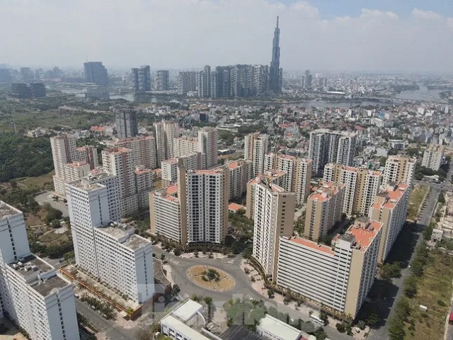
The plan emphasizes the development of high-rise apartment buildings as the predominant form of new housing construction. It encourages compact urban development, integrating social and technical infrastructure with employment centers such as industrial parks, service centers, and universities. This approach aims to provide on-site accommodation for workers and optimize commuting distances.
The plan also focuses on developing concentrated areas for social housing, worker housing, and student accommodation. These areas will be located in the city’s functional zones, transit-oriented development (TOD) areas, and key development zones, totaling approximately 1,400 hectares by 2040. Priority is given to affordable and rental housing, with a particular emphasis on providing accommodation for students and implementing housing policies for families of revolutionary contributors and veterans.
Redesigning the Transportation Network
Transportation-wise, the plan involves upgrading, completing, and developing an inter-regional transportation system in adherence to the 2021-2030 road network planning, with a vision towards 2050. This includes expressways such as Ho Chi Minh City – Long Thanh – Dau Giay, Ho Chi Minh City – Moc Bai (Tay Ninh), and Ho Chi Minh City – Tien Giang – Ben Tre – Tra Vinh – Soc Trang. Efforts will be made to expedite the completion of Ring Road 3 and initiate the construction of Ring Road 4. Additionally, there are plans to upgrade and expand national highways, including National Highway 1, 13, 22, 22C, 50, and 50B, along with the coastal road from Ben Luc – Long Thanh Expressway to the end of the Tien Giang provincial border.
The project will also involve upgrading and completing expressway connectors, such as the Ho Chi Minh City – Long Thanh – Dau Giay Expressway connector, the Ho Chi Minh City – Trung Luong Expressway connector, and the Ho Chi Minh City – Chon Thanh – Hoa Lu (Binh Phuoc) Expressway connector.
To enhance connectivity, a new route will be established, connecting the city center to the Long Thanh International Airport via Phu My Bridge 2. Additionally, a connection will be established to the east with Dong Nai via Dong Nai Bridge 2, alleviating traffic on National Highway 1A and the Ho Chi Minh City – Long Thanh – Dau Giay Expressway. A new link between Thu Duc City and Nhon Trach – Dong Nai via Cat Lai Bridge will improve inter-city transportation and strengthen the road network connecting the Thu Thiêm station, Ho Chi Minh City center, and Long Thanh International Airport.
The plan also includes a coastal road from Go Cong (Tien Giang) through the Soai Rap estuary to Can Gio, extending to the Ben Luc – Long Thanh Expressway in Dong Nai via the road leading to Phuoc An Port. This will support the anticipated cluster of seaports in Can Gio and facilitate connections to other provinces, including Dong Nai, Long An, Binh Duong, and Tien Giang.
Upgrades to the existing Hanoi – Ho Chi Minh City railway line are also in the works, along with the construction of high-speed rail routes on the North-South axis. Additionally, the following railway lines are planned: Trang Bom – Hoa Hung – Tan Kien, Thu Thiem – Tan Kien, Ho Chi Minh City – Can Tho, Bien Hoa – Vung Tau, Ho Chi Minh City – Loc Ninh, Thu Thiem – Long Thanh, Ho Chi Minh City – Tay Ninh, and a dedicated railway connecting Hiep Phuoc Port.

The plan includes upgrades to the existing Hanoi – Ho Chi Minh City railway line and the construction of high-speed rail routes on the North-South axis. |
Notably, the new plan allocates 2,200-2,600 hectares for the formation of new high-tech parks. It focuses on developing industrial functions with 33 industrial parks, three export processing zones, and seven industrial clusters, spanning 9,200-10,200 hectares. These industrial areas will be strategically located along Ring Road 3, the National Highway 22 bypass, and Hiep Phuoc Port, as well as in areas with favorable transportation connections and functional conversions in Binh Chanh, Cu Chi, and Can Gio.
The plan identifies 10 logistics centers in key areas such as Cat Lai, Long Binh, Linh Trung, the high-tech park (Thu Duc City), Tan Kien (Binh Chanh), Hiep Phuoc ( Nha Be), Cu Chi, Hoc Mon, and Binh Khanh (Can Gio). These centers will be integrated with Tan Son Nhat International Airport, seaports, dry ports, and major railway stations, occupying a total area of approximately 490-600 hectares. They will serve as catalysts for the city’s pivotal development zones.
The plan also foresees the establishment of technology-oriented agricultural zones, organic farming areas, and urban agriculture in Cu Chi, Nha Be, Can Gio, and Binh Chanh, combined with tourism, resorts, and agricultural experience models.
Duy Quang
– 12:32 12/06/2025
The City of Ho Chi Minh Unveils Plans for 14 New Industrial Parks

“Ho Chi Minh City embarks on a transformative journey, revolutionizing land use efficiency and reshaping its industrial landscape. With a visionary approach, the city aspires to embrace a greener, more digital and circular future. This dynamic shift paves the way for innovative practices, fostering sustainable growth and a thriving, resilient economy.”
The Tech Hub’s Advantageous Policy Framework

The newly amended Capital Law, passed by the National Assembly, introduces a host of new provisions for the development of high-tech parks, including the Hoa Lac High-Tech Park.


 Eastern Tower at The Gió Riverside")
