


: Corporate Bond Debt Reaches VND 1,270 Trillion by Q3-End")


Planning an area of over 1,300 hectares
The airport planning area covers an area of over 1,300 hectares. This will be a specialized functional area and an important transportation hub for Da Nang, associated with the development of the airport urban area.
The planning boundary of the sub-zone is limited by Nguyen Tri Phuong – Nguyen Huu Tho streets (east), Truong Chinh street (west), Dien Bien Phu street (north), and Cach Mang Thang Tam street (south). With a projected population of about 77,000 people by 2030.
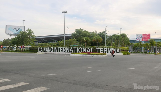
A corner of Da Nang International Airport.
The airport sub-zone is divided into 2 main areas: the urban construction area and the Da Nang International Airport area, organized into 4 development zones with 4 units.
In particular, the Da Nang International Airport area is oriented towards development according to the adjusted plan for the Da Nang International Airport period 2021 – 2030, with a vision to 2050…
According to the plan, land for social infrastructure and greenery in the units is planned to increase gradually to approach the indicators of the new development area. The city’s land units for lease when the lease term expires are given priority for additional planning of social infrastructure, greenery, and parking lots.
For educational land, unit 2 has the characteristic of being the gateway to the airport area, emphasizing the development of services and extending along Nguyen Huu Tho – Nguyen Tri Phuong street, the allocation of school land for this area is very difficult. Therefore, the proposed plan suggests that unit 2 use neighboring schools along Nguyen Huu Tho street.
In this sub-zone, Da Nang will also increase the development of greenery for educational institutions, administrative headquarters, health facilities, hospitals, museums… Developing and promoting green roof areas, vertical green areas in construction works to increase urban green space. When implementing detailed planning and urban design, projects in the units must propose additional greenery, open spaces, and ensure that people have access and use…
The general planning does not determine the urban focal points in the airport sub-zone. To orient, organize architectural and landscape spaces, create distinctive features and identities for the planned area, identify focal points in the areas including: International Airport Terminal designed as a unique architectural work, an iconic gateway from the airway. Green spaces, water surfaces such as parks combined with sports in the south of the airport, Hoa Tho Park, the series of parks along Phan Lang Canal combined with Thanh Khe Sports Center, the series of regulating lakes parks in Cam Le.
Many planned projects
In addition, according to the plan, priority will be given to implementing some projects in the following categories in the airport sub-zone: urban development projects; social infrastructure; technical infrastructure.
Specifically, the urban development area includes 4 projects: Da Nang International Airport; renovation and improvement of old residential areas; upgrading, renovating, and improving the northern residential area of 20 hectares; upgrading, renovating, and improving the southern area of the airport (Cam Le district).
The social infrastructure includes 3 education projects, 1 healthcare project, 2 culture and sports projects, and 2 parks and greenery projects.
In the notable transportation projects, there are the airport tunnel project; Nguyen Phi Khanh, Dang Thuy Tram road expansion projects. Grade separated interchange at Nguyen Van Linh – Nguyen Tri Phuong intersection; Cach Mang Thang Tam – Nguyen Huu Tho intersection; Le Trong Tan – Truong Chinh intersection; pedestrian overpasses…
Da Nang city will also invest in floating and underground parking lots within the planning scope, MRT, LRT railway lines, and intermediate stations, Technical preparation depot… in this sub-zone.


