Hue City: A Vision for the Future

In early 2024, the Vietnamese government approved a master plan for the urban development of Thua Thien Hue until 2045, with a vision extending to 2065. This plan was signed by Deputy Prime Minister Tran Hong Ha.
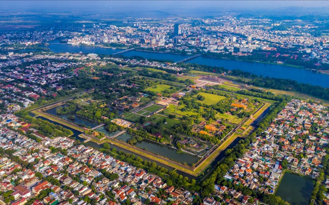
The plan outlines that by 2025, Hue will be a Grade I urban area, a centrally governed city with unique characteristics. As a city built on a foundation of cultural heritage preservation, Hue will continue to develop its tangible and intangible cultural values, while also promoting its distinctive cultural identity. It will be an environmentally friendly and intelligent city, characterized by its picturesque scenery and ecological diversity.
Hue is poised to become a key economic growth center in the Central region, focusing on marine economy and tourism. It will also serve as a national hub for science, technology, healthcare, and education, providing high-quality training across various disciplines.
The planning goal for Thua Thien Hue by 2025 is to establish a centrally governed city built on the preservation and promotion of the ancient capital’s cultural heritage. It will be a city characterized by culture, heritage, ecology, landscape, environmental friendliness, and intelligence.
According to the plan, Hue City (after becoming centrally governed) will have a natural area of 4,947.10 square kilometers and a population of 1,380,000 people. It will have nine administrative units, including two districts, three towns, and four rural districts. There will be 131 commune-level administrative units (73 communes, 51 wards, and seven townships) within the city.
With this expansion, the future city will become larger than any of the five current centrally governed cities in Vietnam.
Centrally governed cities have a natural area of 1,500 square kilometers or more.
According to the General Statistics Office, the natural areas of the five centrally governed cities are as follows: Hanoi (3,359.82 square kilometers), Hai Phong (1,526.52 square kilometers), Da Nang (1,284.73 square kilometers), Ho Chi Minh City (2,095.39 square kilometers), and Can Tho (1,440.40 square kilometers).
The plan identifies three urban centers within Thua Thien Hue:
The central urban area includes Hue City (divided into two districts: the district north of the Huong River and the district south of the Huong River), Huong Thuy District, and Huong Tra Town. Of these, the district on the north side of the Huong River and the district on the south side of the Huong River are regional centers, serving as heritage cities and driving forces for the province’s socio-economic development. They will be the administrative, political, cultural, tourism, sports, healthcare, education, and scientific research hubs. Huong Thuy District will develop a city connected to the Phu Bai International Airport, industrial parks, and key industrial clusters. Huong Tra Town will serve as a satellite city.
The northwestern urban area includes Phong Dien Town, Quang Dien District, and A Luoi District. The central urban area in this region is Phong Dien Town, which will be linked to the Dien Loc port. Phong Dien Industrial Park will focus on developing industrial urban areas as a driving force for the province’s northern region. It will also serve as the northern gateway connecting with the provinces of Quang Tri, Quang Binh, and countries in the Mekong sub-region.
The southeastern urban area includes Phu Vang District, Phu Loc District, and Nam Dong District. This region will prioritize the development of the Chan May area into a Type III city—a modern and intelligent city connected to the Chan May – Lang Co Economic Zone, which will drive transformative growth in the region. It will serve as a southern gateway connecting with Da Nang and providing access to the East-West Economic Corridor countries. The area will have a transportation infrastructure system that includes the La Son – Tuy Loan Expressway and the Chan May deep-sea port, which will accommodate large-scale tourism and cargo transportation. It will also promote coastal urban development connected to the Tam Giang – Cau Hai lagoon.


