Prime Minister Pham Minh Chính has signed Decision 369/QĐ-TTg approving the Planning for the Northern Mid-mountain and Mountainous Region for 2021-2030, with a vision to 2050 (the Plan).
The scope and boundary of the Northern Mid-mountain and Mountainous Region planning includes the entire land territory of 14 provinces: Cao Bang, Dien Bien, Bac Giang, Bac Kan, Ha Giang, Hoa Binh, Lang Son, Lai Chau, Lao Cai, Phu Tho, Son La, Thai Nguyen, Tuyen Quang, Yen Bai.
According to the Plan, economic and social activities in the region will be organized into 3 sub-regions, 5 economic corridors, 3 growth belts and 1 dynamic area.

The Prime Minister approves the Planning for the Northern Mid-mountain and Mountainous Region.
Specifically, the region’s 5 economic corridors are oriented for development, including:
Economic corridor Lao Cai – Yen Bai – Phu Tho – Ha Noi connecting the central sub-region with the capital of Hanoi, gateway ports, the Red River Delta region, with Kunming city and the Southwest China region.
Economic corridor Lang Son – Bac Giang – Ha Noi connecting the Northeast sub-region with the capital of Hanoi, gateway ports, the Red River Delta region, with Nanning city in Southeast China; gradually forming a trade center, inter-regional and international transit center, in conjunction with the construction of the Hanoi – Dong Dang international intermodal railway line.
Economic corridor Dien Bien – Son La – Hoa Binh – Ha Noi linked to the Northwest sub-region, connecting with Laos and ASEAN countries; linking towns and tourist centers in the Northwest sub-region with the Red River Delta and the North Central Coast sub-region, promoting development in disadvantaged and extremely disadvantaged areas in the Northwest sub-region.
Economic corridor Ha Giang – Tuyen Quang – Phu Tho – Ha Noi connecting the central sub-region with the capital city of Hanoi, gateway ports, the Red River Delta and the Southwest China region. Connecting tourist centers in the region and the country, promoting development in difficult and extremely difficult areas in the central sub-region.
Economic corridor Cao Bang – Bac Kan – Thai Nguyen – Ha Noi connecting the Northeast sub-region with the capital of Hanoi, gateway ports, the Red River Delta region, with Chongqing city and the Southeast China region.

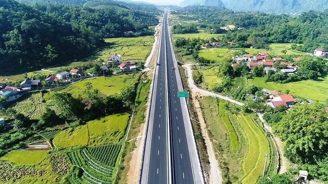
Developing the transport network is one of the important tasks outlined in the Planning for the Northern Mid-mountain and Mountainous Region.
Regarding the transport network, the Plan sets out clear goals, such as accelerating the progress of preparing and commencing the construction of high-speed railway linesLang Son – Hanoi, Lao Cai – Hanoi – Hai Phong – Quang Ninh.
Investing in the expressway route Dong Dang (Lang Son) – Tra Linh (Cao Bang); deploying the construction of the expressway route Son La –Dien Bien, the expressway route Bac Kan – Cao Bang, and upgrading other road routes when capital sources are available.
At the same time, constructing the expressway route connecting Son La with the Hanoi – Lao Cai expressway (Son La – Yen Bai expressway), the road route connecting the Northwest sub-region with the North Central sub-region (Hoa Binh – Ninh Binh route) before 2030 when it is adjusted and supplemented into the national highway network planning…


