Heavy rains and upstream flooding have caused water levels to rise in the rivers and streams of Thanh Hoa province.
Specifically, the Ma River is above the alarm level 3 (0.1m); the Len River is below alarm level 2 (0.37m); the Buoi River is above alarm level 2 (0.19m); the Cau Chay River is above alarm level 1 (0.49m); and the Chu River is above alarm level 2. The complex flood situation has also caused flooding and landslides in many areas, especially in the mountainous districts of Thanh Hoa.
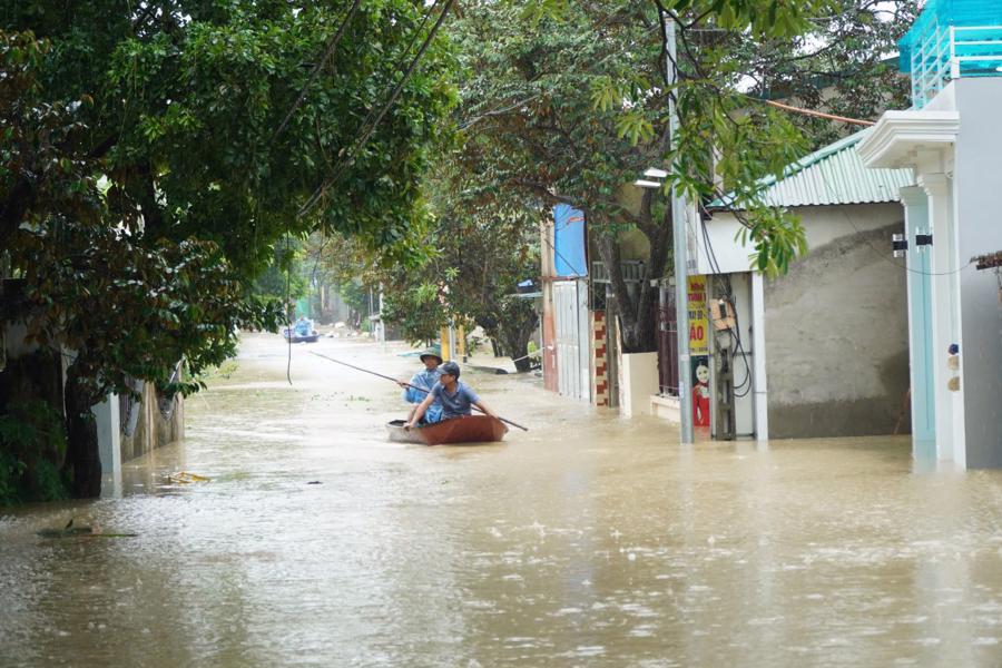
By noon on September 23, to ensure the safety of the residents, authorities in Thanh Hoa had evacuated more than 1,200 households with nearly 5,000 people living along the rivers and streams that were at risk of landslides, flash floods, and debris flows. This included 116 households in Quan Son, 71 in Quan Hoa, 443 in Muong Lat, 7 in Lang Chanh, 14 in Ba Thuoc, 53 in Ngoc Lac, 54 in Thach Thanh, 252 in Tho Xuan, and 273 in Thuong Xuan.
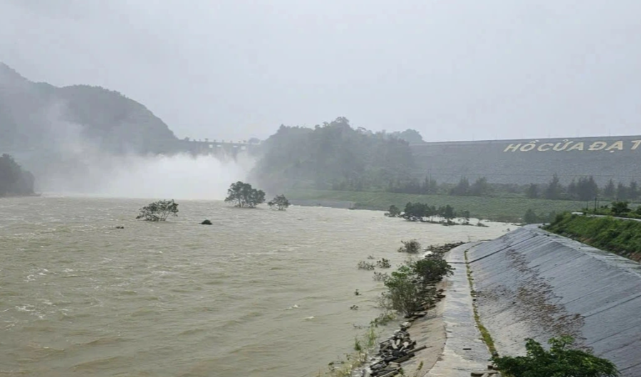
The floods also damaged 113 houses in Muong Lat, Quan Son, and Quan Hoa districts, submerged 12 hectares of rice fields, and affected 7 schools due to landslides. National highways 15C and 16 to Muong Lat district and road 217 to Quan Son district have been isolated and cut off from several communes due to landslides at multiple locations.
According to the Thanh Hoa Department of Transportation, from September 21 to 23, the impact of the fourth storm and the cold spell caused 182 locations on the national highways to experience landslides, rockfalls, roadbed subsidence, and ditch subsidence. Many sections of the roads remain inaccessible.
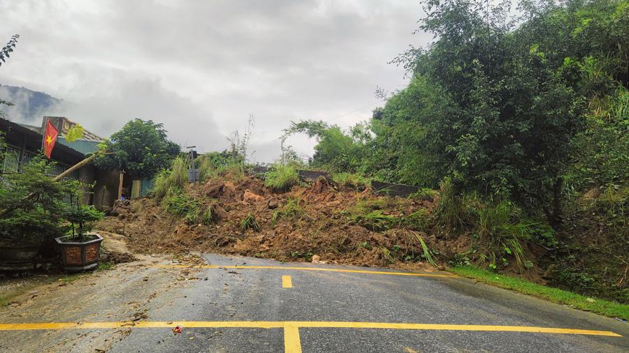
In particular, National Highway 15 experienced landslides at 10 locations, with a volume of about 4,100 cubic meters, and two locations at Km35+950 and Km39+580 in Hoi Xuan town (Quan Hoa district) remain blocked. National Highway 15C had landslides at 140 locations, with a volume of about 46,481 cubic meters, and four locations in Muong Lat district remain blocked. National Highway 16 experienced landslides at nine locations, National Highway 217 at 16 locations, and National Highway 47 at seven locations.
The leadership of the Thanh Hoa Department of Transportation has instructed the maintenance management units and road and inland waterway management units to urgently inspect, clear subsidence, and erect warning signs and barriers at landslide and slip locations, deep water crossings, etc.
At the same time, the Department has coordinated with local authorities to organize propaganda, arrange for on-duty personnel, and guide traffic to ensure the safety of people and vehicles traveling on the routes.
On the afternoon of September 23, Nguyen Hoang Hiep, Deputy Minister of Agriculture and Rural Development, signed a document sent to the People’s Committee of Thanh Hoa province regarding the urgent implementation of measures to protect the dike system as the water levels in the Buoi, Ma, and Chu rivers continue to rise.
According to the document, at 13:00 on September 23, the water level on the Buoi River at Kim Tan commune reached 11.73m, 0.27m below the alarm level 3. On the Ma River, the water level at Cam Thuy district was 20.16m, 0.04m below alarm level 3, and at Ly Nhan commune, it was 11.01m, 0.01m above alarm level 2. On the Chu River, at Bai Thuong commune, the water level was 17.96m, 0.04m below alarm level 3.
To ensure the safety of the dike system, the Ministry of Agriculture and Rural Development requested the People’s Committee of Thanh Hoa province to direct the authorities at all levels and branches to inspect and protect the vulnerable dikes, review the plan to protect the key dikes, especially the works that have had incidents and have not been handled, and at the same time, prepare materials, forces, and means to handle them promptly.
The Ministry of Agriculture and Rural Development also requested the organization of patrols and guards to protect the dikes according to regulations and to monitor the flood situation and report it to the Ministry of Agriculture and Rural Development in a timely manner through the Dyke Management and Flood and Storm Control Department.
The document emphasized that the People’s Committee of Thanh Hoa province needs to urgently implement measures to ensure the safety of the dike system and prevent risks caused by flooding.
The Agricultural Minister Orders Thac Ba Hydropower Director to Close Two Flood Gates
The Minister of Agriculture and Rural Development ordered the Director of Thac Ba Joint Stock Hydro Power Company to close the remaining two spillway gates of the Thac Ba Hydro Power Plant’s flood discharge system at 2:00 PM on September 19th.
Who is Responsible for the Cracks and Tilts in Old Apartments Caused by the Storm?
The Ministry of Construction has assessed that many old apartment buildings are no longer safe after Storm No. 3 and has requested the swift relocation of residents for renovation and rebuilding. The safety of residents is of utmost priority, and the ministry is taking proactive steps to ensure their well-being. With the assessment complete, the focus now shifts to efficient and timely relocation, followed by the much-needed reconstruction of these aging buildings.
The Devastating Impact of Storm No. 4: Flooding, Landslides and Road Disruptions Wreak Havoc in Central Vietnam
As of 5 p.m. on September 19, according to the Department of Dike Management and Disaster Prevention, under the Ministry of Agriculture and Rural Development, heavy flooding caused by Storm No. 4 has resulted in 77 localized areas of inundation and isolation across various central provinces and cities in the region.
The Storm Approaches Central Vietnam: Flooding Wreaks Havoc in Multiple Provinces
The tropical storm, known as Storm No. 4, battered central provinces with heavy rainfall, causing flooding in several localities. Authorities promptly evacuated hundreds of households to safety as the storm wreaked havoc in the region.


