
Hanoi has just released new topographic and cadastral maps for 126 newly reorganized wards and communes as part of the “Project on Arranging, Reorganizing Administrative Units at All Levels and the Model for Local Government with Two Levels” in the area.
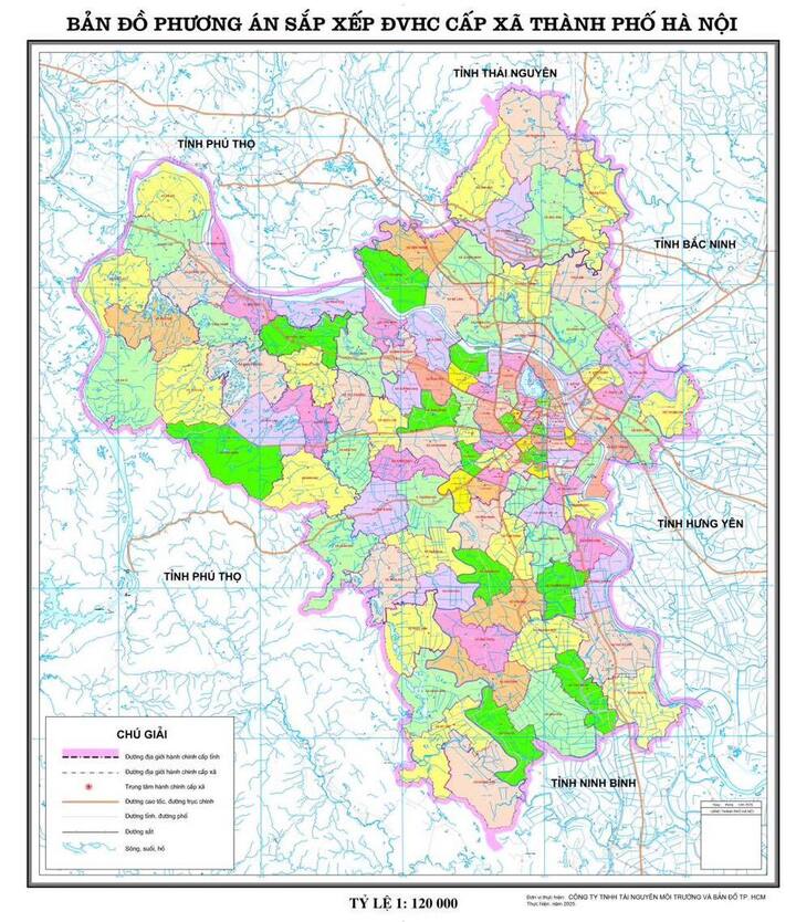
New Map of the 126 Reorganized Wards and Communes in Hanoi
According to the Hanoi Department of Agriculture and Environment, updating cadastral and topographic maps following administrative reorganization is of utmost importance. It contributes to a comprehensive and accurate land registry system, facilitating efficient land management, agriculture, urban planning, and infrastructure development.
The new maps will accurately depict the updated administrative boundaries, land parcels, infrastructure, and agricultural production areas, aligning with reality and adhering to current map surveying standards.
Completing the update of cadastral and topographic maps for these 126 administrative units is essential to ensure legal certainty, transparency, and unified land management as the two-level local government model comes into effect on July 1st.


