On the afternoon of September 5, 2024, at the headquarters of the Ministry of Agriculture and Rural Development, Deputy Prime Minister Tran Hong Ha chaired a teleconference with ministries, sectors, and localities to prepare response plans for Super Typhoon Yagi (Storm No. 3).
At the main venue of the Ministry of Agriculture and Rural Development, 16 units participated in the meeting, including representatives from the Ministry of National Defense, the Ministry of Public Security, the Ministry of Natural Resources and Environment, and the Ministry of Transport. The teleconference was attended by 28 provinces and cities, including 12 provincial People’s Committee Chairmen and 16 vice chairmen who joined the teleconference at the respective locations.
THE TYPHOON HAS INTENSIFIED INTO A “SUPER TYPHOON”
Opening the meeting, Deputy Prime Minister Tran Hong Ha stated that Storm No. 3 is very strong and affects the lives of people in many localities. The government is very concerned about the typhoon’s developments. On the same day (September 5), the Prime Minister issued two urgent dispatches to direct the response to the storm.

After listening to the response plans presented by the leaders of the ministries and provinces, Deputy Prime Minister Tran Hong Ha concluded the meeting by emphasizing the unpredictability of Storm No. 3. As it moved towards the East Sea, the typhoon encountered favorable conditions to intensify into a super typhoon. In fact, it had gained several categories in intensity over the past 24 hours.
The Deputy Prime Minister requested better forecasting, especially in informing the people. It is necessary to make people understand how strong a Category 12 storm is and what a Category 15 or 16 storm would be like. Forecasting should not be constrained by numerical data alone. This information also serves as a basis for rescue and relief forces to coordinate their work.
Highlighting the coordination between relevant forces, the Deputy Prime Minister requested clear task assignments for each party. All levels of leadership must uphold a proactive spirit. Any mistakes must be clearly accounted for. “The aftermath of Storm No. 3, with its strong winds and wide reach, is also a matter of concern. Flooding, flash floods, and landslides may occur,” the Deputy Prime Minister noted.
The Deputy Prime Minister agreed with the proposal of the Ministry of Agriculture and Rural Development to form a delegation to directly inspect the provinces affected by the storm. At the same time, he requested the standing agency to coordinate closely with the localities to help people prevent losses of property and lives when dealing with Storm No. 3.
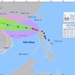
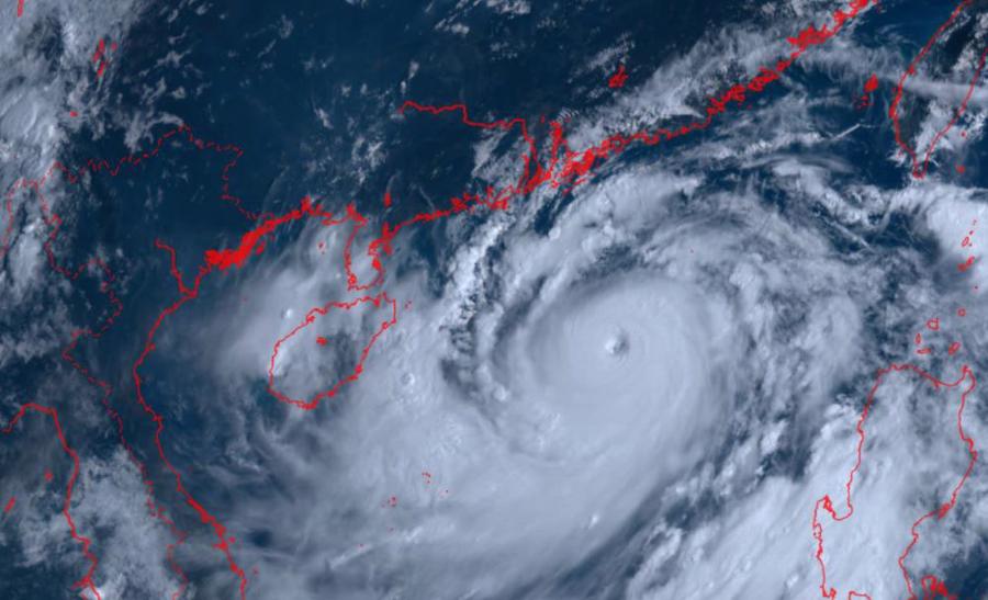
Reporting at the meeting, Mr. Mai Van Khiem, Director of the National Center for Hydro-Meteorological Forecasting, said that in the afternoon of September 5, 2024, Storm No. 3 was located in the northern area of the North of the East Sea, about 420 km east of Hainan Island (China). The intensity of the storm was at Category 16 (super typhoon level), with gusts of over Category 17. This is a very strong typhoon with a wide reach. The radius of strong winds over Category 8 was about 250 km, the radius of strong winds over Category 10 was about 150 km, and the radius of strong winds over Category 12 was about 80 km around the eye.
According to Mr. Khiem, international typhoon forecasting centers shared the view that Storm No. 3 would continue to maintain super typhoon intensity (Category 16 or higher) until it reached the coastal area east of Hainan Island. Chinese meteorological agency forecasters predicted that Storm No. 3 would reach super typhoon status and pass through the area between Hainan Island and Leizhou Peninsula (China), entering the Gulf of Tonkin in the morning of September 7. The storm is expected to bring heavy rain and strong winds to the Gulf of Tonkin, with rainfall of about 250-300 mm and gusts of up to Category 10-13 in the coastal region.
Japanese experts assessed that Storm No. 3 is expected to have wind speeds of up to Category 12 just before making landfall in Vietnam. Although the storm’s wind speed is forecast to decrease rapidly after landfall, the aftermath of Storm No. 3 could still cause heavy rainfall over a large area, even if the eye of the storm does not directly hit Vietnam.
Influenced by Storm No. 3, from the afternoon of September 6, the Gulf of Tonkin area (including Bach Long Vy and Co To districts) will experience strong winds of Category 6, increasing to Category 8-10, with gusts of up to Category 13-14 and violent seas. From the night of September 6 to the morning of September 9, the provinces of Quang Ninh, Hai Phong, Lang Son, Ha Giang, Phu Tho, Hoa Binh, the Northern Delta (including Hanoi), and Thanh Hoa will experience heavy to very heavy rainfall, with average rainfall of 150-350 mm and localized rainfall of over 500 mm.
From the afternoon of September 7 to September 8, the northwestern region will experience heavy rain, with localized very heavy rain, and average rainfall of 100-200 mm. In particular, the provinces of Lao Cai, Yen Bai, and Son La are expected to receive 150-250 mm of rainfall, with localized rainfall of over 350 mm.
MINISTRIES AND LOCALITIES SIMULTANEOUSLY DEVELOP PLANS TO COMBAT THE TYPHOON
Mr. Pham Duc Luan, Director of the Department of Dyke Management and Flood and Storm Control, said that from September 6, the provinces from Quang Ninh to Nghe An will impose sea bans. Ninh Binh province has imposed a sea ban starting today (September 5). Currently, three large hydropower plants in the North, including Hoa Binh, Thac Ba, and Tuyen Quang, are discharging water to cope with the storm.
Deputy Minister of Transport Nguyen Xuan Sang said that depending on the developments of Storm No. 3, the transport sector will have specific plans for lashing, fastening, and reinforcing ongoing construction projects. Some ships in Hai Phong and Thai Binh are involved in court proceedings, which poses challenges to their relocation. Therefore, the ministry is working closely to ensure the safety of the people.
The Ministry of Transport is particularly concerned about the aviation industry and will carefully consider the timing of flight bans to balance the interests of all parties and promptly resume operations as soon as weather conditions permit.
The leader of Quang Ninh province informed that the province had established four working groups to direct the response efforts in various localities. Quang Ninh has mobilized 2,663 officers and soldiers to participate in the typhoon response, and all essential supplies have been prepared.
According to the leader of Thai Binh province, the province plans to impose a sea ban from 5:00 AM on September 6. Regarding aquaculture facilities, there are 1,179 watchtowers and 1,128 cages for aquaculture. Thai Binh plans to evacuate all workers from these facilities to safe places before 6:00 PM on September 6.
“On September 6, the Ministry of Agriculture and Rural Development will organize a delegation to inspect the response to Super Typhoon Yagi in the Red River Delta provinces, including Quang Ninh. The ministry will work with the localities to prepare response measures and be ready to provide necessary support”.
Mr. Le Minh Hoan, Minister of Agriculture and Rural Development.
The leader of Hai Phong city said: “Hai Phong has the particularity of having many container yards. Therefore, the city has inspected the yards in the port areas of Ngo Quyen and Hai An districts, requesting cargo owners to lower the height of containers to prevent them from falling and causing accidents.”
Mr. Hoang Van Thach, Vice Chairman of the Cao Bang Provincial People’s Committee, said that the province has a geographically divided terrain, and heavy rain and flooding could lead to water accumulation in low-lying areas. Cao Bang is about to host an international conference on the Global Geopark Network of UNESCO, and any impact from the storm would be a significant concern.
Mr. Nguyen Manh Quyen, Vice Chairman of the Hanoi People’s Committee, said: “Functional forces in Hanoi are actively pruning trees to minimize the risk of falling trees during the storm. Canals and rivers in the outer city areas have been dredged to ensure smooth drainage and reduce the risk of flooding.”
Minister of Agriculture and Rural Development Le Minh Hoan stated that after ten years, the Red River Delta is facing another massive storm. Therefore, it is necessary to urgently prepare appropriate measures to minimize damage to infrastructure and critical areas. The provinces and cities need to have plans for sea bans, market closures, and restrictions on business and transportation activities to ensure the highest level of safety for the people.
The Minister requested that Quang Ninh province, with its many coal mines, make every effort to ensure the safety of people and property. In a worse-case scenario, rescue and relief forces should be ready to quickly deal with the aftermath.
The Approaching Storm: Northern Central Provinces Brace for Typhoon No. 3
Amidst predictions of Storm No. 3’s impending impact, authorities in the North Central provinces swiftly mobilized their resources to brace for the oncoming storm.
The Impending Storm: Brace for Impact as Typhoon No. 3 Makes Landfall on September 7th. Local Authorities Urged to Take Preemptive Action.
A powerful storm, Typhoon Yagi, is expected to intensify and rapidly strengthen to an equivalent Category 4 hurricane with winds exceeding 130 mph. The storm is forecast to make landfall along the coast of Northern Vietnam, bringing devastating impacts to the region. The provinces of Quang Ninh, Hai Phong, Thai Binh, Nam Dinh, and Ninh Binh are expected to bear the brunt of this storm, with potential for widespread damage and disruption.

