Due to the rising water levels and strong currents of the Red River, on September 10, 2024, the Hanoi Department of Transportation announced restrictions on vehicles crossing the Chuong Duong Bridge. Specifically, in the direction from Hoan Kiem to Long Bien: buses are allowed to operate as usual, while passenger cars, contract cars, and tourist cars with more than 9 seats, as well as cargo trucks over 0.5 tons, are prohibited. In the opposite direction, from Long Bien to Hoan Kiem, the same restrictions apply, with only buses and vehicles under the specified weight limits allowed to cross. Passenger cars, contract cars, tourist cars with more than 9 seats, and cargo trucks over 0.5 tons are redirected to alternative bridges: Thanh Tri, Nhat Tan, Vinh Tuy, and Thang Long.
FLOOD WARNING FOR SELECTED DISTRICTS AND COUNTIES
According to the Department of Transportation, these restrictions are necessary to ensure the safety of commuters and vehicles. The impact of Typhoon Yagi has led to hydroelectric power plants releasing water, causing the Red River’s water levels to rise and affecting the structure of the bridge. Built in 1983 and opened in June 1985, the Chuong Duong Bridge is now 39 years old. From 1985 to 2010, it was the only bridge for vehicles traveling from Hanoi’s city center to Gia Lam and connecting to the northern provinces. Currently, the bridge accommodates approximately 95,000 vehicles daily, more than eight times its designed capacity.
Tran Huu Bao, Deputy Director of the Hanoi Department of Transportation, affirmed that while the Chuong Duong Bridge has deteriorated over time, it still maintains its load-bearing capacity and functions normally. Since the city took over its management, the Department and related units have conducted two bridge inspections, in 2013 and 2021, both of which confirmed the bridge’s structural integrity.
The National Center for Hydro-Meteorological Forecasting issued a flood warning for Hanoi on the morning of September 10, 2024. The warning predicted that the aftermath of Typhoon No. 3 would cause flooding in many inner-city streets, with water levels ranging from 10 to 20 cm. Notably, some streets are expected to experience deeper flooding of more than 25-30 cm.
Streets prone to flooding due to prolonged heavy rainfall:
Tay Ho District: Thuy Khue, Duong Quang Ham, Phu Xa…
Ba Dinh District: Thanh Cong, Huynh Thuc Khang, La Thanh, Lieu Giai, Dien Bien Phu, Nui Truc, Ngoc Khanh, Nguyen Truong To…
Hoan Kiem District: Phung Hung, Lien Tri-Nguyen Gia Thieu, Ta Hien – Luong Ngoc Quyen intersection, Dinh Liet Street, Nguyen Sieu-Ngo Gach, Tong Dan, Quang Trung – Tran Quoc Toan intersection, Tho Nhuom, Ba Trieu, Dien Bien Phu, Quan Thanh, Duong Thanh – Hang Non intersection.
Dong Da District: Bui Xuong Trach, Huynh Thuc Khang, Thai Ha, Chua Boc, Pham Ngoc Thach, Ton Duc Thang, Kham Thien, Le Duan, Van Mieu – Quoc Tu Giam, Kim Lien…
Thanh Xuan District: Le Trong Tan, Hoang Van Thai, Nguyen Ngoc Nai, Vuong Thua Vu, Nguyen Van Troi, Nguyen Tuan, Luong The Vinh, Nguyen Xien, Quan Nhan – Vu Trong Phung, Nguyen Trai, Nguyen Huy Tuong, Phung Khoang, To Huu Street (from Luong The Vinh to Trung Van)…
Hai Ba Trung District: Nguyen Khoai, Lac Trung, Mac Thi Buoi, Hang Chuoi, Tran Xuan Soan, Thanh Nhan, Yec-xanh.
Cau Giay District: Nam Trung Yen – Duong Dinh Nghia intersection (behind Keangnam Tower), Hoang Quoc Viet (near Electric University), Phan Van Truong, Phung Chi Kien, Tran Binh, Hoa Bang Street.
Hoang Mai District: Thinh Liet, Den Lu Street, Hoang Mai Street, Vinh Hung Street, Truong Dinh, Linh Nam, Dinh Cong.
Nam Tu Liem District: Do Duc Duc Street, Phung Khoang Street, underground tunnel through Thang Long Boulevard.
Ha Dong District: Trieu Khuc Street, Quyet Thang Street, To Hieu, Yen Nghia…
OPERATION OF OVER 300 PUMPING STATIONS
A report from the Hanoi Department of Agriculture and Rural Development, signed by its director, Nguyen Xuan Dai, stated that the city currently has approximately 93,138 hectares of annual crops, including 72,058 hectares of rice, which are in the heading to ripening stage, with the harvest expected to take place between September 25 and October 5, 2024. There are also 21,080 hectares of vegetables, of which about 9,064 hectares, or 43% of the area, have been harvested. Additionally, there are 20,339.4 hectares of fruit trees and about 22,600 hectares of aquaculture.
The agricultural sector in Hanoi is prepared to operate 324 pumping stations with a capacity of approximately 4,000,000 cubic meters per hour for various rainfall scenarios. They have also implemented measures to lower water levels to ensure flood protection for 89 irrigation reservoirs and proactively operated buffer pumping stations throughout the system.
The urban drainage system has been comprehensively invested and constructed according to the planning for the inner-city area within the To Lich River basin, covering 77.5 square kilometers. This system can handle flooding caused by rainfall with an intensity of 300 mm/2 days for the entire system and 70 mm/hour for the sewer system.
Regarding casualties due to Typhoon No. 3 and post-typhoon floods, there have been four reported deaths in Nam Tu Liem, Hoang Mai, Chuong My, and Cau Giay districts. Across the city, 25,156 trees have fallen or had broken branches, with the majority located in Hoang Mai, Long Bien, Gia Lam, Dong Anh, and Nam Tu Liem districts. These fallen trees have caused casualties and damaged vehicles and infrastructure.
Hanoi has mobilized 573 officers, 80 vehicles, and 200 chainsaws from the city’s greenery units, along with support from related departments and local forces, to urgently clear the fallen trees and branches, ensuring smooth traffic flow and daily life for the people.
In the outskirts of Hanoi, 2,243 hectares of rice, 1,250 hectares of vegetables, 1,185 hectares of fruit trees, flowers, and annual plants, and 257 hectares of aquaculture were flooded. Additionally, 24,361 hectares of rice, 3,307 hectares of vegetables, 33,117 hectares of fruit trees, flowers, and annual plants, and 151 hectares of aquaculture were damaged by fallen and broken trees.
The Irrigation Companies have been actively operating 203 drainage pumping stations with 776 pumps, pumping approximately 1,349,580 cubic meters per hour. They have also mobilized forces to clear and scoop up garbage and operate pumping equipment to address localized flooding in the inner city, with about 2,416 people, 323 vehicles, and 139 pumping devices deployed.

“The flood situation in the northern provinces is very tense, with a high risk of flooding in low-lying areas along the river in Lang Son, Cao Bang, Lao Cai, Yen Bai, Phu Tho, Bac Giang, Bac Kan, Thai Nguyen, Hoa Binh, Ninh Binh, and Thanh Hoa provinces. There is also a risk of flash floods and landslides in mountainous areas of the Northern region and in Thanh Hoa province. Local authorities need to proactively take decisive action to support and ensure the safety and property of the people.”
At this point, the Tuyen Quang hydropower plant has opened 8 spillway gates, the Thac Ba hydropower plant has opened 3 gates, and the Hoa Binh hydropower plant has opened 2 gates. The inflow to the Tuyen Quang hydropower plant is very large, reaching 6,000 cubic meters per second. However, the Ministry is regulating the discharge at a level of over 2,000 cubic meters per second. With this situation, the Tuyen Quang hydropower plant will continue to open spillway gates.
Currently, the Thao River (Lao Cai, Yen Bai, Phu Tho), Lo River (Ha Giang, Tuyen Quang), Luc Nam and Thuong River (Bac Giang), and Thai Binh River (Hai Duong) are experiencing rising water levels. In many places, the water levels have exceeded the third alarm level, indicating a very dangerous situation where all low-lying areas, including those within cities, are submerged, and the safety of protective dikes along the river is threatened.
The situation is critical. We are directing the spillway release to minimize damage to the downstream areas. There are predefined scenarios for responding to different flood levels. Local authorities need to proactively take decisive actions to support and ensure the safety and property of the people.”
The Lights of Hai Phong: Restoring Power to the City
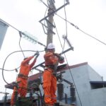
The Hai Phong Power Company has mobilized over 1,000 of its best and brightest engineers and technicians from across the city’s district power companies and high-voltage electrical testing units. With a comprehensive fault-zone inspection strategy, they successfully restored power to 100% of their customers.
“Dr. Nguyen Van Dinh: Ha Nam – A Choice for an Elevated, Worthy, Quality and Luxurious Life”
“The Vice President of the Vietnam Real Estate Association asserts that the robust development of transportation infrastructure and tourism services, coupled with competitive property prices, presents a prime opportunity for the real estate market in Ha Nam province to thrive and accelerate in the coming years.”
The Central Bank Will Continue to Lower Lending Rates
The State Bank is implementing a range of solutions to boost credit growth, with a key focus on reducing lending rates.
The Ultimate Storm Tracker: Yagi’s Path in the Palm of Your Hand
Tropical Storm Yagi, or Storm No. 3, was one of the most powerful storms of 2024, wreaking havoc over the South China Sea. It was an intense and dangerous storm that posed a significant threat as it approached the northern provinces of Vietnam, with the potential to make a direct and devastating landfall.

