


")
 Secures $190 Million Contract for APEC Phu Quoc Convention Center Project")


: Highest Cash Dividend at VND 8,500 per Share")


: Returning to Critical Support Levels?")

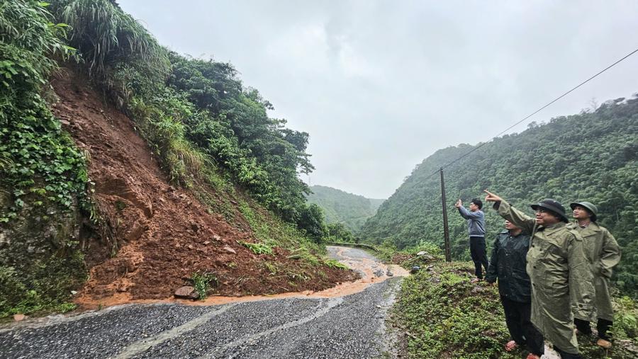
Landslides and localized flooding were reported in Quang Binh, with 10 affected areas. These included a landslide on National Highway 12A at Km121+950, where soil and rocks slipped onto the road. However, the road management unit promptly cleared the debris, ensuring uninterrupted traffic flow.
On National Highway 9B, the Km43+700 underpass was flooded with 0.6m of water, blocking traffic. Similarly, the Km41+990 underpass experienced 0.4m of flooding, also resulting in a roadblock. The road management unit responded by setting up barriers, warning signs, and deploying personnel to ensure safety.
On National Highway 15, the Bung underpass at Km562+200 experienced shallow flooding of 0.2m, but traffic flow was maintained. However, the K Ai underpass in Dan Hoa Commune (Cha Lo border post area) witnessed a water level rise of about 1m, rendering it impassable for both vehicles and pedestrians.
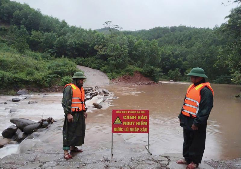
The CuPi and Ta Co underpasses in Trong Hoa Commune (Ra Mai border post area) experienced water levels ranging from 0.5 to 0.7m, making them impassable. The CuPi underpass was completely washed away by the floodwaters. Similarly, the Cay Buou bridge and the bridge-cum-culvert in Luong Nang village, Hoa Son Commune (Ca Xeng border post area), were inundated with 0.6m of water, halting the movement of people and vehicles.
The bridge culvert in Ban Chuoi village, Lam Hoa Commune, was flooded with 2m of water, isolating 18 households comprising 91 individuals. The underpasses in Ca Roong 1 and Khe Rung villages, Thuong Hoa Commune, witnessed water levels ranging from 0.8 to 1m, preventing the passage of people and vehicles.
Several culverts on the roads leading to Bach Dan, Tan Ly, and Xa Khia villages in Lam Thuy Commune, as well as Khe Giua, Cum Coi, and Coi Da villages in Ngan Thuy Commune, and An Bai and Ha Lec villages in Kim Thuy Commune, were flooded with about 1m of water. In response, the border posts have collaborated with local authorities to set up warning signs and advise residents against venturing into areas with strong currents.
In Quang Tri, 33 locations experienced flooding and disruption, including one point on the National Highway, where 0.4m of flooding blocked traffic. Provincial roads were also affected, with four locations experiencing water levels ranging from 0.4 to 0.8m, resulting in traffic disruptions.
Dakrong District reported six flooded locations, including the A Ngo – A Bung floodgate, the Ta Rut – A Ngo culvert, the Ly Ton culvert, the culvert in Lang Cat Village (Dakrong Commune), the culvert in the Huc Nghi resettlement area, and the Ba Long floodgate. Water levels in these areas ranged from 0.4 to 1.5m, leading to transportation disruptions.
Huing Hoa District experienced flooding at 20 locations, with water levels ranging from 0.3 to 1.0m, causing transportation disruptions. Two locations in the provincial town of Quang Tri were also affected: the intersection of Ly Thuong Kiet and Hai Ba Trung streets, and a section of Ly Thai To Street in front of the Citadel, with water levels reaching 0.3 to 0.5m.
On September 18, heavy rains in Da Nang caused localized flooding at 34 locations, with water depths ranging from 20 to 40 cm and lasting for 30 to 50 minutes. The affected districts included Thanh Khe (8 locations), Son Tra (7 locations), Hai Chau (8 locations), Lien Chieu (4 locations), and Cam Le (7 locations). By 6:00 AM on September 19, the flooding in the city had subsided.
Regarding damage, Da Nang experienced the fall of 25 trees, and one location of wall and gate collapse, affecting a residential area. Local authorities mobilized forces to remedy the situation.
In Thua Thien-Hue, a tornado in Phu Ho and Phu Xuan communes slightly injured one person, who was promptly treated at the Phu Ho health station. Twelve households had their roofs blown away, along with some ancillary works…
In Ha Tinh province, strong winds and heavy rains caused by Typhoon No. 4 damaged many houses. Specifically, a strong tornado and heavy rain in the morning of September 19 blew away the roofs and damaged the property of 14 households in Nguyen Hue village, Ky Xuan commune, Ky Anh district.
Earlier, in the early morning of September 18, a tornado and heavy rain also caused damage to 36 households in Cam Duong commune, Cam Xuyen district. Of these, 17 households were severely damaged. The tornado also knocked down many light poles and trees. Local authorities have provided support to help people recover from the damage and stabilize their lives.

In Thinh Loc commune, Loc Ha district, a tornado and heavy rain blew away the roofs of 12 houses and damaged many ancillary works. In addition, about 200 trees along the coast were blown down, and crops were damaged.
In anticipation of natural disasters, rain, and landslides, the People’s Committee of Ha Tinh province and the districts and towns proactively devised plans and evacuated thousands of households from vulnerable areas in Ky Anh town, Cam Xuyen district, Thach Ha, and Huong Khe… to safe places when the situation worsened.
According to the National Center for Hydro-Meteorological Forecasting, as of 5:00 PM on September 19, localities had evacuated a total of 2,208 households with 6,419 people from unsafe housing areas, low-lying areas near rivers and seas, and vulnerable coastal areas. They ensured that no one remained in cages, rafts, or watchtowers as Typhoon No. 4 made landfall.
Quang Binh evacuated 852 households/2,995 people. Quang Tri: 1,073 households/2,937 people evacuated to safety. Thua Thien Hue evacuated 283 households/487 people.
According to the National Center for Hydro-Meteorological Forecasting, the tropical depression weakened from Typhoon No. 4 and became a low-pressure area over central Laos.
As of 7:00 PM on September 19, the center of the low-pressure area was located at approximately 16.9 degrees north latitude and 106.2 degrees east longitude. The strongest winds in the center of the low-pressure area decreased to under 39 km/h. In the next 12 hours, the low-pressure area is expected to continue moving west and weaken before dissipating.
However, heavy rains in Thanh Hoa and Quang Binh provinces, strong winds and high waves in the central region of the East Sea and the northern region of the South China Sea, and the waters from Binh Dinh to Ca Mau remain complex. It is necessary to monitor the heavy rain forecasts and the next sea hazard notices.
The Storm Approaches Central Vietnam: Flooding Wreaks Havoc in Multiple Provinces

The tropical storm, known as Storm No. 4, battered central provinces with heavy rainfall, causing flooding in several localities. Authorities promptly evacuated hundreds of households to safety as the storm wreaked havoc in the region.
The Soaking Deluge: Central Vietnam’s Torrential Rains Leave Hundreds of Homes Submerged

Heavy rainfall battered the central provinces overnight, continuing into the early hours of September 20th. The downpour caused widespread flooding, prompting the swift evacuation of thousands of residents to safer grounds by the authorities.
The Capital City Adjusts Flooding Issues into Land Price Determinants

The Hanoi government has outlined eight specific factors that influence land prices, including water and electricity supply and their impact on drainage. This takes into account the stability of water and electricity provision and the area’s propensity for flooding during heavy rainfall.
“Government-Backed 2000 Billion VND Loan Scheme to Aid Post-Disaster Reconstruction”

Military Commercial Joint Stock Bank (MB) is offering a special loan package of up to 2000 billion VND with a 1% reduced interest rate for individuals and households affected by the floods. This initiative aims to support those impacted by the natural disaster to rebuild their lives and get back on their feet with ease.


