


 Reports Q3 Net Profit Surge of Over 2,000% to VND 3.3 Trillion, Driven by Successful Sale of 107 Million VCR Shares")


According to the master plan for the development of the national airport system approved by the Prime Minister, by 2050, Vietnam will have 33 airports (currently, there are 22 operating airports in the country). Notably, the plan includes a second airport for the Capital Region, located in the south and southeast.
The second airport of the Capital Region aims to relieve pressure on Noi Bai International Airport after 2050.
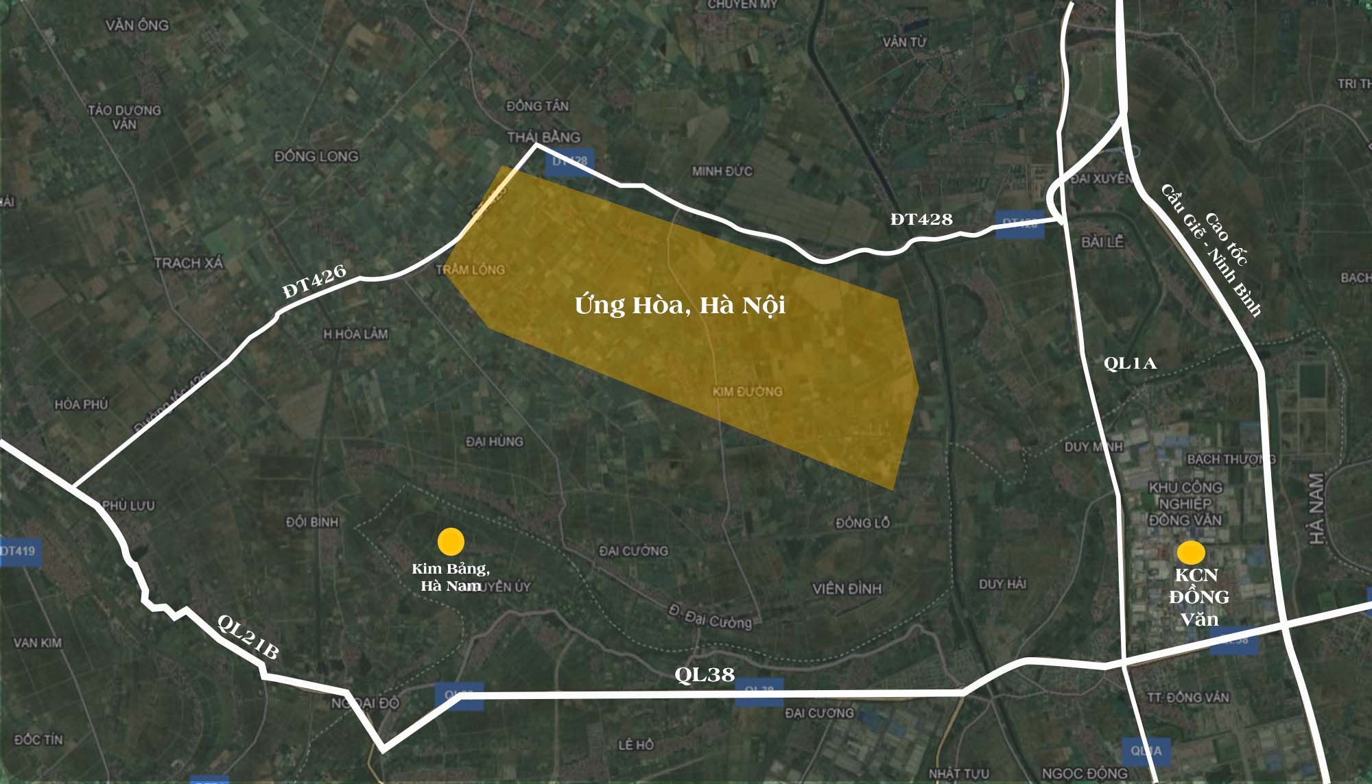
In the adjusted master plan for Hanoi Capital until 2045, with a vision towards 2065, Hanoi oriented the planning of the second airport of the Capital Region to Ung Hoa and Phu Xuyen districts.
The city will allocate space for the development of the second airport of the Capital Region adjacent to the Northwest-National Highway 5 axis, between Phap Van-Cau Gie Expressway, National Highway 1A, the North-South high-speed railway, and the North-South unified railway. The airport will be located in some communes of Ung Hoa and Phu Xuyen districts, with an expected capacity of 50 million passengers per year.
In May 2024, Conclusion No. 80-KL/TW (dated May 24, 2024) of the Politburo concluded on the adjusted master plan for Hanoi Capital. It emphasized the need for careful research and calculation regarding the suitability and impacts on the socio-economic conditions of the Capital and neighboring localities to determine the location of the second airport, ensuring efficiency and alignment with the practical development of the Capital and the Red River Delta region.
Below are four locations that have been proposed and considered for the construction of the second airport of the Capital Region.
1. Thanh Mien and Binh Giang Districts, Hai Duong Province

Thanh Mien and Binh Giang districts in Hai Duong Province are among the proposed sites for the second airport of the Capital Region. About 20 years ago, the Vietnam Urban Development Planning Association also suggested building an international airport here, but it has not been implemented.

According to Ms. Nguyen Thi Ti, a local resident, the proposed airport site in Hai Duong has been in An Lau village, Hong Quang commune, Thanh Mien district, where she farms every day. As a local, she eagerly awaits the project’s realization to boost the local economy.
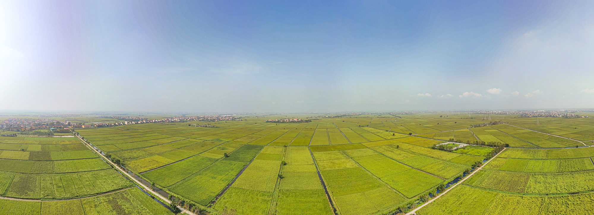
The proposed site for the second airport of the Capital Region in Hai Duong Province consists mainly of large rice fields. Economically, Thanh Mien and Binh Giang districts have primarily developed agriculture. In the future, building an airport here will be a significant landmark and milestone for the two districts and Hai Duong Province. The photo shows the entire An Lau village, Hong Quang commune, Thanh Mien district.
2. Tien Lang District, Hai Phong City
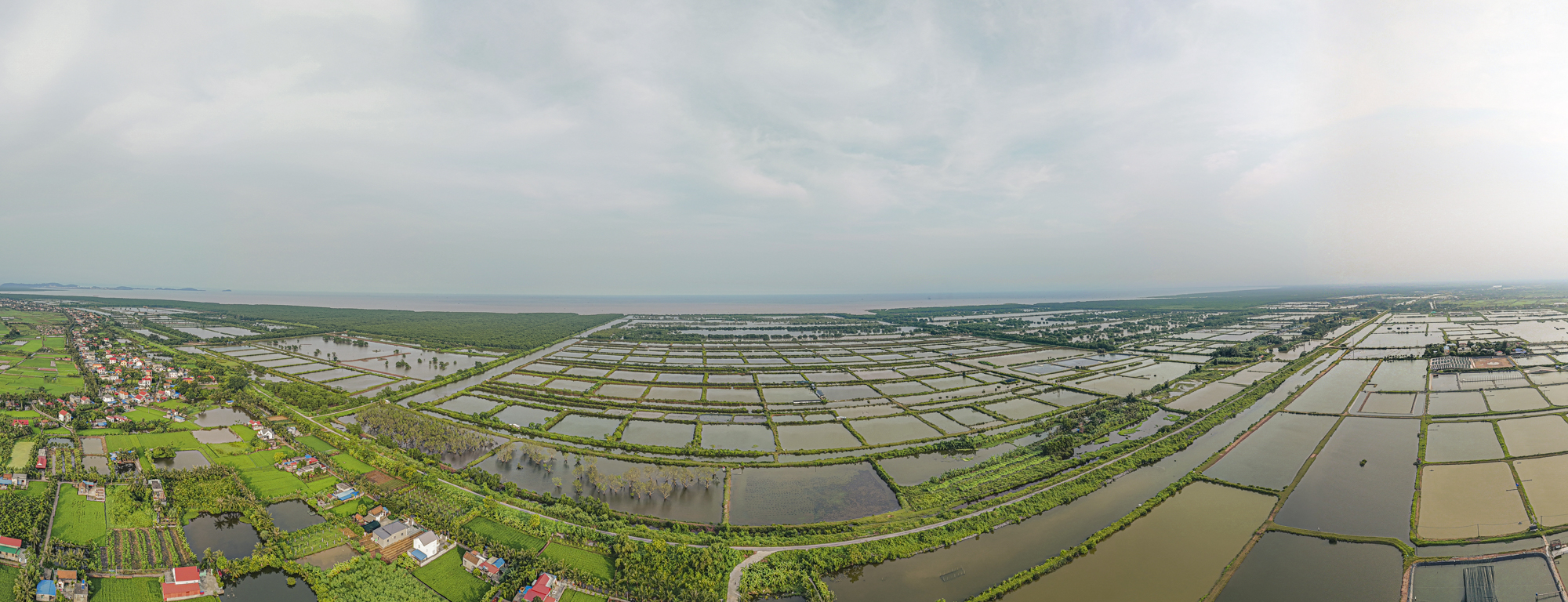
Although not within the Hanoi Capital Region, in early March 2021, the leaders of Hai Phong City proposed planning Tien Lang as the second international airport in the Capital Region. The photo shows the entire area expected to be the Tien Lang International Airport.
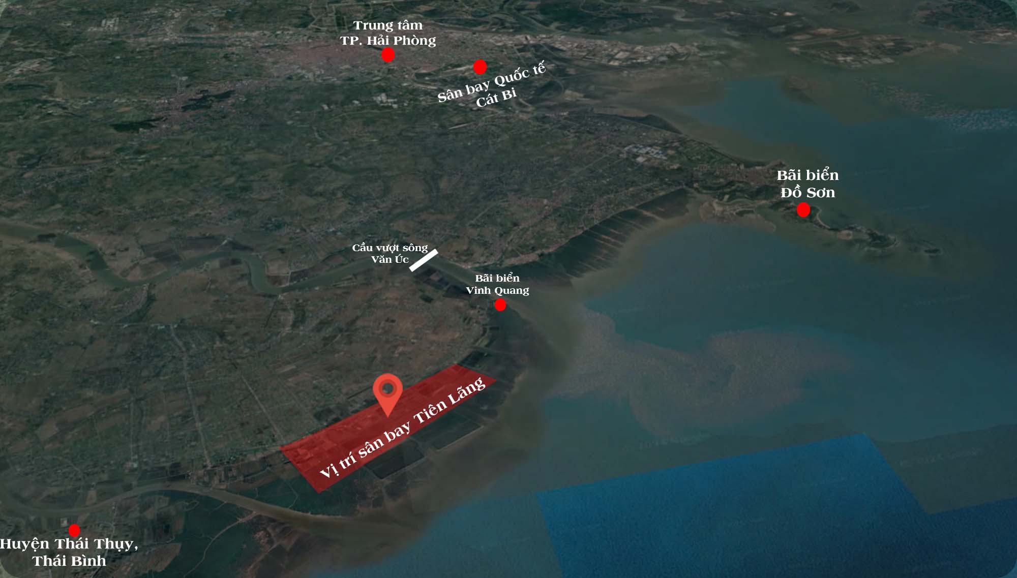
The proposed location for the Tien Lang International Airport is in Tien Lang district (near Vinh Quang beach). It is 40 km from the center of Hai Phong City and only 35 km from Cat Bi International Airport. After the proposal, in 2022, the Prime Minister assigned the Ministry of Transport to study the construction plan for the Tien Lang International Airport according to the master plan for the development of the national airport system.
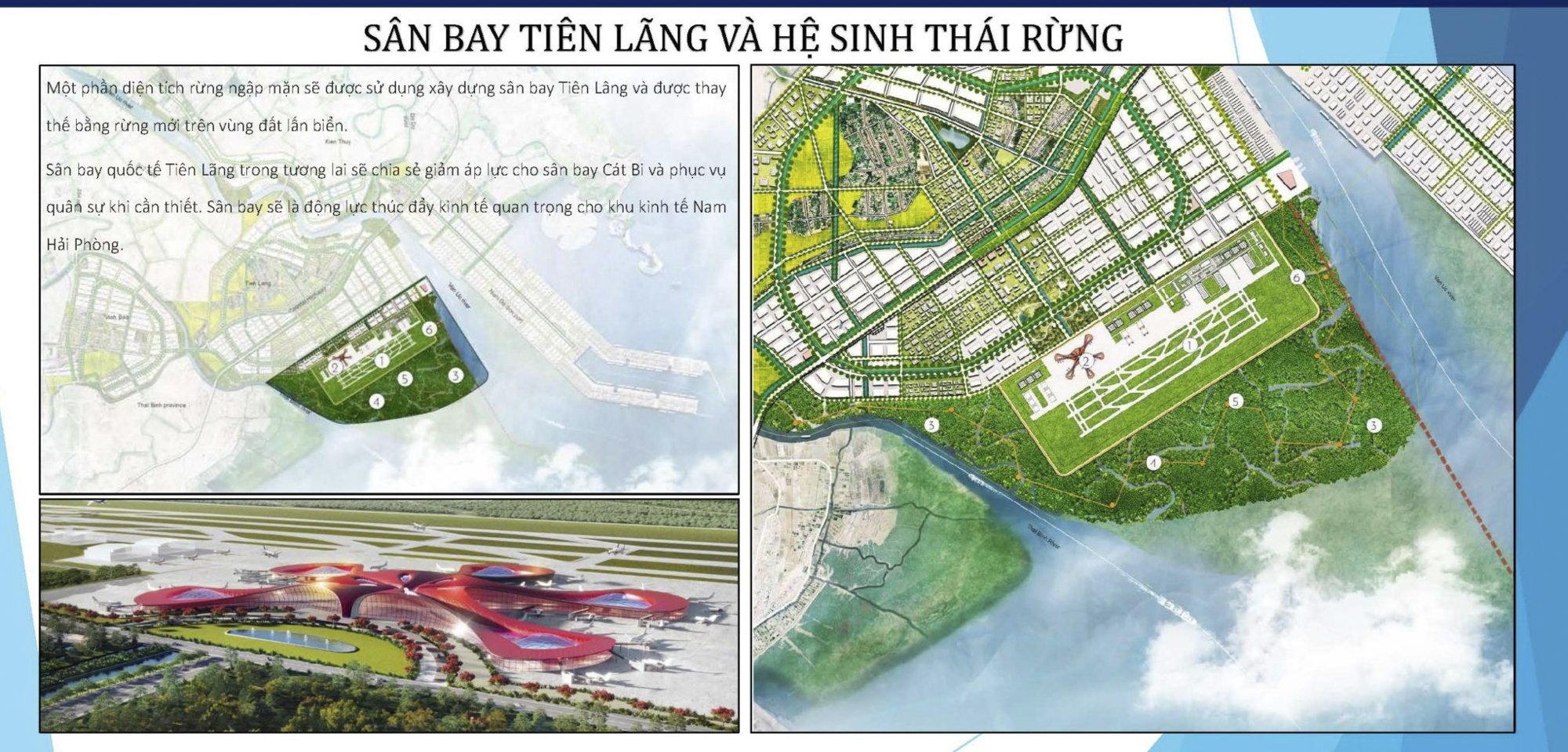
Notably, Hai Phong City has been studying the proposal for the Southern Coastal Hai Phong Economic Zone. The highlight of this plan is the Tien Lang International Airport, expected to cover an area of 1,150 hectares (11.5 km2) with an investment of about VND 10,000 billion. Source: Haiphong Economic Zone Authority (HEZA)
The recorded site for the proposed Tien Lang International Airport is mainly coastal land with a few residential houses and some temporary structures. According to the Vietnam Aviation Authority, they have thoroughly surveyed areas in the Northeast region. Locating the airport in Tien Lang (Hai Phong) meets all the ideal conditions: minimal resettlement of residents, convenient transportation connections with localities such as Hai Phong, Hai Duong, Thai Binh, Nam Dinh, and feasible costs for site clearance and construction.
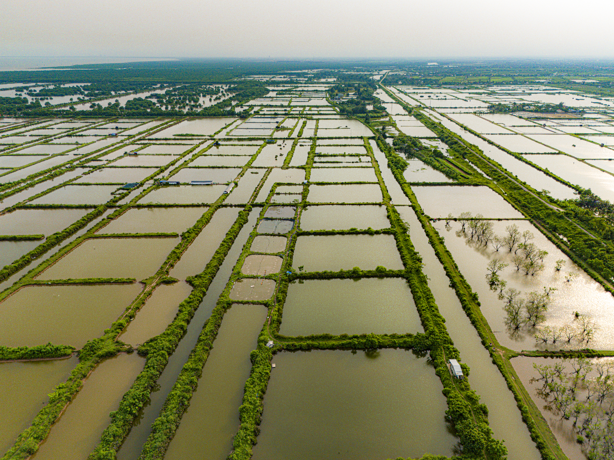
3. Ly Nhan District, Ha Nam Province
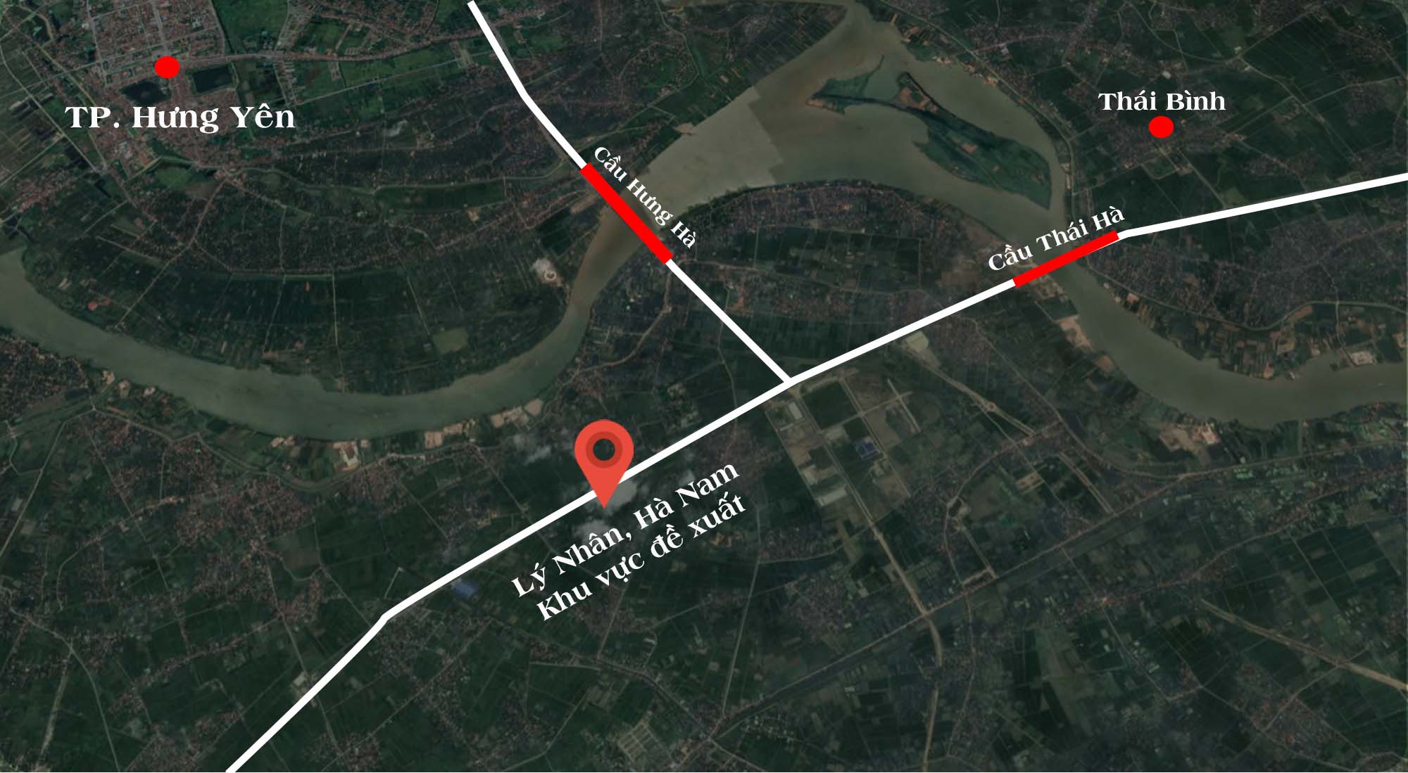
Ly Nhan district, Ha Nam province, is also among the proposed sites for the second airport of the Capital Region. However, according to the Ha Nam People’s Committee, the expected land fund of 13.5 km2 in Dao Ly and Duc Ly communes (Ly Nhan district) is no longer feasible due to the planning of many industrial and urban areas, some of which are already under implementation.
Moreover, the proposed site is crowded with scattered residential areas. Therefore, the Ha Nam People’s Committee requested the consulting unit to research, evaluate, and propose a more feasible location. The photo shows Ly Nhan district, Ha Nam province.
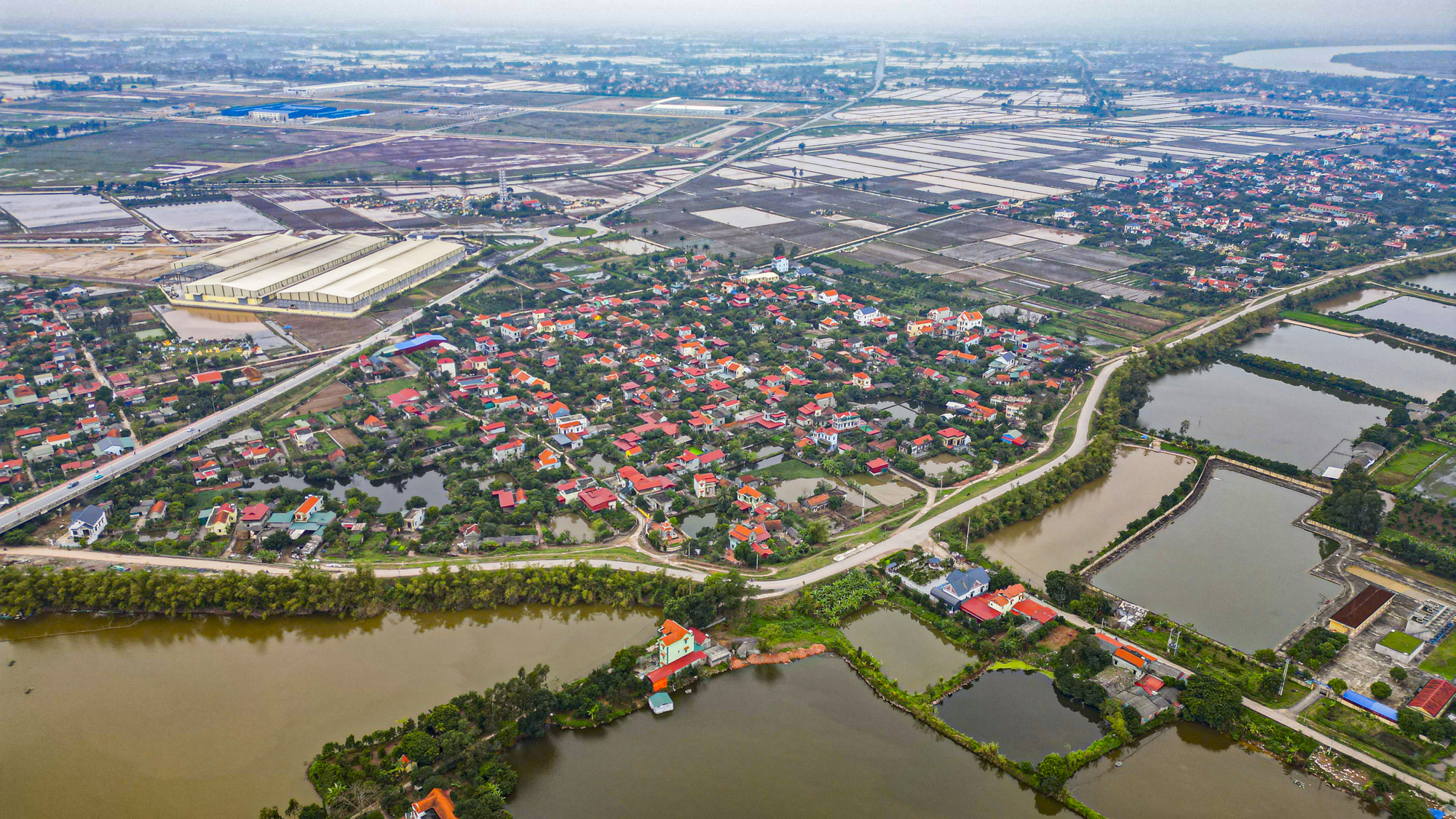
4. Phu Xuyen and Ung Hoa Districts, Hanoi City
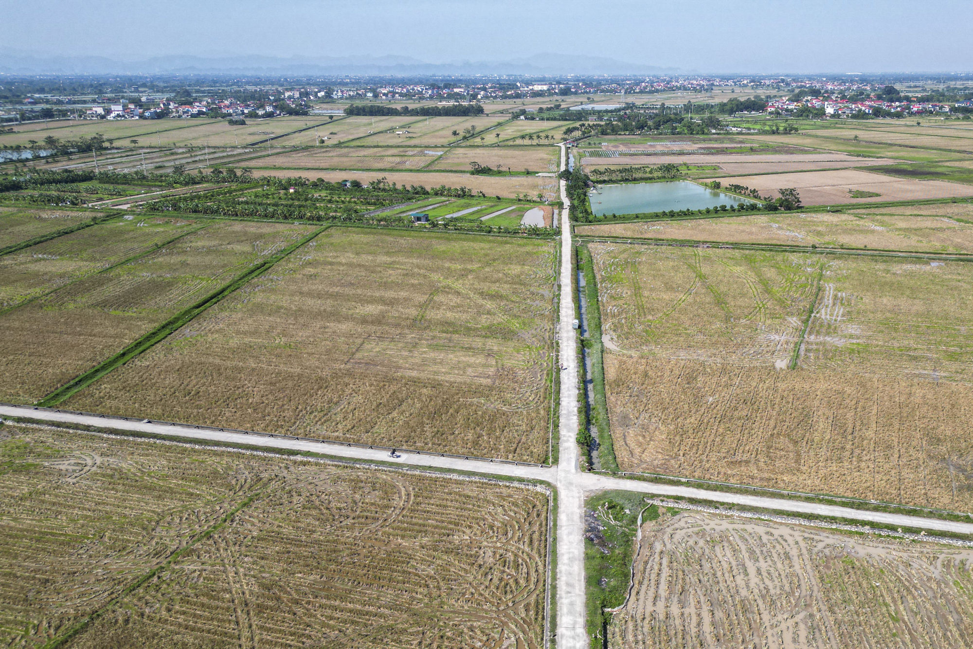
At the consultation conference on the orientation of the master plan for Hanoi Capital until 2045, with a vision towards 2065, held in early October 2023, the Hanoi Institute for Planning and Architecture (the unit in charge of adjusting the master plan for the Capital) proposed an additional option for the second airport in Phu Xuyen and Ung Hoa districts, Hanoi City. The photo shows Minh Duc commune, Ung Hoa district.
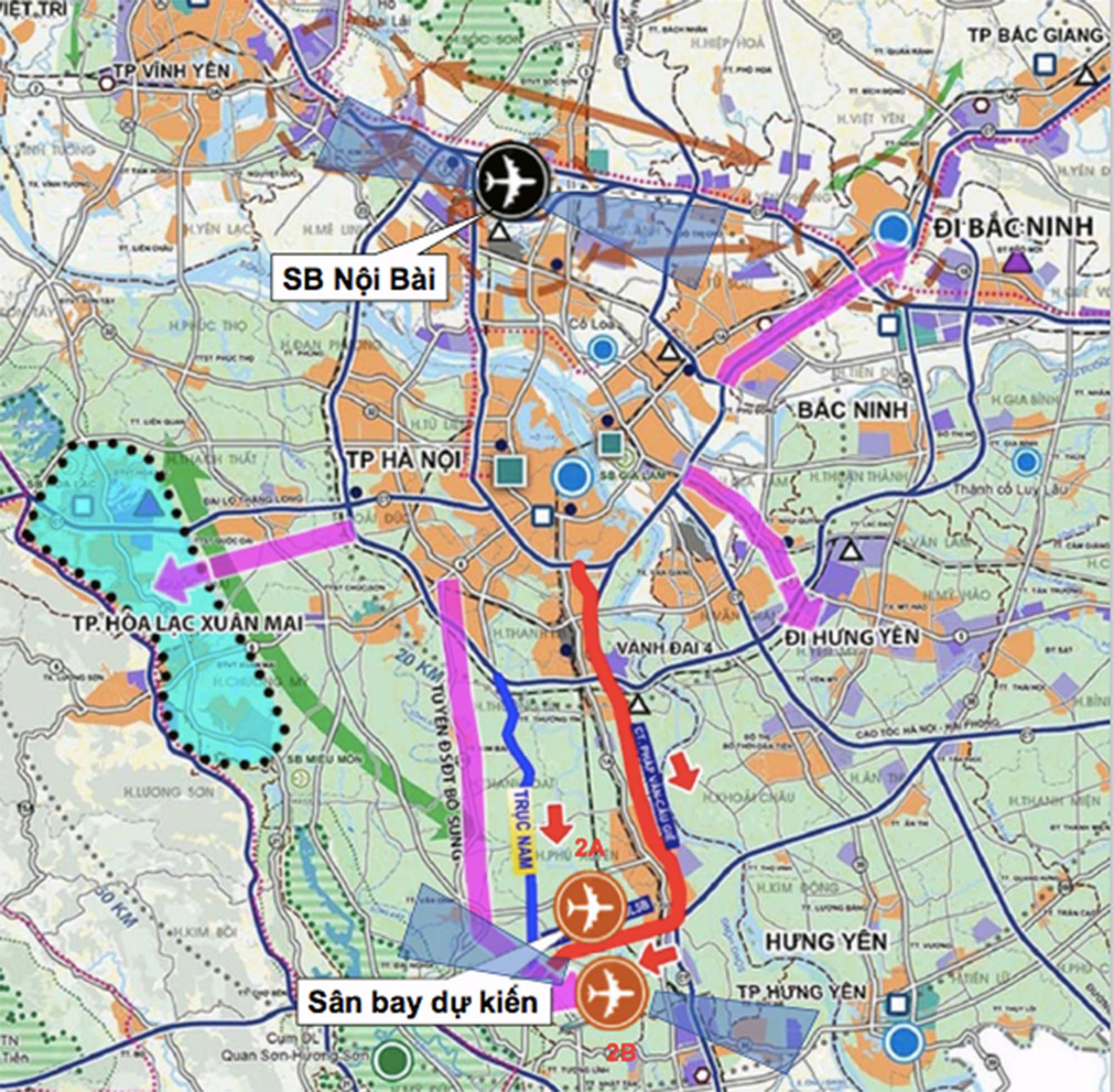
The proposed location for the second airport is north of the Northwest-National Highway 5 axis, covering Tan Dan and Chuyen My communes in Phu Xuyen district and Dong Tan, Minh Duc, and Trung Tu communes in Ung Hoa district (known as option 2A) with an expected area of 17 km2. Option 2A is similar to option 2B previously presented to the Hanoi People’s Council. The photo shows the locations of options 2A and 2B, source: Hanoi Institute for Planning and Architecture.
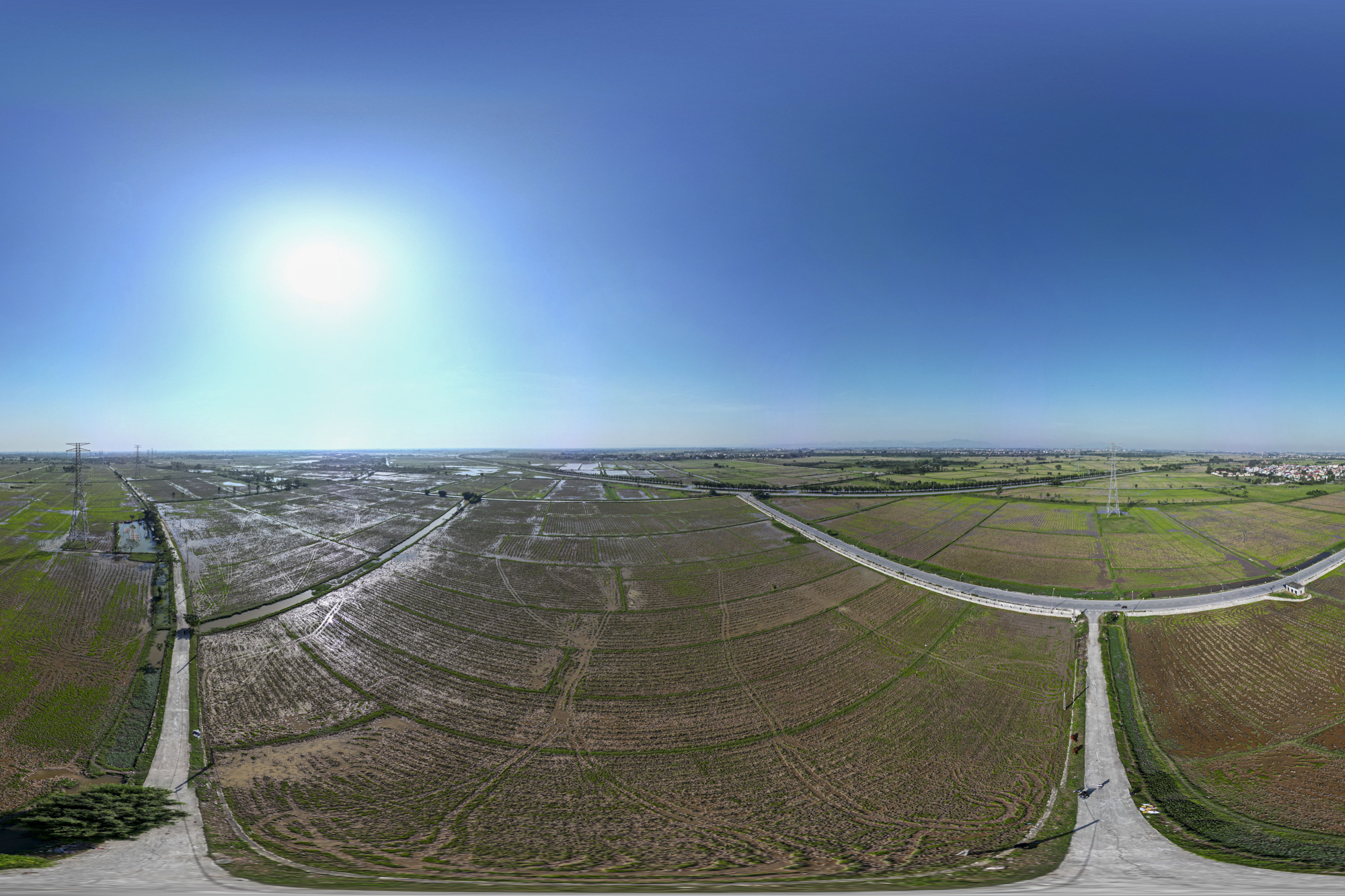
The construction of the airport in options 2A and 2B is located in the southern space, connecting the central urban area and linking Phu Xuyen as an industrial and transportation hub for cargo transshipment, driving the development of the southern region. The photo shows the construction location.
In addition to Phu Xuyen and Ung Hoa, the first option proposed building the airport in Tan Uoc and Thanh Van communes (Thanh Oai district) and Tien Phong and Tan Minh communes (Thuong Tin district) with an area of about 13 km2. The advantage of this option is the proximity to the center of Hanoi, only 20-30 km2, and easy connections to expressways and national highways. However, it would require resettling 5,000 people and clearing over 52 hectares of village land. The photo shows Tan Uoc commune, Thanh Oai district.
The Storm’s Aftermath: Hải Phòng Shuts Down 41 Old Apartments, Prioritizing Resident Safety and Relocation Assistance.

The city of Haiphong is home to over 70 old apartment blocks, many of which were constructed in the 1960s and have since fallen into disrepair. The passage of time and the elements have taken their toll on these structures, and their condition has further deteriorated following the recent Typhoon No. 3. These apartments are now in a state of severe disrepair and are at risk of collapse at any moment.
The Second International Airport: A Vision for Haiphong’s Future

Tiên Lãng, a district in the vibrant city of Hai Phong, has been proposed as the site for the brand-new Tien Lang Airport. With a planned investment of 10,000 billion VND, this airport is envisioned to span an impressive 11 square kilometers.
The Great Relocation: Evacuating 5,400 Residents from Old Apartment Blocks to Weather Super Typhoon Yagi

In the face of the impending Super Typhoon Yagi, residents of dilapidated apartment buildings in Hai Phong City were forced to evacuate as a precautionary measure.
Unveiling Hai Phong’s Old Apartment Blocks Slated for Demolition to Make Way for Resettlement.

The 16 dilapidated apartment blocks in Haiphong, no longer safe for human habitation or capable of safeguarding property, will be demolished to make way for a brand-new resettlement area.


