On November 14, 2024, the National Assembly Standing Committee issued Resolution No. 1286 on the rearrangement of Hanoi’s communal-level administrative units for the 2023-2025 period. The resolution entails the following key decisions:
1. Ba Vi District:
– Establishment of Phu Hong Commune by merging the entire natural area and population of Chau Son, Phu Phuong, and Tan Hong communes.
Post-rearrangement, Ba Vi District comprises 29 communal-level administrative units, including 28 communes and one town.
2. Chuong My District:
– Formation of Hong Phu Commune by amalgamating the entirety of Dong Phu and Hong Phong communes’ area and populace.
– Creation of Hoa Phu Commune by integrating the entire area and population of Phu Nam An and Hoa Chinh communes.
Post-rearrangement, Chuong My District encompasses 30 communal-level administrative units, including 28 communes and two towns.
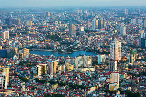
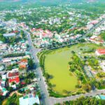
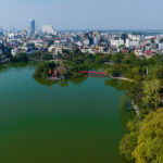
A bird’s-eye view of Hanoi city
3. Me Linh District:
– Integration of Van Yen commune’s entirety of natural area and populace into Lien Mac commune. Post-merger, Lien Mac commune spans 11.31 sq. km with a population of 23,220 individuals.
Post-rearrangement, Me Linh District consists of 17 communal-level administrative units, encompassing 15 communes and two towns.
4. My Duc District:
– Founding of My Xuyen Commune by merging the entirety of natural area and populace of My Thanh and Bot Xuyen communes.
– Establishment of Van Tin Commune by amalgamating the entire area and population of Doc Tin and Van Kim communes.
Post-rearrangement, My Duc District comprises 20 communal-level administrative units, including 19 communes and one town.
5. Phu Xuyen District:
– Integration of Tri Trung commune’s entire natural area and populace into Hong Minh commune. Post-merger, Hong Minh commune covers 9.45 sq. km with a population of 13,945 individuals.
– Amalgamation of Dai Thang commune’s entire natural area and populace into Van Hoang commune. Following this merger, Van Hoang commune spans 10.21 sq. km, housing 14,728 people.
– Founding of Quang Ha Commune by merging the entirety of Son Ha and Quang Trung communes’ area and populace.
– Integration of Nam Trieu commune’s entire natural area and population into Nam Phong commune. Post-merger, Nam Phong commune covers 9.63 sq. km with a population of 12,480 people.
Post-rearrangement, Phu Xuyen District consists of 23 communal-level administrative units, including 21 communes and two towns.
6. Phuc Tho District:
– Establishment of Tich Loc Commune by amalgamating the entire natural area and population of Tho Loc and Tich Giang communes.
– Founding of Long Thuong Commune by merging the entirety of Thuong Coc and Long Xuyen communes’ area and populace.
– Creation of Nam Ha Commune by integrating the entire area and population of Van Ha and Van Nam communes.
Post-rearrangement, Phuc Tho District comprises 18 communal-level administrative units, including 17 communes and one town.
7. Quoc Oai District:
– Formation of Phuong Son Commune by merging the entirety of natural area and populace of Phuong Cach and Yen Son communes.
– Integration of Tan Hoa commune’s entire natural area and population into Cong Hoa commune. Post-merger, Cong Hoa commune covers 8.31 sq. km with a population of 15,484 individuals.
– Founding of Hung Dao Commune by amalgamating the entire area and population of Dai Thanh and Tan Phu communes.
– Establishment of Liep Nghia Commune by merging the entirety of Liep Tuyet and Nghia Huong communes’ area and populace.
Post-rearrangement, Quoc Oai District consists of 17 communal-level administrative units, including 16 communes and one town.
8. Thach That District:
– Founding of Lam Son Commune by amalgamating the entirety of natural area and populace of Di Nau and Canh Nau communes.
– Establishment of Quang Trung Commune by merging the entire area and population of Huu Bang and Binh Phu communes.
– Integration of Chang Son commune’s entire natural area and population into Thach Xa commune. Post-merger, Thach Xa commune spans 6.14 sq. km with a population of 19,526 people.
Post-rearrangement, Thach That District comprises 20 communal-level administrative units, including 19 communes and one town.
9. Thanh Oai District:
– Formation of Cao Xuan Duong Commune by merging the entirety of natural area and populace of Xuan Duong and Cao Duong communes.
Post-rearrangement, Thanh Oai District consists of 20 communal-level administrative units, including 19 communes and one town.
10. Thuong Tin District:
– Integration of Thu Phu commune’s entire natural area and population into Chuong Duong commune. Post-merger, Chuong Duong commune covers 6.60 sq. km with a population of 13,197 people.
– Founding of Van Nhat Commune by amalgamating the entirety of Van Diem and Thong Nhat communes’ area and populace.
Post-rearrangement, Thuong Tin District comprises 27 communal-level administrative units, including 26 communes and one town.
11. Ung Hoa District:
– Establishment of Hoa Vien Commune by merging the entirety of natural area and populace of Vien Noi and Vien An communes.
– Founding of Cao Son Tien Commune by amalgamating the entire area and population of Cao Thanh, Son Cong, and Dong Tien communes.
– Creation of Thai Hoa Commune by merging the entirety of Hoa Xa and Van Thai communes’ area and populace.
– Establishment of Binh Luu Quang Commune by integrating the entire natural area and population of Luu Hoang, Hong Quang, and Doi Binh communes.
– Integration of Hoa Lam commune’s entire natural area and population into Tram Long commune. Post-merger, Tram Long commune covers 16.66 sq. km with a population of 13,322 people.
Post-rearrangement, Ung Hoa District consists of 20 communal-level administrative units, including 19 communes and one town.
12. Gia Lam District:
– Founding of Thien Duc Commune by merging the entirety of natural area and populace of Dinh Xuyen and Duong Ha communes.
– Integration of Dong Du commune’s entire natural area and population into Bat Trang commune. Post-merger, Bat Trang commune covers 5.42 sq. km with a population of 15,566 people.
– Establishment of Kim Duc Commune by amalgamating the entirety of Kim Lan and Van Duc communes’ area and populace.
– Founding of Phu Son Commune by merging the entire natural area and population of Phu Thi and Kim Son communes.
– Integration of Trung Mau commune’s entire natural area and populace into Phu Dong commune. Post-merger, Phu Dong commune spans 16.12 sq. km with a population of 22,014 people.
Post-rearrangement, Gia Lam District consists of 17 communal-level administrative units, including 15 communes and two towns.
13. Cau Giay District:
– Adjustment involving the transfer of a portion of Yen Hoa ward’s natural area (0.14 sq. km) and population (7,188 individuals), along with a part of Dich Vong ward’s area (0.05 sq. km) and populace (120 individuals), into Quan Hoa ward.
– Post-adjustment, Quan Hoa ward spans 1.08 sq. km with a population of 41,378 individuals.
– Yen Hoa ward, following the above adjustment, covers 1.92 sq. km and is home to 42,314 people.
– Alteration involving the transfer of a portion of Dich Vong ward’s natural area (0.16 sq. km) and population (2,750 individuals), along with parts of Nghia Do ward’s area (0.12 sq. km) and populace (2,439 individuals), and Dich Vong Hau ward’s natural area (0.16 sq. km) and population (3,380 individuals), into Nghia Tan ward.
– Post-adjustment, Nghia Tan ward spans 1.12 sq. km with a population of 31,536 individuals.
– Dich Vong ward, following the above changes, covers 1.15 sq. km and is home to 25,661 people.
– Nghia Do ward, post-adjustment, spans 1.22 sq. km with a population of 33,003 individuals.
– Dich Vong Hau ward, after the changes, covers 1.45 sq. km and is inhabited by 28,696 people.
Post-rearrangement, Cau Giay District comprises eight wards.
14. Dong Da District:
– Integration of Trung Phuong ward’s entire natural area and population into Kham Thien ward. Post-merger, Kham Thien ward spans 0.42 sq. km with a population of 22,201 individuals.
– Founding of Van Mieu – Quoc Tu Giam Ward by amalgamating the entirety of Quoc Tu Giam and Van Mieu wards’ area and populace.
– Adjustment involving the transfer of a portion of Ngã Tư Sở ward’s natural area (0.09 sq. km) and population (2,476 individuals) into Khuong Thuong ward.
– Integration of Ngã Tư Sở ward’s entire natural area and population into Thinh Quang ward. Post-merger, Thinh Quang ward covers 0.59 sq. km with a population of 20,593 people.
– Establishment of Phuong Lien – Trung Tu Ward by merging a portion of Trung Tu ward’s natural area (0.17 sq. km) and population (4,924 individuals) with Phuong Lien ward.
– Integration of the remaining natural area (0.25 sq. km) and population (7,241 individuals) of Trung Tu ward, post-adjustment as per the above, into Kim Lien ward.
Post-rearrangement, Dong Da District consists of 17 wards.
15. Ha Dong District:
– Amalgamation of yet Kiêu and Nguyễn Trãi wards’ entire natural area and populace into Quang Trung ward. Post-merger, Quang Trung ward covers 1.43 sq. km with a population of 43,957 people.
Post-rearrangement, Ha Dong District comprises 15 wards.
16. Hai Ba Trung District:
– Integration of Đong Mac ward’s entire natural area and population into Dong Nhan ward. Post-merger, Dong Nhan ward spans 0.30 sq. km with a population of 18,109 individuals.
– Amalgamation of Quynh Loi ward’s entire natural area and populace into Bach Mai ward. Post-merger, Bach Mai ward covers 0.51 sq. km with a population of 28,948 people.
– Adjustment involving the transfer of a portion of Cau Den ward’s natural area (0.14 sq. km) and population (9,502 individuals) into Bach Khoa ward.
– Integration of the remaining natural area (0.03 sq. km) and population (2,036 individuals) of Cau Den ward, post-adjustment as per the above, into Thanh Nhan ward.
Post-rearrangement, Hai Ba Trung District consists of 15 wards.
17. Long Bien District:
– Alteration involving the transfer of a portion of Sai Dong ward’s natural area (0.13 sq. km) and population (4,817 individuals) into Phuc Dong ward.
– Integration of the remaining natural area (0.73 sq. km) and population (13,175 individuals) of Sai Dong ward, post-adjustment as per the above, into Phuc Loi ward.
Post-rearrangement, Long Bien District comprises 13 wards.
18. Thanh Xuan District:
– Amalgamation of Thanh Xuan Nam ward’s entire natural area and populace into Thanh Xuan Bac ward. Post-merger, Thanh Xuan Bac ward covers 0.80 sq. km with a population of 39,953 people.
– Integration of Kim Giang ward’s entire natural area and population into Ha Dinh ward. Post-merger, Ha Dinh ward covers 0.93 sq. km with a population of 34,651 people.
Post-rearrangement, Thanh Xuan District consists of nine wards.
19. Ba Dinh District:
– Integration of Nguyen Trung Truc ward’s entire natural area and population into Truc Bach ward. Post-merger, Truc Bach ward spans 0.66 sq. km with a population of 16,782 individuals.
Post-rearrangement, Ba Dinh District comprises 13 wards.
20. Son Tay Town:
– Amalgamation of Le Loi and Quang Trung wards’ entire natural area and populace into Ngo Quyen ward. Post-merger, Ngo Quyen ward covers 2.08 sq. km with a population of 25,749 people.
Post-rearrangement, Son Tay Town consists of 13 communal-level administrative units, including six communes and seven wards.
21. Following the rearrangement of communal-level administrative units, Hanoi city is comprised of 30 district-level administrative units, encompassing 12 districts, 17 rural districts, and one town. The city now has 526 communal-level administrative units, including 160 wards, 345 communes, and 21 towns.


