


: Mixed Signals Emerge")

: Short-Term Outlook Continues to Deteriorate")

Highway 51: The Lone Road
Formed during the French colonial era to connect Saigon with Cap Saint Jacques (now Vung Tau), Highway 51 has undergone several expansions over the years. Initially a small road, it was widened to 7 meters in 1962. In 1997, the highway was expanded to 14 meters, and in 2010, it underwent further expansion to 22 meters, along with the addition of a central divider.
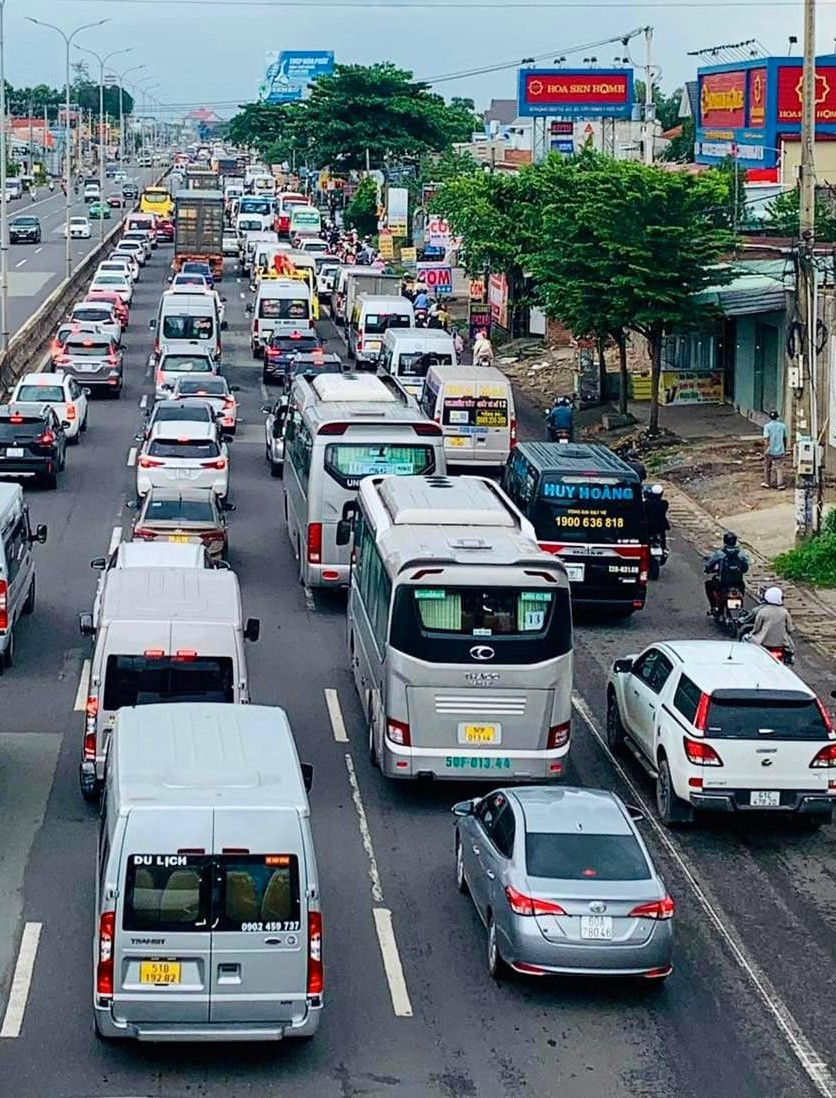
Highway 51 frequently experiences prolonged traffic congestion.
However, these expansions have not alleviated the traffic issues on Highway 51. On the contrary, the rapid increase in traffic volume has outpaced the road expansion, resulting in frequent traffic jams, especially during weekends.
Previously, travelers from Ho Chi Minh City to Ba Ria – Vung Tau had alternatives to Highway 51, such as the Hanoi Highway to Ngã Ba Vung Tau (in the former Bien Hoa, Dong Nai province) or the Cat Lai ferry. The opening of the Ho Chi Minh City – Long Thanh – Dau Giay Expressway in 2014 provided some relief to Highway 51 by diverting traffic from the Bien Hoa-Long Thanh section. Similarly, the Vung Tau – Long Son route, inaugurated in 2018, helped reduce traffic pressure in the Ba Ria area.
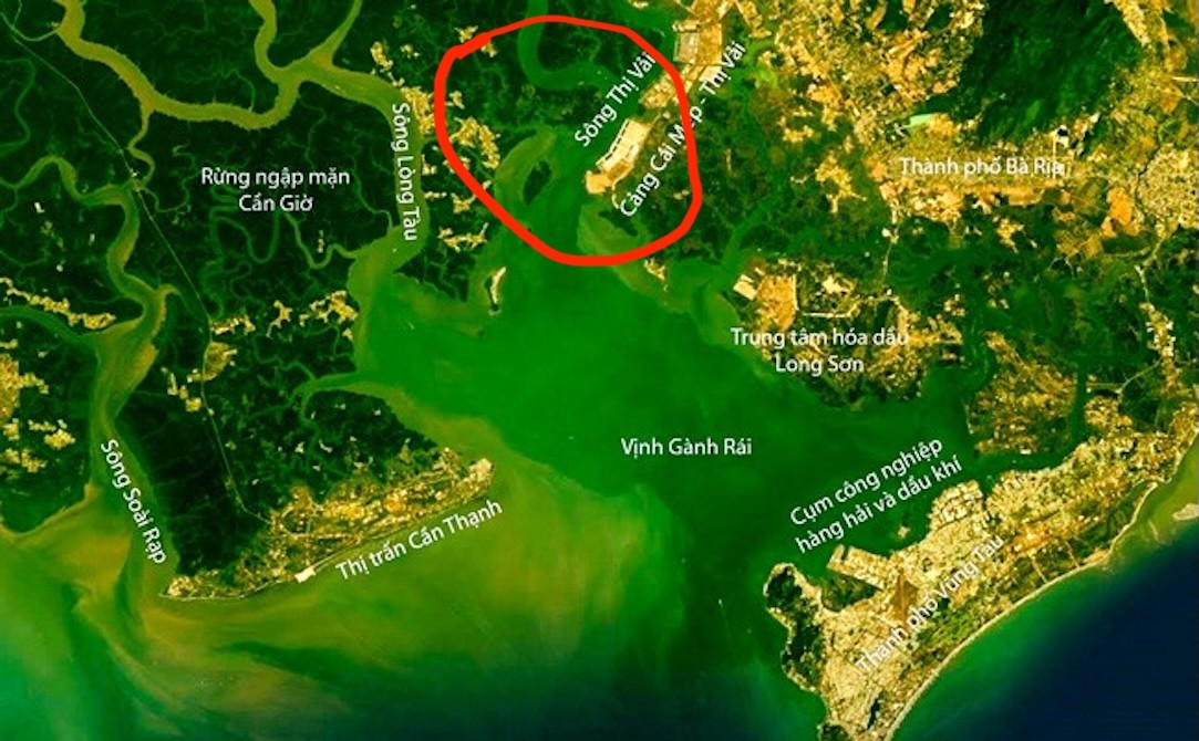
The Thi Vai River (within the red enclosure) marks the boundary but presents challenges for constructing a connecting road.
Nonetheless, travelers are still largely dependent on Highway 51, regardless of their chosen route.
The Gap in the Border Area
Prior to the merger, on the map, Ba Ria- Vung Tau shared over 30 km of land border with Ho Chi Minh City along the Thi Vai River and more than 20 km of coastline in Ganh Rai Bay. However, this area is a mangrove forest without a residential population. The only means of transportation between the two sides was an infrequent ferry service at the Ganh Rai estuary, connecting Vung Tau City (formerly of Ba Ria- Vung Tau) and Can Gio District (formerly of Ho Chi Minh City).
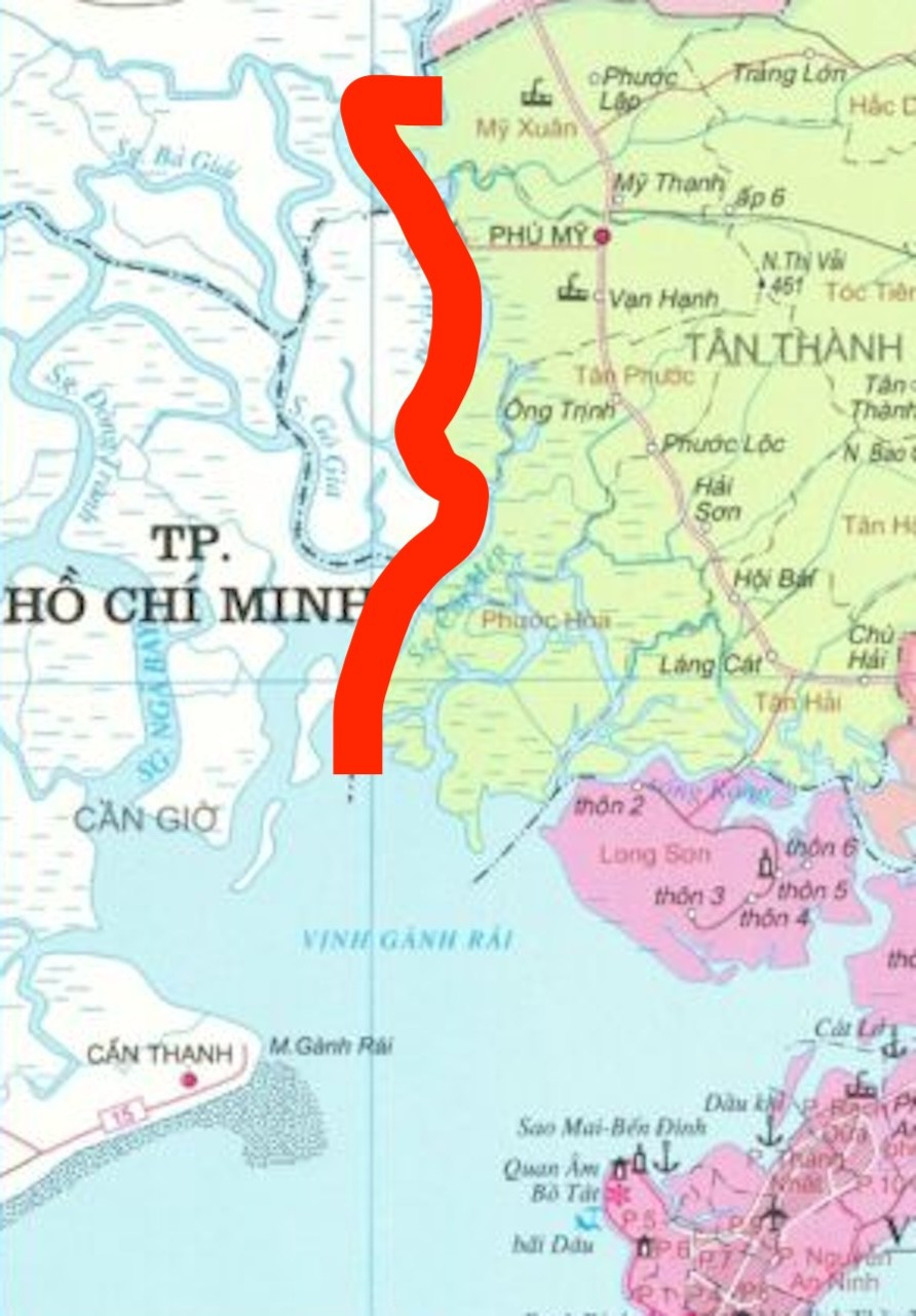
The red line indicates the land boundary between the former Ho Chi Minh City and Ba Ria- Vung Tau.
In 2021, the Vung Tau- Can Gio sea ferry route was introduced, replacing the old ferry service and providing a new road transport option (albeit via a ferry). However, as a sea-crossing ferry, passengers often experience long waiting times, and the unpredictable sea weather can disrupt the ferry’s operations. Consequently, this route is mostly convenient for residents in the border areas of Can Gio, while most travelers from other regions continue to opt for Highway 51.
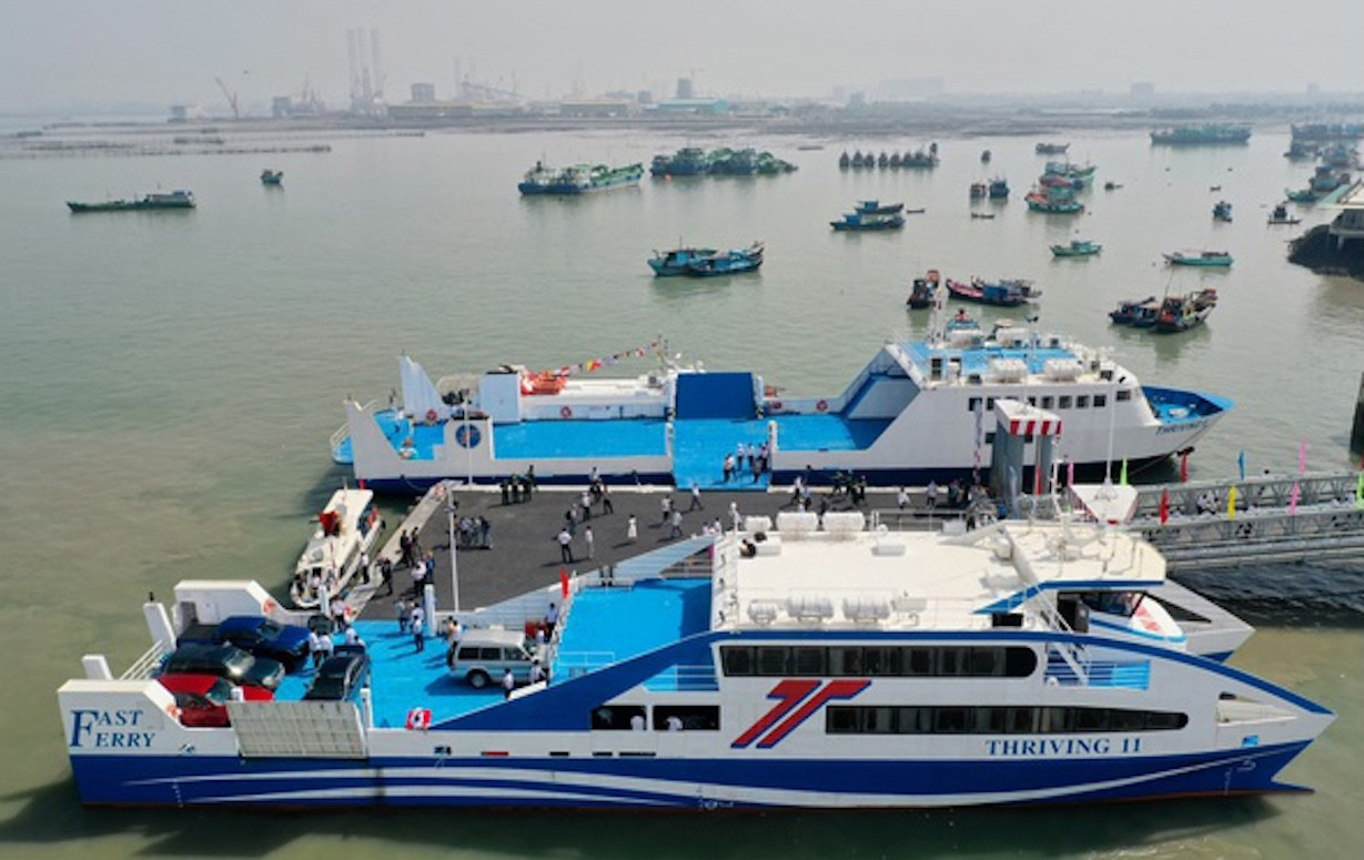
Can Gio- Vung Tau Ferry
The Congested Route
In recent times, this route has been plagued by frequent traffic jams. On the Ho Chi Minh City- Long Thanh- Dau Giay Expressway, the number of vehicles has exceeded the designed capacity by over 25%, leading to prolonged congestion even with minor incidents. The partial road closures for the construction of access roads to the Ring Road 3 (under development) have also contributed to the traffic woes in this area.
Highway 51 faces similar challenges, with a significant volume of container trucks from the expanded ports in Dong Nai and Ho Chi Minh City using this route.
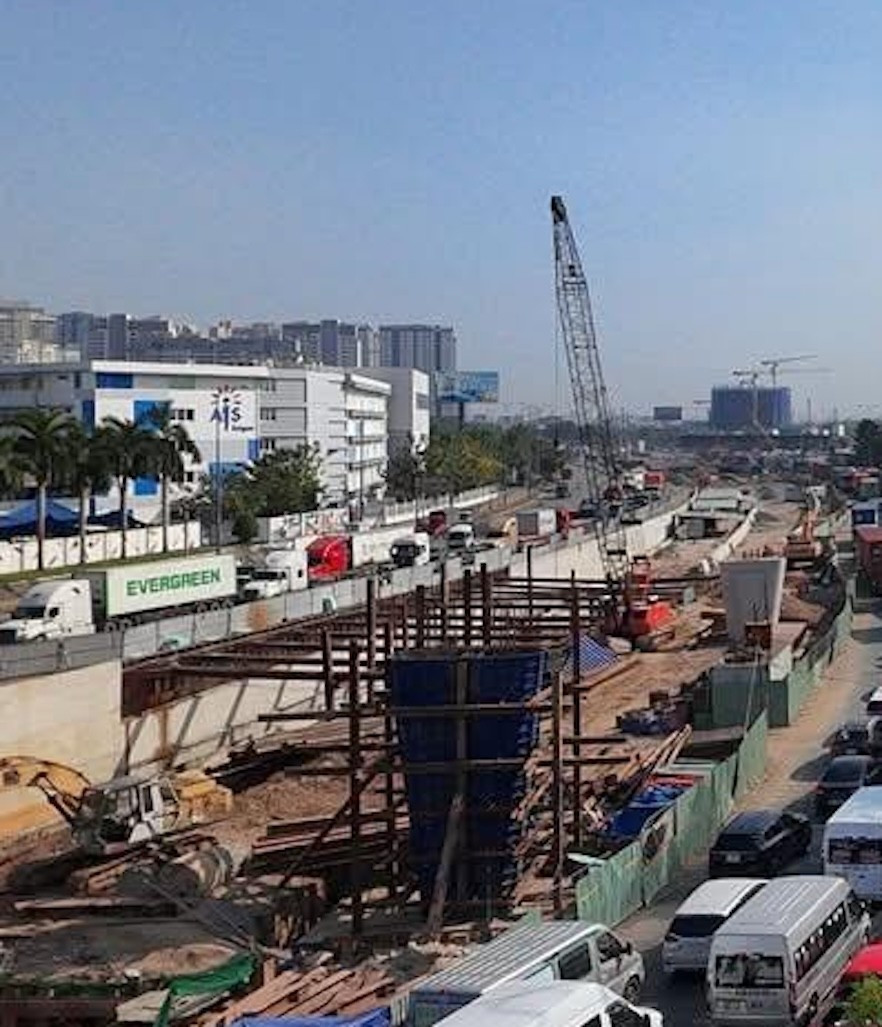
Ongoing transportation projects are among the causes of traffic congestion.
The merger has further exacerbated the situation, with an increased number of vehicles heading to the center of Ho Chi Minh City, leading to more frequent and severe traffic jams. Since the beginning of July, the Ho Chi Minh City – Vung Tau route has been congested almost daily, even during off-peak hours.
Mr. Nguyen Thanh Ha, a bus driver for Hoa Mai, which operates the Ho Chi Minh City – Vung Tau route, shared that on congested days, the travel time could increase from 2 hours to 5 hours. Many drivers transporting passengers to Tan Son Nhat Airport have to leave a day in advance to ensure timely arrival.
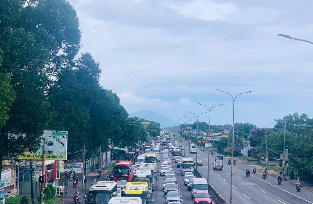
Vehicles lined up on Highway 51.
According to transportation experts, if the projects for renovating and constructing new roads are not completed in time, the situation will worsen by 2026 when the Long Thanh Airport becomes operational.
The Merger Challenge
Following the merger, the primary route connecting Ba Ria – Vung Tau and Ho Chi Minh City remains Highway 51, which passes through Dong Nai province.
To address the issue of Ba Ria – Vung Tau being an “island” within Ho Chi Minh City, proposals have been made to build a sea-crossing bridge connecting Can Gio and Vung Tau via Ganh Rai Bay. This option would shorten the distance between the two localities within Ho Chi Minh City and provide a boost to tourism, maritime economy, and port development.
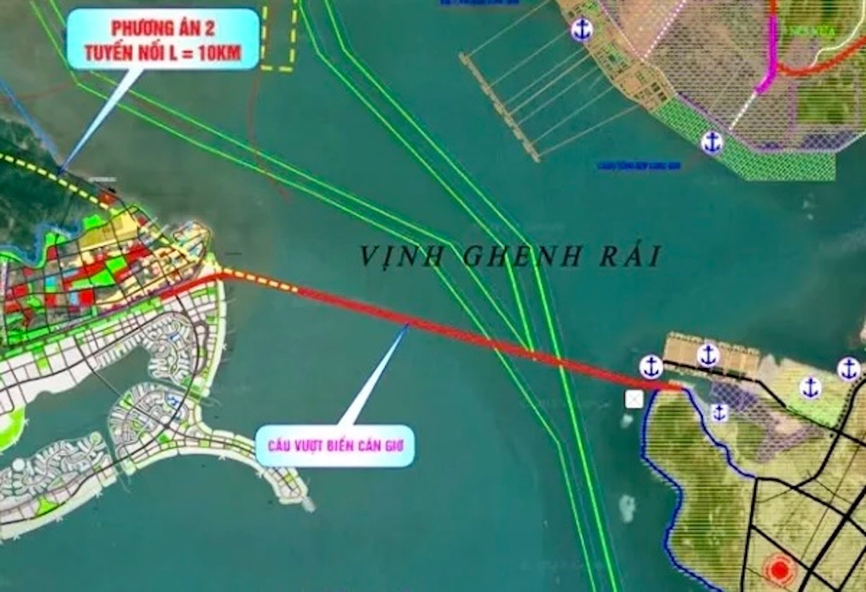
The proposed Can Gio sea-crossing bridge aims to connect the two new wards of Ho Chi Minh City.
Another suggestion by investors is to extend the high-speed railway from Ho Chi Minh City to Can Gio and then across the sea to Vung Tau. If realized, this option would offer a travel time of approximately 35 minutes from downtown Ho Chi Minh City to Vung Tau, faster than any current mode of transportation.
Projects aimed at reducing congestion on Highway 51.
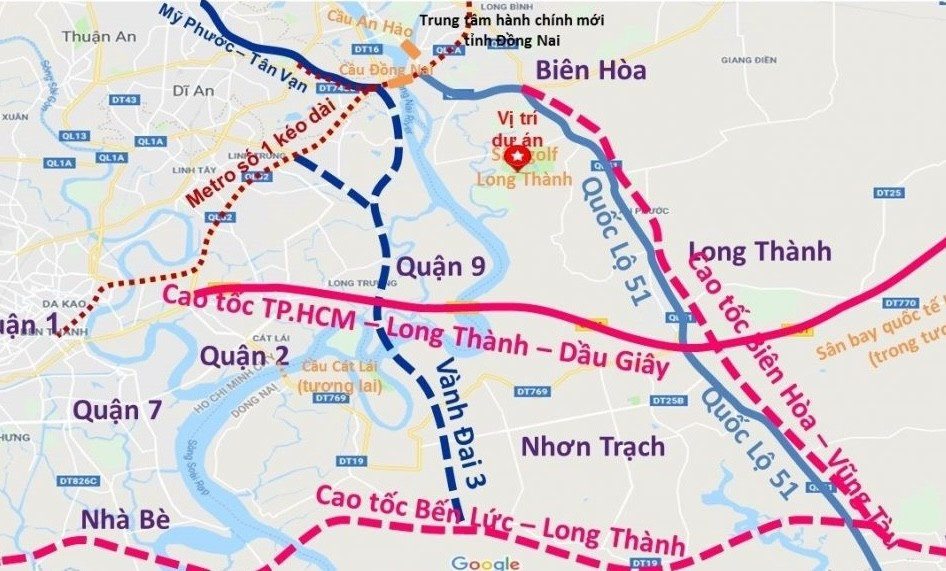
Currently, there are three projects underway to alleviate the traffic burden on the Long Thanh- Dau Giay Expressway: the Ho Chi Minh City Ring Road 3, the Ben Luc- Long Thanh Expressway, and the Bien Hoa- Vung Tau Expressway.
However, due to various reasons, these routes will not be operational in the near future. Moreover, even when they are completed, travelers will still have to pass through Dong Nai province to reach their destinations.
As a result, the former Ba Ria- Vung Tau continues to face the challenge of being “near yet far away” from Ho Chi Minh City.
“TV Holdings Enters Strategic Partnership with Altara Hospitality Group”

On Tuesday, August 3rd, 2025, TV Holdings, a prominent real estate company, and Altara Hospitality Group, a member of the Eco Business System managed by Altara Singapore, solidified their strategic partnership. This momentous occasion took place at the Sales Gallery of the captivating Fresia Riverside project in Bien Hoa, Dong Nai.
The Hottest News: Ho Chi Minh City Implements a 3-Tier Land Pricing System

The leaders of Ho Chi Minh City’s People’s Committee have initiated the process of establishing land price tables for the first time, in accordance with the Land Law of 2024.
The Rise of the Southern Metropolis: Satellite Cities and Infrastructure Take Off

As urban decentralization gains momentum and central land resources deplete, the southern region of Ho Chi Minh City is emerging as a “golden destination” for real estate investors. Benefiting from the infrastructure boost and integrated urban planning, this once-peripheral area is now transforming into a thriving satellite city, offering both residential and investment opportunities ahead of its upcoming breakthrough in the new development cycle.
The 36-Story Apartment Complex Cracks: Developer Yet to Implement Remedial Measures

Upon inspection, the People’s Committee of Tam Thang Ward found that the owner of Lapen Center apartment building had not implemented the urgent requirements as instructed by the inter-agency inspection team from the Ho Chi Minh City Department of Construction.
“Pitaland and ATTLand Join Forces: A Strategic Alliance for the Distribution of ArtStella Project”

On August 1st, at the strategic partnership signing ceremony for the ArtStella project between investor ATTLand, An Phong Group, BIDV Bank, and other agencies, Pitaland officially became the strategic distribution unit for the ArtStella project.


