

: Downward Trend Amid Global Robusta Harvest Outlook")


: A Mixed Bag of Wins and Woes")


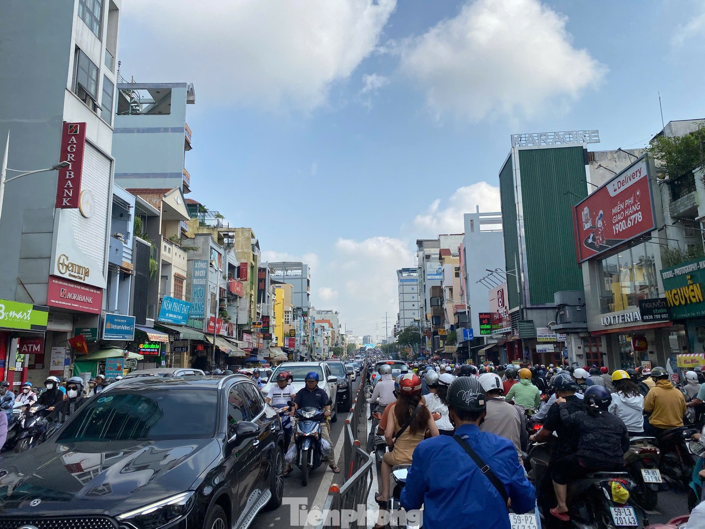
The roads leading from the southern area to the center of Ho Chi Minh City are currently experiencing severe congestion. Major routes such as Nguyen Tat Thanh, Nguyen Huu Tho, Kenh Te Bridge, and Pham Hung Street are frequently jammed, even during off-peak hours.
In response to this situation, the Ho Chi Minh City Management Authority for Transportation Infrastructure Investment Projects (Ho Chi Minh City Transportation Authority) has announced plans for two important transportation infrastructure projects: the Nguyen Khoai Bridge and Road, and the Binh Tien Bridge and Road.
According to the Ho Chi Minh City Transportation Authority, the construction of the Nguyen Khoai Bridge and Road project is expected to commence in November 2025 and be completed by the fourth quarter of 2027, provided that land clearance and procedures are timely.
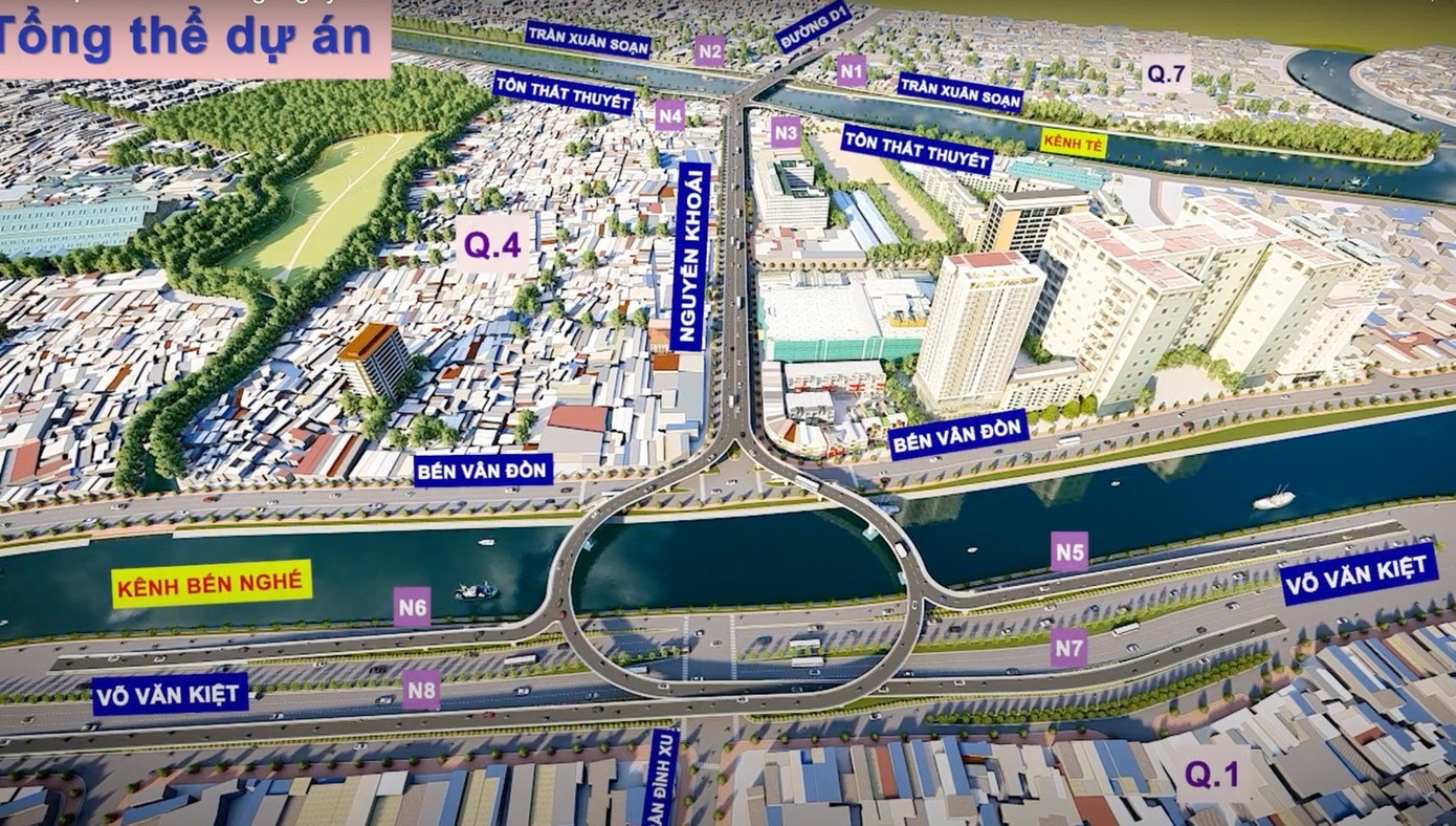
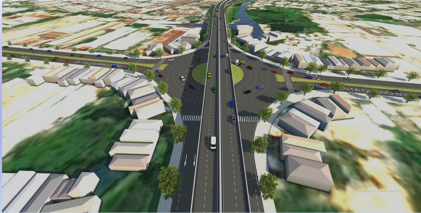
Nguyen Khoai Bridge and Road project overview.
The project has a total investment of over VND 3,724 billion from the city budget, including approximately VND 1,392 billion for compensation, resettlement, and infrastructure relocation, and VND 1,619 billion for construction.
The project will include a 2.5 km long bridge, ranging from 6.5 to 25.5 meters in width, connecting the old District 7 to the old District 1, crossing the Kenh Te and Rach Ben Nghe channels. Additionally, there will be over 1 km of access roads, a 626-meter Nguyen Khoai road, two 222-meter Hoang Trong Mau roads, and the improvement of nearly 900 meters of Vo Van Kiet road, widening it to 63.5 meters.
Upon completion, the Nguyen Khoai Bridge and Road project, crossing the Kenh Te and Ben Nghe channels, will form a major route connecting the South area with the city center of Ho Chi Minh City.
This infrastructure will help alleviate traffic congestion at existing bottlenecks such as the Kenh Te Bridge, Nguyen Huu Tho Street, Nguyen Van Cu Bridge, and Chu Y Bridge. It will also contribute to the completion of the transportation and technical infrastructure in accordance with the city’s planning, meeting the growing transportation demands in the area.
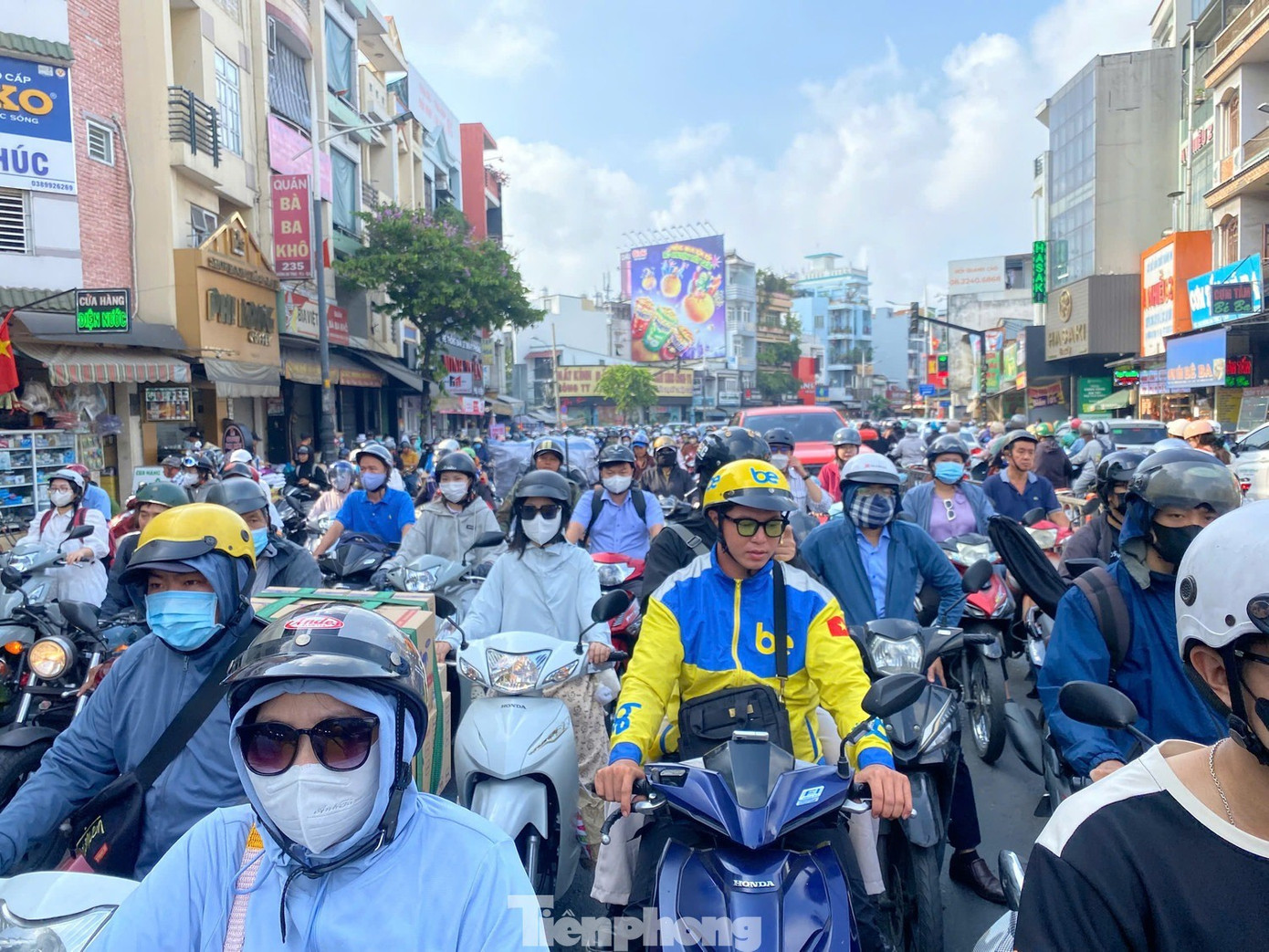
The roads from the South area to the center of Ho Chi Minh City are often congested during rush hours. Photo: Huu Huy
Aerial view of Ho Chi Minh City, showing the complex road system.
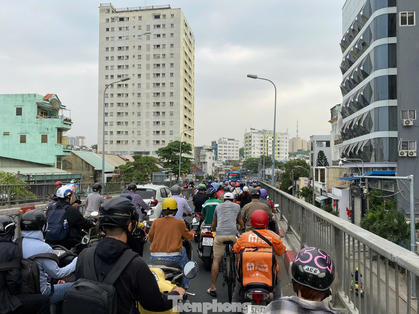
Traffic congestion at the Chu Y Bridge (left) and Nguyen Van Cu Bridge (right) during rush hour. Photo: Huu Huy
Regarding the Binh Tien Bridge and Road project, the Ho Chi Minh City People’s Committee has recently approved the design architecture competition regulations and tasks for this project. The route will be 3.66 km long, connecting Pham Van Chi Street (in the old District 6, now Binh Tien Ward) to Nguyen Van Linh Street (in the old Binh Chanh District, now Binh Hung Commune).
The project includes a 3.1 km long bridge, with 4-6 lanes, spanning the Tau Hu, Kenh Doi, Vo Van Kiệt, and Nguyen Van Linh channels to connect with National Highway 50. A 2-6 lane parallel road will be constructed underneath. The project requires approximately 22.5 hectares of land.
Artistic rendering of the Binh Tien Bridge and Road project.
With a total investment of nearly VND 6,300 billion from the city budget, the project will allocate more than VND 3,369 billion for compensation and site clearance, and VND 2,915 billion for construction. It is expected to commence in 2026 and be completed by 2028.
The Binh Tien Bridge and Road project is anticipated to open a new transportation axis from the city center to the South area and Hiep Phuoc Port, while also connecting to the city’s Ring Roads 2, 3, and 4.
The Top 10 Urban Giants of Hung Yen: Ecopark and Vinhomes Reign Supreme, With a 5-Month-Old Newcomer Giving Them a Run for Their Money

Hưng Yên is emerging as one of the new “hot spots” on the Northern real estate map. Its strategic location bordering Hanoi, coupled with an ever-improving infrastructure and a wave of investments from both domestic and foreign giants, is transforming the area.
The FDI Equity Inflows in the First Seven Months of the Year Surged by 27.3%

According to the latest statistics from the Ministry of Finance, foreign direct investment (FDI) into Vietnam reached a remarkable high of over $24 billion as of July, marking a significant 27.3% increase compared to the same period last year.
The Hottest Property Area in Danang: Unveiling the Buzzing Scene

Less than 15 minutes from the heart of Da Nang, Hoa Xuan is a burgeoning area that straddles the core center and the burgeoning southeastern urban cluster, expanding towards Quang Nam. With the recent administrative boundary merger, this prime riverfront land is swiftly attracting the attention of savvy investors.
Prime Land Opportunities in Southern HCMC: Securing Your Red Book Dream

According to a survey by Batdongsan.com.vn, for the first half of the year, the most popular types of real estate purchases were land (33%), apartments (30%), and private homes (21%). This indicates that land remains the dominant segment and is hard to dethrone in this new development cycle.
Savills: Dalat’s Potential as a Haven for the Ultra-Wealthy

“With its breathtaking natural heritage and ever-improving transport links, Dalat stands at the precipice of explosive growth. The city has the potential to become a haven for the ultra-wealthy, akin to renowned mountain resorts such as Aspen in the United States or Davos in Switzerland.”


