
: A Dismal Week for Coffee Prices")


: A Wave of Negativity Sweeps In")


As of 4 PM on September 30th, the Nam Thang Long Urban Area (Ciputra) experienced severe flooding. The entrance from Pham Van Dong Road and several internal roads were completely submerged, turning the area into a virtual river.
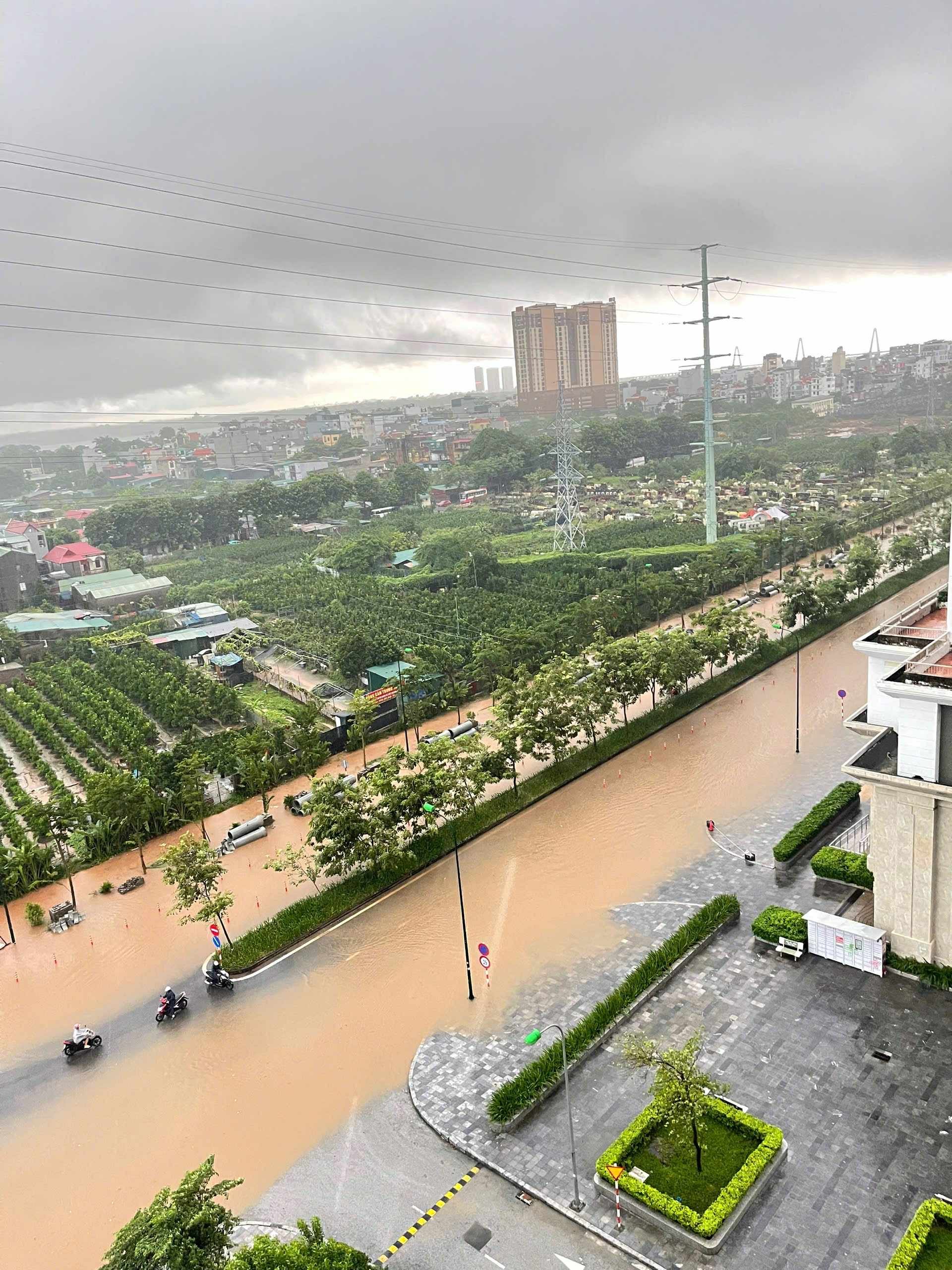
Internal roads in Nam Thang Long Urban Area (Ciputra) transformed into rivers.
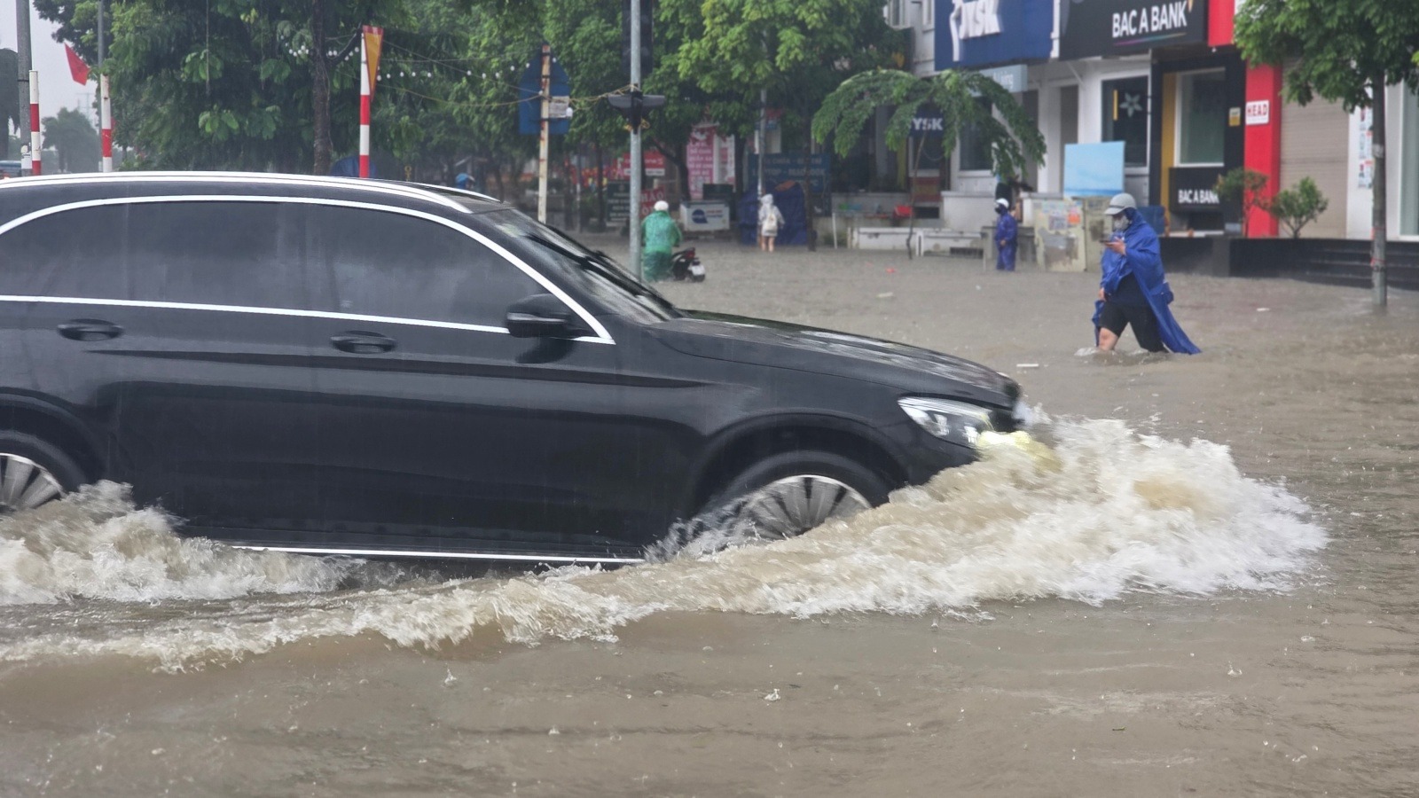
Major roads within the area were deeply flooded, forcing cars to move slowly. Many motorcyclists had to abandon their vehicles and wade through the water.
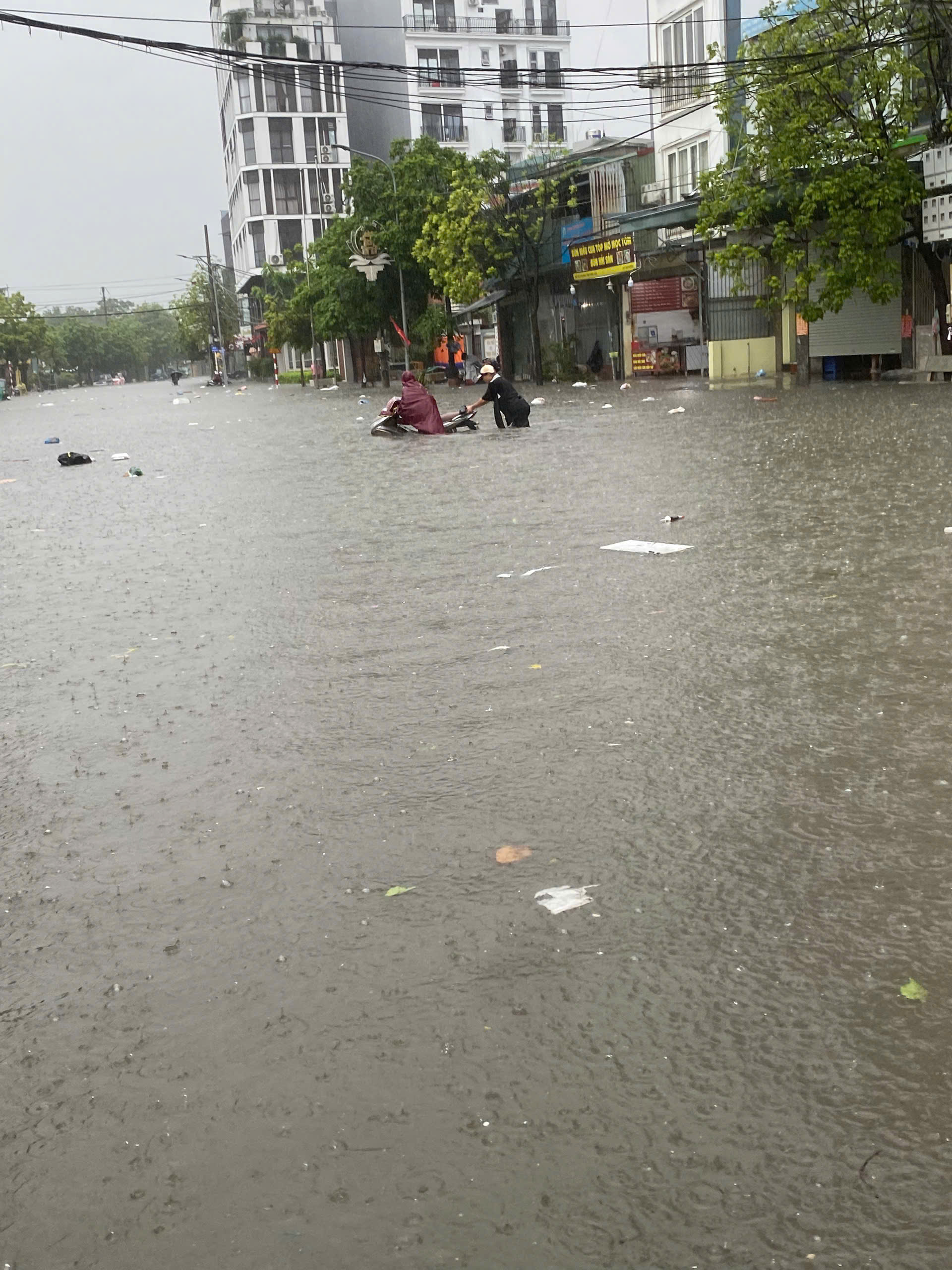
Similar scenes unfolded in Geleximco Le Trong Tan and Nam An Khanh Urban Areas. Deep flooding in internal roads left residents struggling to navigate, with numerous motorbikes stalling and cars stranded, disrupting daily life.
The entrance arch of Nam An Khanh submerged in floodwaters.
Residents of many villas and townhouses used metal sheets to block water from entering their homes and employed mini pumps to remove any water that did manage to get in.
Deep flooding in Nam An Khanh Urban Area. (Photo: Nam An)
In the Diplomatic Corps Urban Area (Xuan Dinh Ward, Hanoi), major roads such as Xuan Tao, Minh Tao, Nguyen Huu Lieu, Hoang Minh Thao, and internal roads leading to apartment buildings and villas were also severely flooded, making access to surrounding areas difficult.

Residents of Diplomatic Corps apartments reported rising water levels, with security personnel blocking entrances to prevent water from entering.
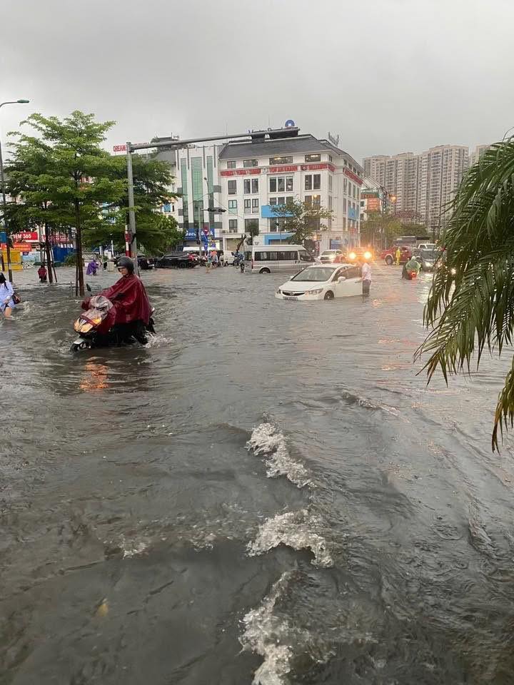
The flooding wasn’t limited to urban areas. Many roads in other parts of the city, such as My Dinh, Hoang Quoc Viet, Le Quang Dao, Me Tri, and Trieu Khuc, were also deeply submerged.
Vast flooding in the Trieu Khuc area.
Notably, the area in front of My Dinh Stadium and both directions of Le Quang Dao Road were submerged. Similar conditions were observed on Trinh Van Bo Street and the Thang Long Boulevard service roads (near the Vietnam Military History Museum). Authorities had to cordon off underpasses and warn commuters to ensure safety.
According to the National Center for Hydro-Meteorological Forecasting, on September 30th, many areas in Hanoi experienced heavy rain and thunderstorms, with potential for whirlwinds, lightning, and strong gusts.
The Hanoi Drainage Company reported rainfall measurements from 7 AM on September 29th to 7 AM on September 30th reaching nearly 200 mm in some areas, including Xuan Mai (198 mm), Tay Mo (169 mm), Phu Luong (118 mm), and O Cho Dua (104 mm). Other areas recorded rainfall below 100 mm.
The city identified over 30 high-risk flooding areas, including Nguyen Khuyen, Cau Giay, Minh Khai, Nguyen Trai, and Nguyen Xien. Residents were advised to take proactive measures and stay updated on weather forecasts to ensure safety.
List of over 30 high-risk flooding areas in Hanoi on September 30th:
• Nguyen Khuyen Road (in front of Ly Thuong Kiet Secondary School)
• Hoa Bang Street (from numbers 91–97 and 54–56)
• Cau Giay – Dich Vong Intersection (from numbers 235–255 Cau Giay)
• Phan Van Truong Street
• Duong Dinh Nghe – Pham Hung (behind Keangnam Tower)
• Tran Binh Street (in front of Mai Dich Ward People’s Committee – 19/8 Hospital)
• Phan Boi Chau – Ly Thuong Kiet Intersection; Bat Dan – Nha Hoa Five-way Intersection
• Tong Dan Street (auxiliary gate of Hanoi Party Committee)
• Dinh Tien Hoang Street (fountain, tram station)
• 155 Phung Hung Street
• Cao Ba Quat Street (in front of Hanoi Urban Environment Company)
• Thuy Khue Street (La Pho slope)
• Minh Khai Street (foot of Vinh Tuy Bridge)
• Nguyen Chinh Street (from alley 74 to Tan Mai canal)
• Mac Thi Buoi Street
• Thang Long Boulevard (Le Trong Tan intersection, underpass 356, An Khanh junction)
• Do Duc Duc Street
• Ngoc Lam Street (from Long Bien 1 intersection to Gia Lam Urban Environment Company)
• Hoang Nhu Tiep Street (from Ngoc Lam Primary School to Hoang Nhu Tiep – Ai Mo intersection)
• Co Linh – Dam Quang Trung Road (in front of Aeon Mall)
• Quan Nhan Street
• Cu Loc Street
• Nguyen Trai Street (in front of University of Social Sciences and Humanities)
• Nguyen Xien Street
• Ke Ve Street (Ve Market intersection)
• Ecohome 3
• Resco Urban Area
• National Highway 3 (through Mai Lam Commune)
• Road 23B (through Co Dien Village)
Luxury Meets Chaos: Million-Dollar Urban Living in Hanoi, Where DIY Boat Rides and Flooding Coexist

When heavy rains persist, the An Khánh urban area transforms into a vast, flooded landscape. Residents are forced to navigate by boat or cart, their daily lives upended in what was promised to be a premium residential haven.
“Heavy Rainfall Submerges Hanoi’s ‘Wealthy Neighborhood’: Luxury Villas Resort to Metal Barriers to Block Floodwaters”

Heavy rainfall throughout the night of September 29-30, caused by the circulation of Typhoon Bualoi, led to severe flooding in several areas within the Geleximco Le Trong Tan and Nam An Khanh districts. Residents struggled to wade through deep waters, pushing their vehicles and using metal sheets to block floodwaters from entering homes and underground parking areas.
Hanoi to Welcome $860 Million Urban Complex Spanning 75 Hectares Near Thang Long Boulevard

Hanoi is seeking investors for the Nam Thang Long Urban Functional Area project, a transformative development with an estimated investment capital of 20,247 billion VND. This ambitious initiative promises to redefine the city’s landscape, offering unparalleled opportunities for growth and innovation.
The Luxe Life in Ciputra: When Heavy Rains Turn the Affluent Neighborhood into a “Fishermen’s Village”

The heavy rainfall from the night of the 25th to the morning of the 26th of August caused widespread flooding in the Nam Thang Long – Ciputra urban area in Tay Ho, Hanoi. Despite the efforts to clear the water, many areas remained inundated, posing challenges to residents and highlighting the need for improved drainage systems in the area.


