


: Returning to Critical Support Levels?")


Anti-Flooding Promises Left Unfulfilled
On the morning of October 7th, heavy rainfall caused severe flooding across Hanoi, turning the capital into a vast body of water. This scene repeated itself just over a week after Typhoon Bualoi’s impact left many areas submerged for 4-5 days.
Speaking with VietNamNet, Dr. Bùi Sỹ Lợi, former Deputy Chairman of the National Assembly’s Social Affairs Committee, attributed the persistent flooding to the rapid construction of buildings without corresponding upgrades to the drainage system. “Even moderate rainfall leads to flooding,” he noted.
“The capital must urgently revise its urban planning. Hanoi shouldn’t resemble a river,” he emphasized.
Dr. Lợi suggested that local authorities reassess the city’s basic infrastructure, particularly in high-rise residential areas and urban developments. These zones must prioritize effective drainage solutions. Developers cannot simply sell properties and leave residents to fend for themselves.
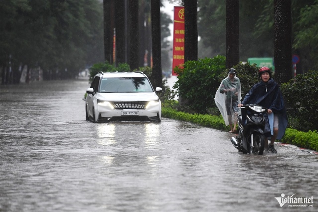 Hanoi residents navigate streets turned rivers. Photo: Nam Khánh |
Additionally, urban planning must incorporate advanced drainage systems to ensure rapid water discharge during floods.
Previously, Hanoi authorities claimed the city would be flood-free by 2010. However, Dr. Lợi noted these promises remain unfulfilled.
Moreover, while the city announces strategies and action plans, insufficient funding often stalls progress. This issue isn’t unique to Hanoi.
Dr. Vũ Thị Hồng Nhung of RMIT University observed that flooding has become the “new normal” in Vietnamese cities, no longer confined to the rainy season.
She attributed this to overburdened drainage systems and the ineffectiveness of traditional solutions like dikes and tidal barriers against unpredictable climate changes.
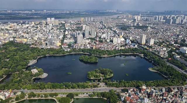
Transforming Thống Nhất Park into a Reservoir?
Dr. Nhung proposed shifting from “flood prevention” to “living with water” by utilizing existing urban spaces—parks, plazas, and parking lots—as temporary water storage during heavy rains. This “dual-mode” infrastructure approach is gaining global traction.
Cities like Rotterdam (Netherlands), Copenhagen (Denmark), Singapore, Tokyo (Japan), Seoul (South Korea), and several in China have pioneered “sponge park/water plaza” models.
These spaces serve dual purposes: everyday community hubs and emergency water reservoirs following the “slow-store-percolate-release” principle.
In Rotterdam, Benthemplein Plaza features three tiered basins, doubling as a sports field and rainwater storage for nearby neighborhoods.
Singapore’s “ABC Waters” program transformed the concrete Bishan-Ang Mo Kio Canal into an ecological park with meandering streams and floodplains, blending flood control with community space.
Copenhagen’s extreme rainfall management plan converts streets and parks into controlled surface drainage systems, complemented by underground retention tanks, effectively mitigating heavy rains.
Seoul revitalized the 5.8 km Cheonggyecheon Stream, replacing a highway with a riverside park that reduces flooding while improving air quality and microclimates.
Even megacities integrate large-scale underground solutions, such as Tokyo’s 6.3 km flood diversion channel and massive underground tank capable of discharging 200 m³/s, protecting millions from floods.
To end post-rain flooding, Hanoi must shift from reaction to adaptation, integrating water into urban planning. Photo: Thế Bằng |
China’s “sponge city” initiative, launched in 2014, combines green and gray infrastructure to absorb and reuse 70-80% of urban rainwater.
These models demonstrate that flexible, multi-functional green infrastructure not only mitigates flooding but also enhances livability, boosts property values, and fosters sustainable urban identities, Dr. Nhung explained.
Returning to Hanoi’s flooding crisis, post-Typhoon Bualoi, the city recorded severe inundation with significant economic losses. Integrating water storage into large parks, reservoirs, and residential areas is now critical.
Dr. Phan Thanh Chung of RMIT University proposed converting part of Thống Nhất Park into a temporary reservoir holding 8,000-15,000 m³, serving districts like Hoàn Kiếm and Hai Bà Trưng.
Additionally, restoring and expanding the Red River corridor into an adaptive ecological buffer zone could retain upstream water, reducing downtown flood risks.
In suburban industrial zones like Đông Anh, constructing underground tanks combined with green infrastructure could absorb 70% of rainwater, alleviating pressure on aging drainage systems.
“Urban flooding cannot be solved solely through rigid dikes or tidal barriers, especially after storms like Bualoi. Hanoi must adopt a ‘living with water’ model, repurposing parks, plazas, parking lots, and riverbanks as water storage infrastructure,” he advised.
Trần Chung
– 20:00 07/10/2025
Flood Warnings from Rain-Prone Residential Areas in Hanoi

The torrential rains unleashed by Typhoon No. 10 have left numerous streets and urban areas in Hanoi submerged, painting a stark picture of the city’s vulnerability. Beyond being an alarming situation, this serves as a critical wake-up call, exposing the underlying weaknesses in the capital’s urban management system.
Phan Xich Long Food Street Seeks Extended Late-Night Hours

Numerous proposals advocate extending the operating hours and organizing entertainment activities at Phan Xích Long food street to boost Ho Chi Minh City’s night-time economy.
Electric ‘Subway’ Scooter Cheaper Than Vision Floods Hanoi, Yet Grab Riders Keep Delivering Despite Near-Submerged Seats

This scooter is priced lower than the Vision, offering an affordable alternative without compromising on quality.
Ho Chi Minh City Proposes 680,000-Hectare Urban Development Plan

Under current regulations, urban master planning is limited to a maximum area of 360,000 hectares. However, Ho Chi Minh City currently spans nearly 680,000 hectares. Consequently, the Department of Construction of Ho Chi Minh City proposes that the Ministry of Construction consider approving and providing additional guidance on expanding the scale of the master planning process.
Ho Chi Minh City Proposes 680,000-Hectare Urban Development Plan

Under current regulations, urban master planning is limited to a maximum area of 360,000 hectares. However, Ho Chi Minh City currently spans nearly 680,000 hectares. As a result, the Department of Construction of Ho Chi Minh City has proposed that the Ministry of Construction review and approve supplementary guidelines to accommodate the expanded scale of planning requirements.


