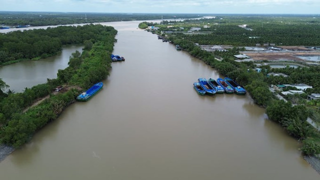
The planning scope encompasses the entire administrative boundaries of provinces and cities within the Mekong Delta region, including Can Tho, Vinh Long, Ca Mau, An Giang, Dong Thap, and parts of Tay Ninh, covering an area of approximately 4 million hectares (excluding islands).
The primary objectives of this plan are to efficiently regulate water resources, support livelihoods, agricultural production, industrial activities, and other economic sectors, while enhancing resilience to climate change and upstream Mekong River development. Additionally, the irrigation system will be optimized to provide water supply, drainage, and flexible salinity control.
By 2030, the Mekong Delta aims to ensure a stable water supply for 17-18 million residents and industrial zones, including export processing and high-tech areas. Rural regions severely affected by drought and salinity will have their potable water shortages fully addressed. The plan also focuses on improving canal and waterway networks to support 1 million hectares of high-quality, low-emission rice cultivation, aligned with green growth objectives.
By 2050, the Mekong Delta will ensure water security under all adverse conditions.
|
Regarding drainage, the 2030 target is to proactively manage water for 1.6 million hectares of 2-3 rice crops, 0.4-0.45 million hectares of fruit trees, 0.21 million hectares of annual crops, and 0.8 million hectares of aquaculture. In urban areas like Can Tho, Ca Mau, Vinh Long, An Giang, and Dong Thap, the plan mandates flood prevention measures with a 1% frequency, allocating 7-10% of land for water retention and eco-friendly landscape development.
Salinity control is another critical focus, aiming to actively manage 1.35 million hectares of agricultural land, maintaining salinity levels between 1g/l and 4g/l, depending on the area.
Looking ahead to 2050, the Mekong Delta envisions complete water autonomy under any unfavorable scenario, minimizing damage from droughts, salinity intrusion, and tidal surges. The irrigation system will be comprehensively upgraded, ensuring closed-loop connectivity from main sources to inland areas, enhancing water storage, regulation, and inter-regional connectivity for effective flood, salinity, and water-related disaster management.
The region is divided into three main ecological zones. The freshwater zone, covering approximately 1.9 million hectares, includes areas like Dong Thap Muoi, Tu Giac Long Xuyen, Bac-Nam Vam Nao, and U Minh Ha, focusing on fruit trees, rice, vegetables, and freshwater aquaculture. The brackish water zone, spanning 1.35 million hectares, comprises systems like Nhat Tao-Tan Tru, Bac Ben Tre, Nam Mang Thit, Long Phu-Tiep Nhat, and U Minh Thuong, promoting shrimp-rice farming and adaptable fruit cultivation based on water conditions. The saline zone, covering 0.75 million hectares along the coast, prioritizes aquaculture, especially shrimp-forest and improved extensive farming models.
Salinity control points are clearly defined. The 1g/l threshold (for domestic use and fruit trees) is maintained at locations such as Bac Dong sluice on the Vam Co Tay River, Nguyen Tan Thanh canal (Tien River), An Hiep (Ham Luong River), Mang Thit-Co Chien confluence, Cai Cui canal (Hậu River), and Cai Tu bridge (Cai Lon River). The 4g/l threshold (maximum salinity for rice production) is controlled at sites like Xuan Hoa, My Hoa, Vung Liem sluices, Cai Con canal, and Tan An.
Infrastructure solutions prioritize flood control from Cambodia in the freshwater zone, enhancing inland drainage and water supply from main rivers to remote and coastal areas. The brackish water zone will complete closed irrigation systems for domestic, agricultural, and aquaculture needs. The saline zone will strengthen salinity regulation, tidal control, water storage in canals, and proactive seawater supply for aquaculture.
Non-infrastructure solutions emphasize enhanced management, inter-regional coordination, water resource forecasting, salinity intrusion warnings, and strengthened sea dikes, wave breakers, and mangrove reforestation to protect shorelines and communities.
The approval of the Mekong River Basin Irrigation Plan marks a strategic step, laying the foundation for the region to proactively adapt to climate change, ensure water security, and achieve sustainable development for decades to come.
– 15:00 19/10/2025
Proposed Recommendations to the Ministry of Construction Regarding Can Tho Airport

The People’s Committee of Can Tho City has urged the Ministry of Construction to promptly approve the investment policy for the upgrade of Can Tho International Airport. The project aims to increase the airport’s capacity to 7 million passengers annually in phase 1, with a further expansion to 12 million passengers per year in phase 2, significantly boosting regional development.
Charming Heritage Street in a Nearly 240-Year-Old City

Nestled on the last remaining prime land in the heart of Long Xuyên, Mekong District embraces the lush banks of the Hậu River, offering a distinctive urban haven in the Mekong Delta—a feat rarely achieved by other residential projects.
What’s Holding Back the Wind Energy Capital?

The Mekong Delta, renowned as Vietnam’s wind energy powerhouse, boasts immense potential for wind power development. However, despite its advantages, the region faces significant challenges in harnessing this renewable resource. Key obstacles include institutional barriers, inadequate power transmission infrastructure, and cumbersome investor selection processes. These hurdles are currently impeding provincial efforts to attract investment in wind energy projects.
Citadines Riverside: The Ascott Limited’s New Venture in Can Tho

Unveiling in 2028, Citadines Riverside Can Tho promises a refined living experience with its 244 meticulously designed serviced residences.
City to Invest Nearly $430 Million in Flood Control, Climate Resilience, and Infrastructure Upgrades

Haiphong City is set to invest nearly VND 10,000 billion in two major initiatives: urban flood control and the construction of Ring Road 3. These projects aim to achieve sustainable infrastructure development and enhance resilience to climate change.


