


: Mixed Signals Emerge")

: Short-Term Outlook Continues to Deteriorate")
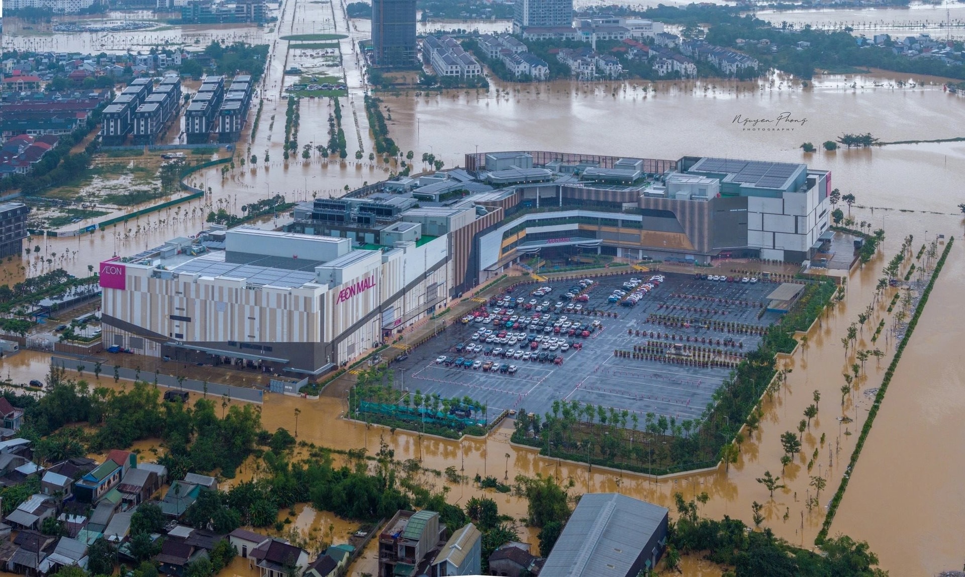
Aerial View of Aeon Mall Hue: An Oasis Amidst Historic Floods. Photo: NGUYỄN T.A PHONG, Thanh Nien Newspaper
During Hue’s historic flood, Aeon Mall Hue remained dry and illuminated, standing as a beacon amidst the surrounding deluge.
With an investment of approximately $170 million, the Japanese-backed project meticulously analyzed 70 years of Hue’s hydrological and flood data. This research led to a critical engineering decision: elevating the ground floor by 1.15 meters above the surrounding road level.
This elevation strategy proved invaluable, safeguarding not only the investment but also enabling the mall to support the community. During the flood, Aeon Mall opened its parking lot, providing free shelter for approximately 300 cars and 600 motorcycles.
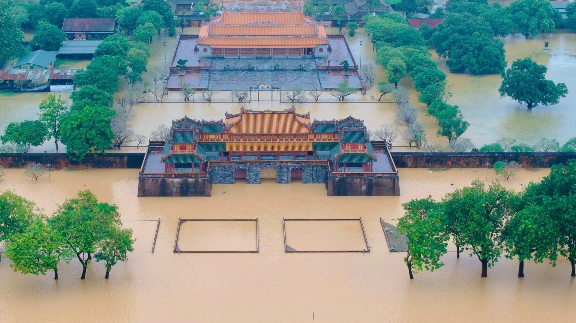
Thai Hoa Palace Behind Ngo Mon Gate on October 28th. Photo: Tran Thien
Similarly, Thai Hoa Palace demonstrates the effectiveness of historical engineering, despite lacking modern technology. The palace remained dry while its surroundings were submerged.
Experts attribute this to the foresight of the Gia Long-Minh Mang era. The palace’s foundation (1,360 m²) was elevated 2.35 meters above ground and 1 meter above the courtyard. Situated on the highest “dũng đạo” axis, its turtle-shell topography facilitates natural drainage.
Crucially, the area is encircled by a network of hydraulic systems (lakes, moats, canals) acting as natural regulators. Lakes like Thai Dich expedite water absorption and river discharge, alleviating pressure on the city center.
Both cases highlight the effectiveness of elevating foundations based on hydrological data and terrain understanding. However, why isn’t this model universally applied to Hue’s new urban developments?
The answer lies in Hue’s heritage city status. City leaders emphasize that such models must be cautiously implemented. Hue’s planning prioritizes heritage conservation. Floodwaters follow physics: flowing from higher to lower ground. If new developments like An Van Duong arbitrarily elevate foundations, it could trigger a “foundation race”.
Consequently, if all structures are elevated, the urban baseline shifts, causing floodwaters to rise further or stagnate. This would disproportionately affect lower-lying areas—primarily the Dai Noi heritage core and older residential zones incapable of elevation—turning them into deeper flood basins.
In practice, An Van Duong’s foundation is restricted to +2.5 meters, lower than standard, to ensure flood drainage and heritage protection. Aeon Mall’s 1.15-meter elevation is considered a localized adjustment, compatible with the broader drainage system.
Learning from successful projects like Aeon Mall is essential. However, instead of a one-size-fits-all “build higher” approach, these lessons must be adapted to local topography and comprehensive planning. Flood mitigation cannot be isolated; it requires balancing urban development, heritage preservation, and watershed resilience.


