


: Mixed Signals Emerge")

: Short-Term Outlook Continues to Deteriorate")
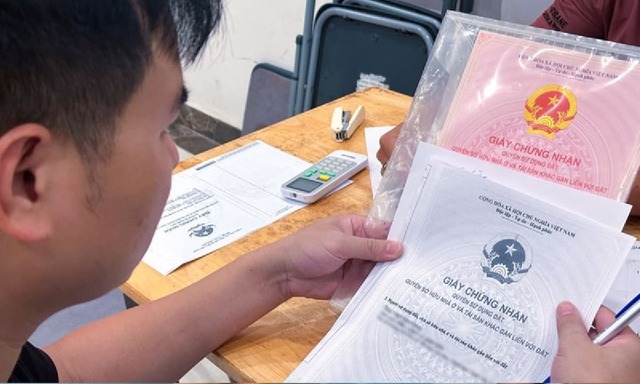
The VNeID app recently launched its 2.2.4 update, introducing several new features. Notably, it now allows users to provide Land Use Rights Certificate (Red Book) information to government agencies.
To access all functionalities, users must visit any local police station (regardless of their registered residence) to complete VNeID Level 2 verification.
Illustrative image
To integrate the Land Use Rights Certificate (Red Book) into the VNeID app, follow these steps:
Step 1: Navigate to the “Provide Information to Government Agencies” section. This section explains that the information provided will be used for verification, cross-checking, and processing by authorized agencies.
Step 2: Click “Create New” and select “Land Use Rights Certificate” as the information type.
Step 3: Fill in the required details. Pre-filled information includes the account holder’s full name and personal identification number. If filing on behalf of someone else, enter the name of the person listed on the Red Book and the reason for proxy filing.
Mandatory fields include the certificate number and the land address as stated on the Red Book. For file submission, upload images or documents of the Red Book in PDF, PNG, or JPG format.
Finally, confirm the accuracy of the information and submit the request. The details will be sent to the Ministry of Agriculture and Rural Development.
The online submission of the Red Book is part of a 90-day campaign (from September 1 to November 30) to review and cleanse the entire land database. This initiative is led by the Ministry of Agriculture and Rural Development, the Ministry of Public Security, and provincial People’s Committees.
Authorities will verify land user and property owner information against the National Population Database. They will also review, update, and supplement missing data for land plots, as well as link citizen ID card information to the land database.
The Ministry of Agriculture and Rural Development plans to synchronize land databases from 34 provinces and cities into the National Land Database. This centralized system will be connected to the National Population Database and shared with relevant ministries, localities, and government bodies, including the Party, National Assembly, Government, Vietnam Fatherland Front, People’s Courts, People’s Procuracy, and socio-political organizations.
Unlocking Land Use Conversion: Resolving Challenges in Changing Land Purposes

Families seeking to legalize the conversion of 49m² of perennial crop land into residential land were met with an unexpected demand: demolish their existing house before their application could be processed. Legal experts argue that such a rigid interpretation of the law, without considering the evolving nature of administrative management over time, unfairly impacts citizens’ rights.
Mastering Traffic Rules: A Nationwide Essential for All Road Users

This is the must-have app for every road user.
Unlocked Benefits for Tens of Millions Starting November 1st: What You Need to Know

This decree officially takes effect on November 1st.
Major Changes to Land and Property Documents Effective November 1st: What Every Citizen Needs to Know

As of November 1st, new regulations will bring significant changes to various procedures related to real estate transactions and documentation.
“Citizens Forced to Photocopy Land Certificates for Data Integration: Lawmakers Call it ‘Cumbersome and Time-Consuming’”

According to a member of the National Assembly, the requirement for citizens to photocopy land use rights certificates to facilitate land data integration highlights inefficiencies, wastes time, and causes unnecessary inconvenience for the public.


