


According to the National Hydro-Meteorological Forecasting Center, Typhoon No. 3 (Yagi) is likely to make a direct landfall in the northern provinces, particularly Quang Ninh, Hai Phong, Thai Binh, Nam Dinh, Ha Nam, and Ninh Binh.
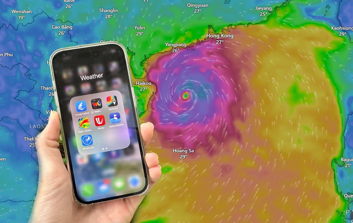
On the App Store, the storm-tracking application Windy has been downloaded by many people, becoming the most downloaded free application on the iOS platform in Vietnam. The Windy app also topped the weather app category on the Android platform.

Windy becomes the most downloaded free app on the iOS platform in Vietnam.
Windy is a weather tracking application that supports multiple viewing modes such as wind direction and speed, rainfall, temperature, clouds, and air quality. Users can view future forecasts of weather information for each location on subsequent days. The application is based on open-source map data from OpenStreetMap.
Over the past two days, Google statistics for Vietnam also showed a sudden increase in searches related to Typhoon Yagi, live tracking of the storm’s path, etc.
How to Track the Path of Typhoon No. 3 (Yagi)
First, install the Windy app on your phone via Google Play or the App Store.
Once installed, simply open the application and grant permission for Windy to access your location for accurate results.

To get accurate and detailed real-time updates on the storm’s movement, download the Windy app.
On the home screen, you will see the location of Typhoon No. 3 (Yagi) in the East Sea, and by pressing the Play button in the bottom left corner of the screen, users can easily track the storm’s path and take proactive steps to avoid it.
In the extended Menu of Windy, you can change the map display style, such as weather radar, satellite, wind, rain, lightning, temperature, etc., to know which areas are experiencing rainfall (or potential rainfall).
Additionally, you can use Windy directly on the website at https://www.windy.com . The steps to use and track the storm’s path are similar to those on the app.
The Energy Sector Prepares for Typhoon Yagi

The energy corporations and companies are taking proactive measures by preparing the “4 on-site strategies”: on-site command, on-site forces, on-site supplies, and on-site logistics to effectively tackle Typhoon No. 3 and minimize its potential impact.
The Hanoi Hustle: Stocking Up Before Super Typhoon Yagi Strikes

As news broke of the impending landfall of Super Typhoon Yagi, which was expected to bring torrential rain and widespread flooding, people rushed to stock up on supplies. The storm, which was predicted to make landfall on the evening of September 7th, had people flocking to stores to ensure they had enough food to weather the storm.
The Strongest Storm in 2 Decades is Approaching: What Air Travelers Need to Know

As of the evening of September 7th, the storm made landfall in the northern provinces of Bac Bo.
The Perfect Storm: As Super Typhoon No. 3 Looms, Thanh Hoa Endures Heavy Rains and Strong Winds, with Trees Uprooted and Strewn Across the Province.

From the evening of September 5th to the early hours of the 6th, heavy rains and strong winds battered the province of Thanh Hoa, causing extensive damage. Many trees were uprooted and toppled, a scene of chaos and destruction was witnessed across the region.


