The second campus of the Pham Ngoc Thach University of Medicine in Ho Chi Minh City was inaugurated on August 26. This landmark is part of the Tan Kien Medical Cluster – the first “medical campus” model in Vietnam.
Attending the inauguration of this remarkable project, Mr. Duong Anh Duc, Head of the Ho Chi Minh City Party Committee’s Propaganda and Training Commission, considered this a significant milestone for not only the Pham Ngoc Thach University of Medicine but also the entire city’s healthcare sector in the journey of enhancing the quality of medical training and improving people’s health.
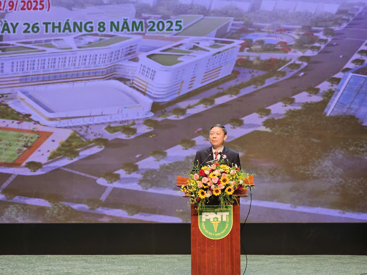
Mr. Duong Anh Duc, Head of the Ho Chi Minh City Party Committee’s Propaganda and Training Commission, speaks at the ceremony
“Two and a half years ago, I was present at the groundbreaking ceremony for this project. Today, I am deeply moved and proud to be back for the inauguration of this modern facility. This is a testament to the city’s steadfastness, determination, and efforts in investing in the development of high-quality medical human resources,” Mr. Duong Anh Duc emphasized.
With an investment of over VND 2,400 billion from the city’s budget, the second campus of Pham Ngoc Thach University of Medicine is part of the orientation to build the first “medical campus” in Vietnam at the Tan Kien Medical Cluster. This model integrates teaching, practice, research, and healthcare, aiming for international standards.
According to Mr. Duong Anh Duc, the decision to build a university with such a large investment demonstrates the city’s special priority for education and healthcare.
The project’s uniqueness lies in its integrated model of training, practical training, and healthcare research, striving for international standards. This approach contributes to creating a comprehensive learning environment, fostering the development of physicians with strong theoretical knowledge and excellent practical skills.
The Head of the Propaganda and Training Commission of Ho Chi Minh City expressed his hope that the university would effectively utilize the new facility to enhance the quality of training and research, thus contributing to the city’s and the country’s healthcare development.
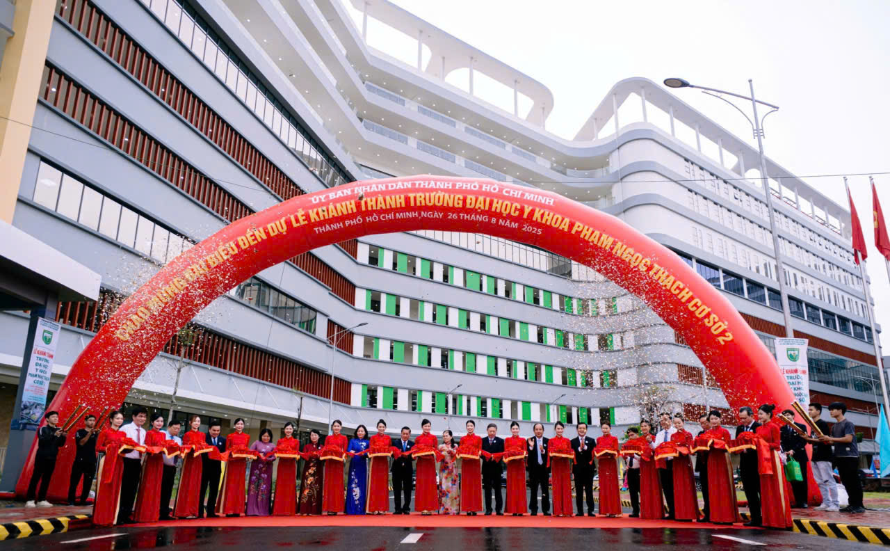
The second campus of Pham Ngoc Thach University of Medicine at Tan Kien Medical Cluster is a large-scale project with complex techniques, completed three months ahead of schedule, ensuring quality and safety.
According to Assoc. Prof. Dr. Nguyen Trong Hao, Chairman of the Board of Trustees of Pham Ngoc Thach University of Medicine, this project crystallizes the dedication of generations of teachers, staff, and students. “This is not only a milestone in terms of infrastructure but also a symbol of unity and enduring dedication. I deeply appreciate the contributions of our predecessors, such as Prof. Dr. Nguyen Tan Bing, Assoc. Prof. Dr. Nguyen Thi Ngoc Dung, and Prof. Dr. Ngo Minh Xuan, who laid the foundation for this project,” he expressed.
Assoc. Prof. Dr. Nguyen Trong Hao recognized that with the modern infrastructure, the second campus would enable the university to expand its training scale while elevating the quality to international standards. He envisioned this campus as a strategic boost, propelling the Pham Ngoc Thach University of Medicine to become a leading medical training center in the country and a prominent institution in the region.
Mr. Vo Duc Thanh, Director of the Management Board of Investment and Construction of Civil and Industrial Works in Ho Chi Minh City, stated that the second campus of Pham Ngoc Thach University of Medicine was built on an area of over 67,000 square meters, with a scale of over 132,000 square meters of floor space. It comprises blocks of 10 floors aboveground, one basement, and auxiliary areas. The facility boasts a modern infrastructure, including 19 lecture halls with capacities ranging from 50 to 1,000 seats, 19 practical training areas, research centers, clinical simulation zones, public service areas, accommodation, green spaces, and sports grounds.
The construction of the second campus of Pham Ngoc Thach University of Medicine commenced in February 2023 and was completed three months ahead of schedule. The project involved complex techniques and modern investments in both architecture and medical specialties, aiming to train competent physicians to meet the demand for high-quality healthcare professionals. This also marks the initial formation of the Tan Kien Medical Cluster – a specialized medical center in the ASEAN region.
The New Heart of Ho Chi Minh City: Saigon Marina International Financial Centre Opens Its Doors

Ho Chi Minh City unveils the iconic Saigon Marina IFC, a transformative development that underscores Vietnam’s ascent as a prominent financial hub in the region. This landmark project serves as a testament to the country’s thriving economy and its ambition to become a key player in the global financial landscape.
“Rethinking Land Valuation for Three BT Contracts in Thu Thiem”

The three construction investment projects: four main roads in the new Thu Thiem Urban Area, Thu Thiem 2 Bridge, technical infrastructure for the northern residential area, and completion of the North-South axis within the new Thu Thiem Urban Area will undergo a comprehensive review. This review will delineate boundaries, pinpoint locations, and determine the land area and land prices for the portions that have been allocated for land handovers or leases to investors as a form of payment.
Which Province Ranks Third in the Country for the Number of Billionaire Tycoons, After Hanoi and Ho Chi Minh City?

Introducing the vibrant city of Hai Phong, a bustling hub of economic activity in Northern Vietnam. Despite its thriving business landscape, the city has yet to witness the emergence of a powerhouse enterprise with a market capitalization surpassing the impressive threshold of 100,000 billion VND.
The Ultimate Traffic Camera: Unveiling the Secrets of Ho Chi Minh City’s Road Vigilance with an Astonishing 70,000 Cold Cases Uncovered.

In the first eight months of 2025, the traffic surveillance camera system in Ho Chi Minh City detected nearly 70,000 violations. This innovative technology has proven to be a game-changer in ensuring road safety and holding accountable those who break the law. With its advanced features and round-the-clock vigilance, this system is a powerful tool in the city’s quest for safer roads and a more responsible driving culture.
The Fashion and Accessories Market is Ablaze with Patriotic Flair.

The fashion and souvenir items featuring the national flag and slogans celebrating the 2nd of September have become popular among young consumers as a way to express their patriotism.


