


: Mixed Signals Emerge")

: Short-Term Outlook Continues to Deteriorate")
Strategically located on the regional development map, Can Gio serves as a natural gateway connecting Ho Chi Minh City’s center, Vung Tau, and southern industrial zones and seaports. Every journey from the city to the sea passes through this area, positioning Can Gio as a pivotal hub in coastal trade and tourism. However, its potential has long been hindered by limited infrastructure, preventing it from fully realizing its role as a true maritime gateway.
Infrastructure to Catalyze Can Gio’s Development
Once a remote area surrounded by mangrove forests with challenging accessibility, Can Gio now stands on the brink of transformation into a modern coastal city of Ho Chi Minh City. A series of strategic transportation projects are set to propel Can Gio forward, establishing it as a vital link in the Southeast Region’s coastal development corridor.
“Currently, access to Can Gio relies solely on the Rung Sac road via the Binh Khanh ferry. To unlock its potential, Can Gio must be robustly connected to the city center and neighboring economic zones,” stated Dr. Tran Du Lich, an economic expert, during an interview with Tien Phong newspaper regarding the region’s development direction.
According to Dr. Lich, the ongoing and upcoming infrastructure projects will serve as a catalyst for Can Gio’s transformation, unlocking its long-stifled maritime economic potential.
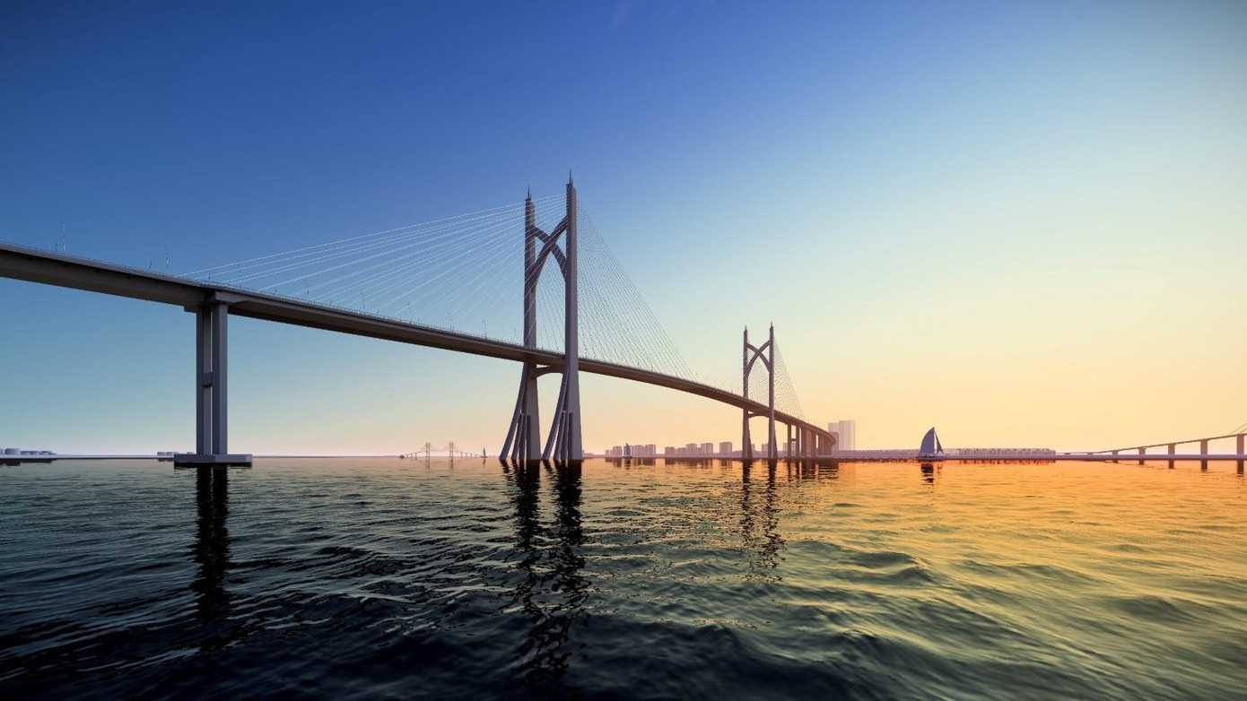
Previous design concept for Can Gio Bridge.
First, the Can Gio Bridge will replace the Binh Khanh ferry, the current sole transportation route. “This bridge will not only provide convenient travel for residents but also integrate Can Gio into the broader transportation network of Ho Chi Minh City and the Southeast Region,” Dr. Lich explained.
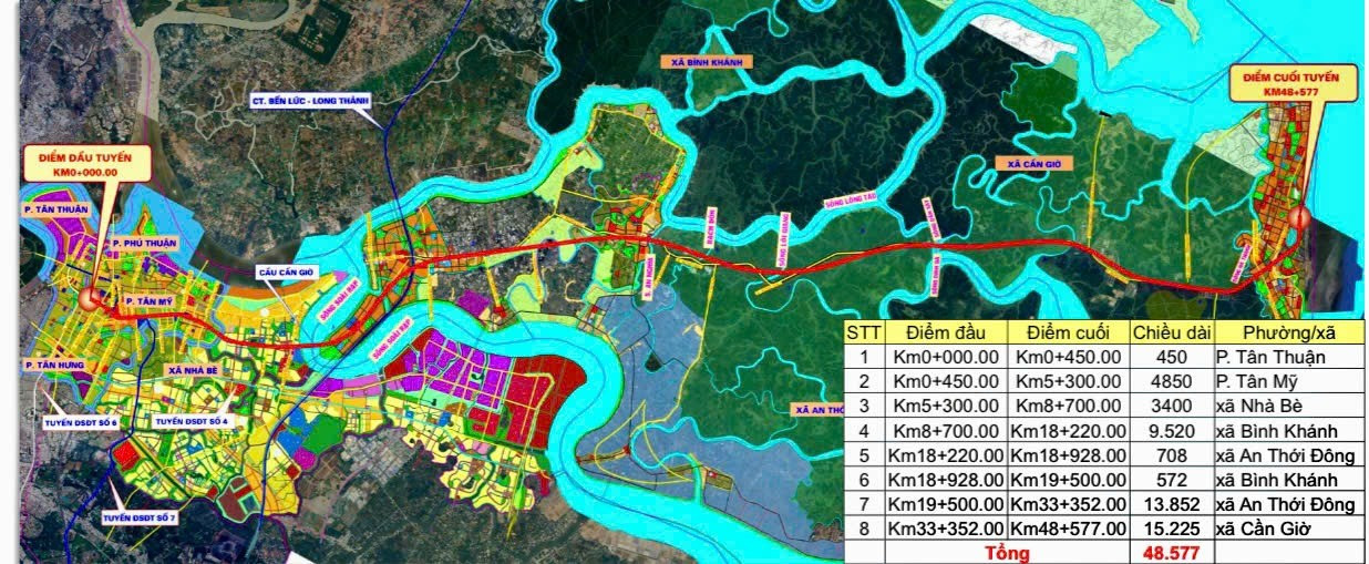
Second, a 48km high-speed railway from District 7 (old) to the Can Gio reclaimed urban area is expected to drive development in the reclaimed area and support operations at the upcoming Can Gio transshipment port.
Ho Chi Minh City – Can Gio Metro Line Diagram.
Third, the coastal road from Ca Mau to the Cai Mep – Thi Vai Port, connecting Ring Roads 3 and 4, and the Ben Luc – Long Thanh Expressway. Notably, a proposed sea-crossing route from Can Gio to Vung Tau is under investment consideration.
“Once completed, this coastal route will drive economic growth and enhance national defense. It will position Can Gio as a central point in the Southern Coastal Corridor, stretching from Ho Chi Minh City to Ca Mau,” Dr. Tran Du Lich analyzed.
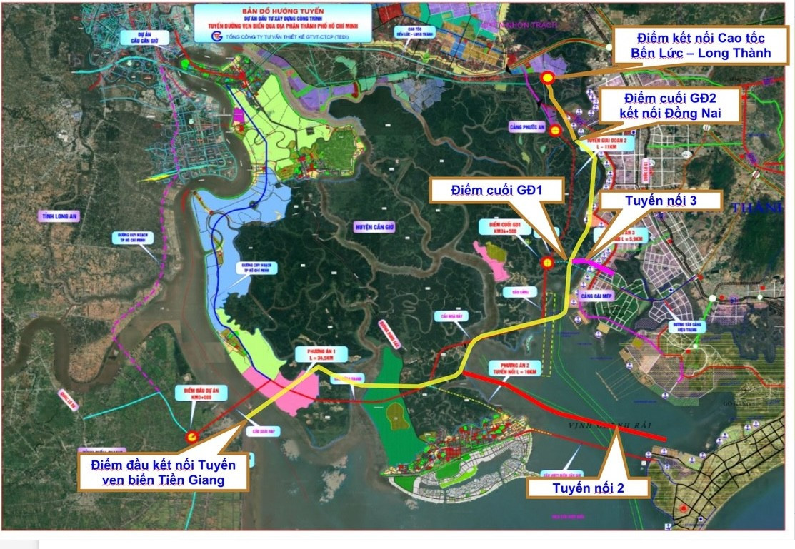
Previous coastal route plan through Ho Chi Minh City, including the sea-crossing route (Link 2) via Gan Rai Bay (connecting Can Gio and Vung Tau).
According to the expert, these bridges, railways, and sea-crossing routes will revolutionize travel and reshape the region’s development trajectory.
Visitors from Vung Tau could reach Can Gio in just 10 minutes for relaxation, while Ho Chi Minh City residents gain a new coastal living option. Businesses will benefit from a seamless logistics corridor. With improved infrastructure, Can Gio will evolve from a coastal district into a central hub for commerce, tourism, and maritime economic growth.
Expanding Development Horizons from Ho Chi Minh City’s New Growth Pole
Experts agree that as Ho Chi Minh City expands eastward and southward, Can Gio will transform from a mangrove ecological zone into a “new growth pole” focused on maritime and ecotourism economies.
“Post-expansion, Ho Chi Minh City’s coastline will extend to the Ba Ria – Vung Tau area, unlocking significant maritime economic advantages,” Dr. Tran Du Lich noted.
He added that with expanded administrative boundaries, the Can Gio International Transshipment Port will collaborate with the Cai Mep – Thi Vai Deep-Water Port to form a strategic Southeast Asian logistics hub.
“The merger of Ho Chi Minh City, Ba Ria – Vung Tau, and Binh Duong will exponentially amplify their combined strengths. It’s not just 1+1+1=3, but 1+1+1=5 or 7,” he illustrated.
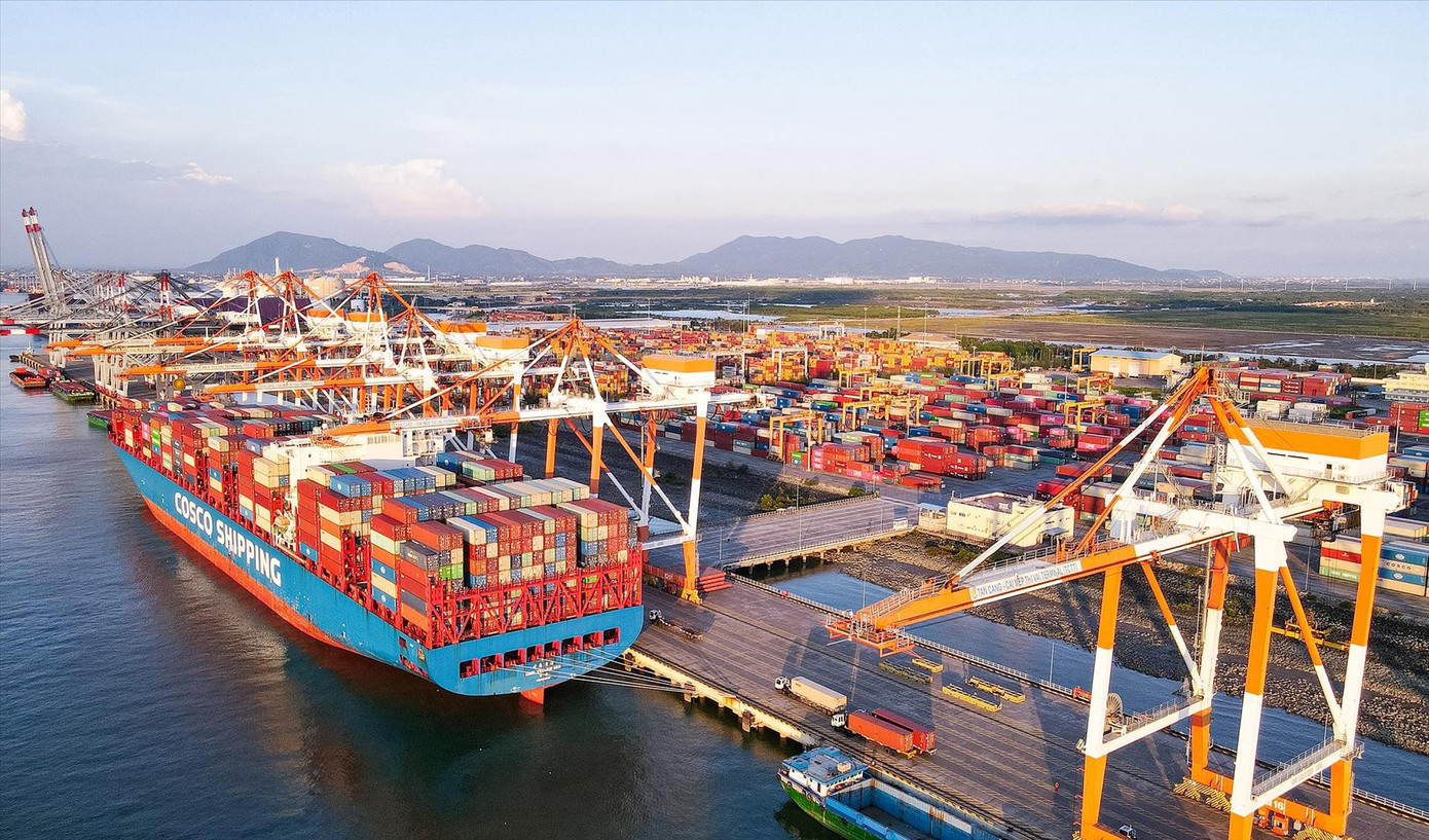
Cai Mep – Thi Vai Seaport.
Dr. Ngo Viet Nam Son, an urban planning expert, emphasized the need for upgraded regional infrastructure aligned with maritime economic development. This includes multimodal logistics corridors: highways, railways, high-speed rail, waterways, and air transport.
With improved infrastructure, Can Gio will integrate into a continuous coastal tourism chain stretching from Can Gio to Vung Tau, Long Hai, Ho Tram, and Phan Thiet.
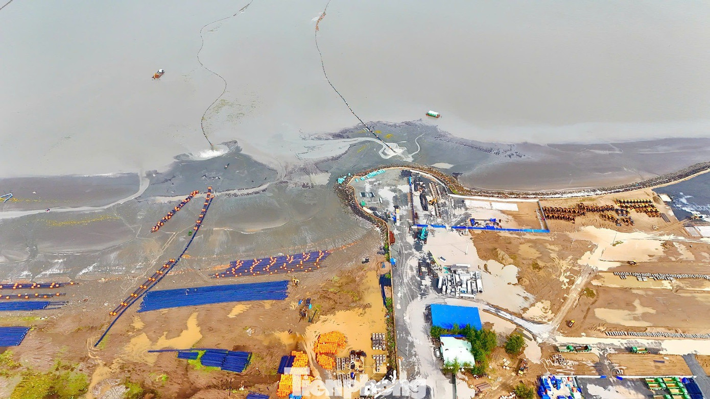
Can Gio Reclaimed Urban Area under construction. Photo: PV
“Near the mangroves, ecotourism can thrive; the reclaimed area could emulate Dubai’s maritime urban model; and the eastern coastline could host luxury resorts. A continuous coastal tourism axis, supported by seamless connectivity to major airports like Long Thanh and Tan Son Nhat, will attract both domestic and international visitors,” Dr. Son suggested.
He also noted that Can Gio’s development will redistribute population and employment, alleviating urban pressure in the city center. “Improved transportation will enable workers to live and work in peripheral areas, from Binh Duong to Ba Ria – Vung Tau, fostering sustainable, expansive growth,” he added.
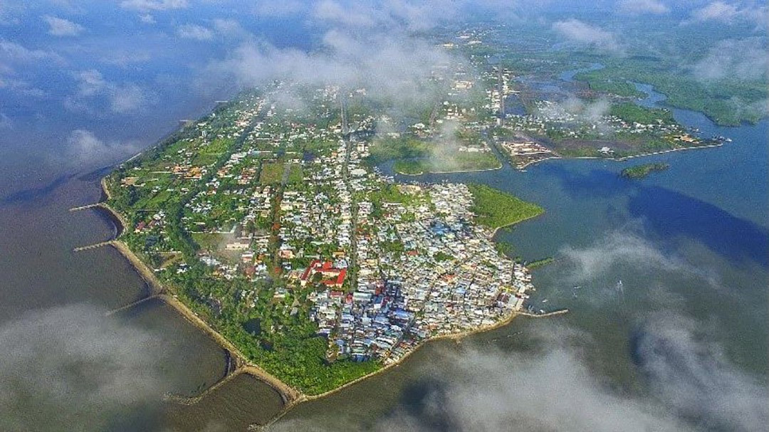
Can Gio is rapidly transforming.
Free Metro Rides on Line 1 in Ho Chi Minh City During Two Tet Holidays

We propose offering free rides on Metro Line 1 during the 2026 New Year’s Day and Lunar New Year celebrations to encourage greater use of public transportation.
Revitalizing Saigon’s Golden Land: Ho Chi Minh City Finalizes Plans for 9,000m² Tax Trade Center Redevelopment

Ho Chi Minh City has mandated that relevant agencies collaborate to inspect and address the over 9,000 m² plot of land, once home to the iconic Tax Trade Center, which has lain abandoned for years in the heart of the city.
Grand Stadium, Thriving Population: A Glimpse into the Emerging Hub Rivaling My Dinh’s Scale and Can Gio’s Density

With a population rivaling that of a district and a stadium of national caliber, Vinhomes Can Gio’s Zone B is being hailed by investors as the “new capital” of Southern Vietnam’s coastal real estate market.
Exclusive Interest from International Clients: The Privé

According to InterNations’ Expat City Ranking 2021, the world’s largest expat community, Ho Chi Minh City secured the 6th spot among the top 10 best cities for expatriates to live and work, out of 57 global cities surveyed.
Sun Urban City: The Epitome of Modern Urban Living in Southern Hanoi

As transportation infrastructure expands and education and healthcare facilities flourish, visionary urban developments like Sun Urban City are poised to redefine modern living standards in South Hanoi, setting a new benchmark for sophistication and progress.


