


: Returning to Critical Support Levels?")


: A Wave of Negativity Sweeps In")
The Vietnamese government has submitted a pre-feasibility study report to the National Assembly for the Vinh – Thanh Thuy Expressway project. This strategic highway is expected to establish a vital connection between Vietnam and Laos, contributing to the East-West Expressway network. It will link with major north-south routes, including the North-South Expressway, Ho Chi Minh Highway, National Highway 1, and the coastal road.
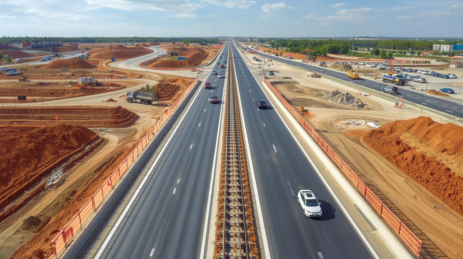
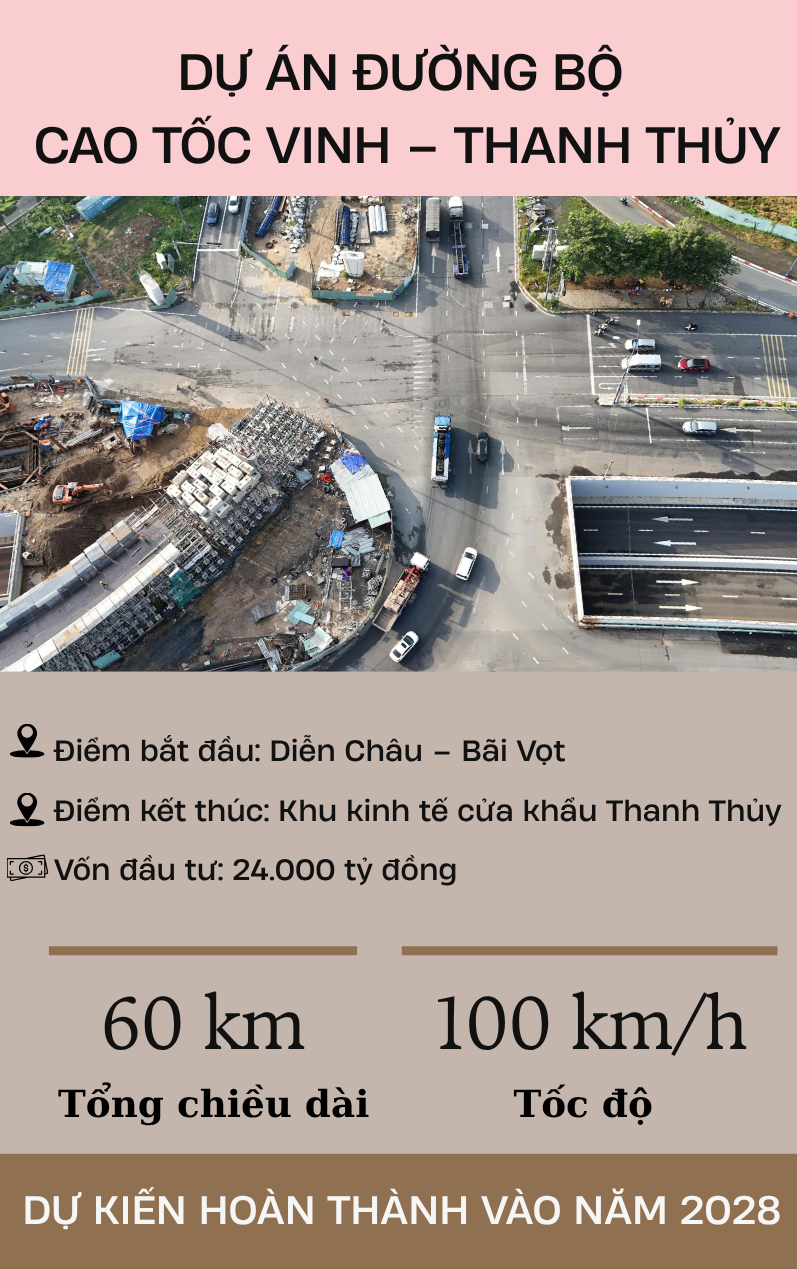
The expressway will commence at the intersection with the North-South Expressway’s eastern section in Dien Chau – Bai Vot (Hung Nguyen commune, Nghe An province) and terminate at the Thanh Thuy Border Gate Economic Zone, adjacent to the Thanh Thuy – Nam On border crossing with Laos. Spanning approximately 60 kilometers, the route traverses nine communes: Hung Nguyen, Kim Lien, Dai Hue, Van An, Nam Dan, Xuan Lam, Hoa Quan, Son Lam, and Kim Bang.
Designed with a four-lane capacity, the expressway will have a road width ranging from 22 to 24.75 meters. In challenging terrain and overpass sections, a six-lane standard will be applied to ensure a design speed of 100 km/h in favorable conditions and 80 km/h in more difficult areas.
The preliminary total investment is nearly VND 24 trillion, covering construction, equipment, land acquisition, resettlement, and contingency costs. The government proposes public investment and is exploring state capital recovery options once the expressway becomes operational.
To comply with legal requirements and expedite land acquisition, the government suggests dividing the project into ten sub-projects. The main component, focusing on expressway construction, accounts for over VND 21 trillion, while the remainder addresses land clearance in the nine affected communes.
The final 20 kilometers of the Vinh – Thanh Thuy Expressway pass through extremely challenging terrain with steep longitudinal and transverse slopes. Several sections are located within protected forests, requiring forest land-use conversion procedures and the construction of elevated bridges with pillars exceeding 50 meters in height. Access to land, material transportation, and equipment assembly in this area are deemed “very difficult.”
Given these challenges, the government proposes special mechanisms for the project, including exemptions from capital source evaluation and balancing as per the Public Investment Law. It also seeks permission for direct procurement of all project packages, following legal bidding procedures.
If approved, the project is scheduled for investment policy approval in 2025, with the feasibility study report finalized by Q2 2026. Construction is slated to begin in Q3 2026, with substantial completion by 2028 and operation commencing in 2029.
Nghe An, once Vietnam’s largest province by area, now ranks fourth with approximately 16,490 km². Following provincial mergers, Lam Dong currently holds the top position with an area of 24,233.07 km².
Ho Chi Minh City Allocates $240 Million to Upgrade Southern Central Road Network

Discover the transformative expansion of Ton That Thuyet Road in Ho Chi Minh City, a $5.621 trillion VND project set to redefine urban connectivity. With the relocation of 598 households, this initiative includes the construction of a new bridge, riverbank reinforcement, and a scenic park along the Kenh Te Canal, blending infrastructure with green spaces for a modern, vibrant cityscape.
Real Estate Tycoon Invests Over $250 Million in 100-Hectare Urban Development Project Near Vinh Airport, Just 1km Away

Following the success of Vicentra, Eurowindow Tower, and Sport Garden, Eurowindow Holding expands its footprint in Nghe An with the Nghi Lien Urban Area. Spanning nearly 104 hectares, this development is strategically located adjacent to Nghe An Oncology Hospital and just over 1 km from Vinh Airport.
Vietnam’s International Airport Unveils Stunning Transformation After 3-Month Closure

This airport is poised to become the premier aviation and logistics hub for North-Central Vietnam.
Riverbank Collapse in Vinh: Floodwaters Surge into Urban Area

A section of the Vinh riverside (Nghe An) unexpectedly collapsed, causing water to surge into the adjacent urban area and resulting in localized flooding.
Hanoi to Construct Nearly VND 1 Trillion Road Connecting to Ninh Binh

Funded by Hanoi’s municipal budget through public investment, this route boasts a preliminary investment of over 840 billion VND. The city will fully allocate the entire budget, with construction slated for the 2026–2028 period.


