Decoding the “Matrix” of Suburban Zoning Plans
The real estate market in Hanoi and its surrounding areas is undergoing a dramatic transformation in infrastructure. Numerous detailed zoning plans, district plans, and new land use schemes have been announced in hotspots such as the areas around Noi Bai Airport and districts poised to become wards.
Profit opportunities are tangible, but they come with risks like being caught in suspended zoning plans, land falling within protected corridors, or subject to reclamation. For new investors or those purchasing in distant areas, traditional methods of searching through paper records and administrative offices reveal significant limitations: slow and non-visual information.
Instead of scouring paper records or visiting multiple government offices for information, users can now open their phones, locate the land plot, and directly view it on a digital zoning map.
Launched in 2021, Meey Map—a digital zoning inquiry platform developed by Meey Land Joint Stock Company (Meey Group)—is now one of the leading applications providing comprehensive updates on the two most critical datasets in the real estate market: construction zoning and land use planning. The data displayed on Meey Map is digitized and aggregated from zoning plans, land use plans, approval decisions, and more, all issued by competent state authorities.
On the map interface, users can view detailed land plots according to construction zoning and current land status, or zoom out to an entire region through land use planning layers.
Actions such as zooming in, zooming out, measuring area, and measuring distance can all be performed directly on the screen. In areas frequently discussed for future infrastructure, clearly viewing boundaries, protected corridors, and functional zones on Meey Map helps investors avoid purchasing land subject to clearance, road expansion, or incorrect land use purposes.
Representatives from Meey Map stated that the product’s goal is to “bring zoning closer to the people,” transforming complex technical record searches into simple actions on a mobile app.
Mitigating Risks with Land Use Planning Data
Alongside construction zoning information, a dataset of particular interest to many investors is land use planning and annual land use plans. These serve as the basis for determining which areas will retain residential land, which will transition to public land, green spaces, technical infrastructure, or be subject to reclamation.
Through Meey Map, users can quickly check what type of land their plot of interest is classified as and whether it falls within an area slated for functional conversion.
For brokers, this check is typically performed immediately upon receiving a property, even before listing it on the market. For individual investors, it acts as a “risk filter,” minimizing legal disputes.
Many brokerage offices report integrating Meey Map as a mandatory tool in their workflow: every new property must be checked for zoning on the app to provide more transparent advice to clients and reduce the risk of post-transaction disputes.

Meey Map’s interface allows users to inquire about zoning maps online, ensuring informed real estate transactions.
Proactively Seizing Investment Opportunities
To meet the diverse needs of the market, Meey Map offers flexible inquiry packages tailored to various customer segments, from individual homebuyers and brokers to professional trading floors.
Service packages are categorized by usage duration—monthly, quarterly, or annually—helping users optimize costs while ensuring sufficient inquiry limits. Inquiry limits are calculated for the total number of construction zoning and land use planning views throughout the package period, enabling more comprehensive and accurate legal assessments.
Thanks to its ability to flexibly meet the needs of both individual users and brokerage firms, Meey Map is becoming a familiar tool in many trading offices and investment groups.
Hanoi’s Saturated Market Drives Capital Flow to Real-Value Real Estate in Outlying Areas
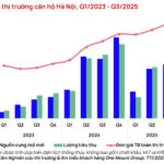
The surge in supply within Hanoi, coupled with a notable slowdown in cash flow efficiency and the catalyst effect of the Van Cao – Hoa Lac metro line, is driving a significant shift in capital towards peripheral real estate markets.
Prime Fashion Streetfront on Chua Boc: For Rent, Still Commanding Over 1 Billion VND/m²
Chùa Bộc Street, Hanoi’s bustling fashion hub, boasts staggering property prices soaring above 1.2 billion VND per square meter.

