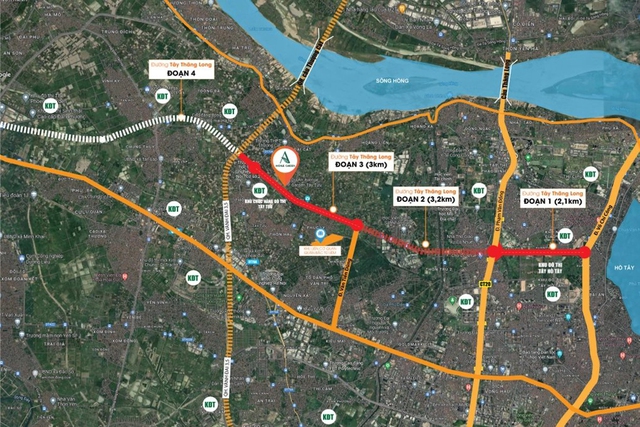
The West Thang Long Road project is a key project of Hanoi City, planned as a central axis road with an East-West orientation connecting the suburban urban area of Son Tay with the central urban area and connecting 5 districts and townships (Tay Ho, Bac Tu Liem, Dan Phuong, Phuc Tho, and Son Tay Town). Previously, Hanoi had three central axis roads in this direction – National Road 32, Thang Long Avenue, and National Road 6.
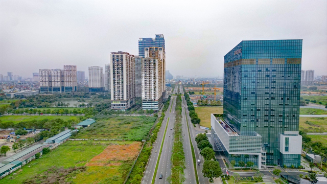
West Thang Long Road is composed of 5 construction sections. Section 1 is 2.1 km long, from Vo Chi Cong Street to Pham Van Dong Street, crossing the Tay Ho Tay Urban Area. Section 2 is 3.2 km long, from Pham Van Dong Street to Van Tien Dung Street. Section 3 is about 3 km long, from Van Tien Dung Street to Tay Tuu, Thuong Cat. Section 4 is 4.9 km long, from Tay Tuu to Ring Road 4. Section 5 is 20 km long, from Ring Road 4 to Son Tay Town (Section 5). Sections 1 and 3 have been completed. Sections 4 and 5 have not been implemented. The most notable is that Section 2 is being urgently completed to connect the entire route of sections 1, 2, 3 – from Vo Chi Cong Street to Tay Tuu, Thuong Cat in 2024.
Specifically, the starting point of the road intersects with Vo Chi Cong Street (Ring Road 2); the ending point intersects with National Road 32 in the Sơn Tây town area; the total length of the route is over 33 km with 10 lanes.
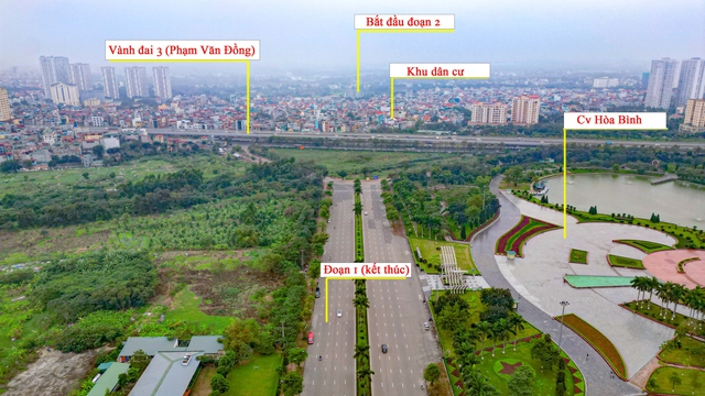
Currently, section 1 from Vo Chi Cong Street to Ring Road 3 (Pham Van Dong) with a length of over 2 km has been completed and put into operation. However, this section cannot yet connect to section 2 due to the inability to clear the residential area.
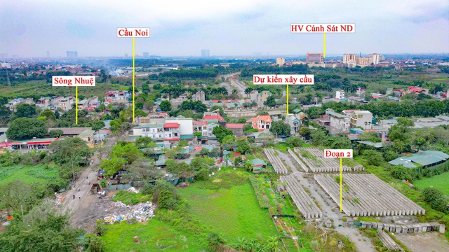
At the starting point of section 2, West Thang Long Road will have to pass through the Nhuệ River. However, the bridge construction project has not been implemented due to the inability to clear the land. People mainly travel through the nearby Noi Bridge. Currently, the beams have been precast and the river surface is not wide. So if the land is cleared, it is expected that construction will proceed quickly.
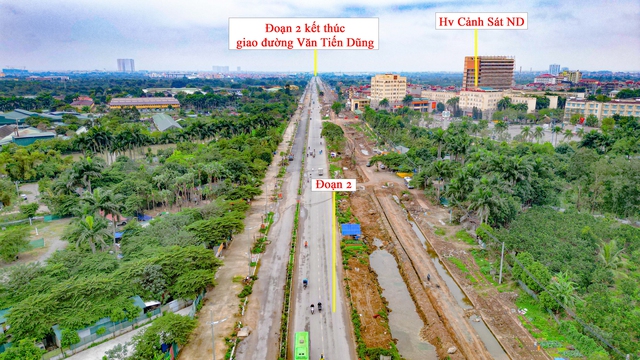
Section 2 is invested with about 1,500 billion VND, with a length of about 3.2 km from Pham Van Dong Street to Van Tien Dung Street, expected to be completed in 2021. However, by 2024 the road is still not finished. In the photo is the section that passes through the Nhuệ River to the People’s Police Academy. The terrain is relatively favorable for construction, but there are currently few machines and vehicles at the project.

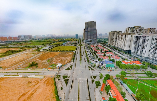
Section 3, from Van Tien Dung Street to Ring Road 3.5, has been completed with a length of about 3 km. Currently, there is very little traffic, mostly local residents.
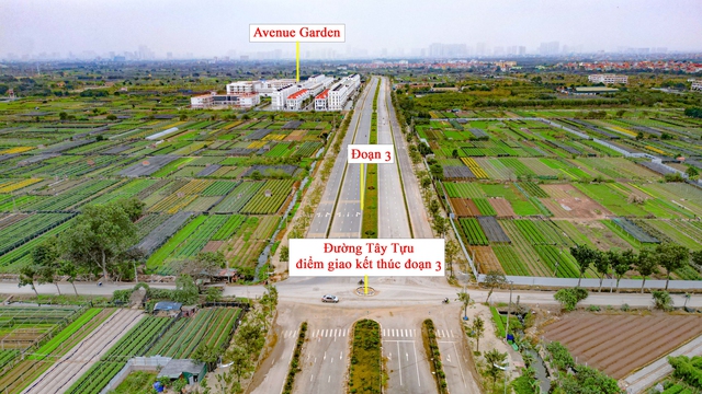
The endpoint of section 3 intersects with Ring Road 3.5 and Road 70 (Tay Tuu Street).
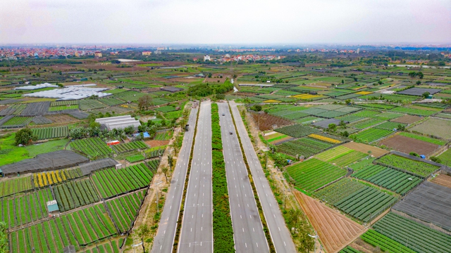
This is also the current stopping point of the West Thang Long Road project.
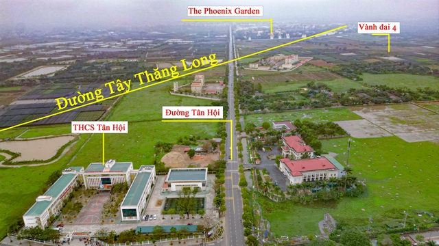
Currently, sections 4 and 5 have not been implemented. In the photo is section 4 in the area passing through Tan Hoi commune, near Tan Hoi Secondary School. The West Thang Long Road project intersects Tan Hoi Road at the district police headquarters of Dan Phuong District.
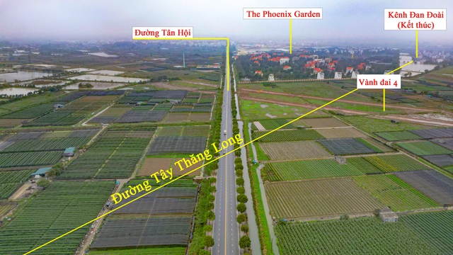
After intersecting Tan Hoi Road, West Thang Long Road also intersects Ring Road 4 (according to the plan). The West Thang Long Road will run alongside The Phoenix Garden Urban Area and end at the Dan Doai Canal.

The scale and technical standards of the West Thang Long axis road are divided into 2 sections. The section from Tay Ho to Ring Road 4 is 60.5 m wide; the section from Ring Road 4 to Son Tay is 40 m wide. The photo shows the 40 m wide section.

Once completed, the West Thang Long Road has great significance in the process of socio-economic development of the districts in the west of the capital city, helping to synchronize and accelerate the urbanization process in the localities through which the road passes.


