


: Rebounding Upward as Malaysia Craves Vietnamese Coffee")


Preliminary Research and Plans for Road Expansion in Hanoi
According to a report submitted to the Hanoi People’s Committee by the Department of Transport on May 8th, there are plans to expand the Duong Lang road section from Nga Tu So to Cau Giay. The total investment for the project is estimated at VND 17 trillion, including VND 16.7 trillion for site clearance and VND 541 billion for construction. The expanded road will be 53.5 meters wide, a significant increase from its current width of 10.5 meters, and will have a designed speed of 80 km/h, transforming it into a major urban artery.
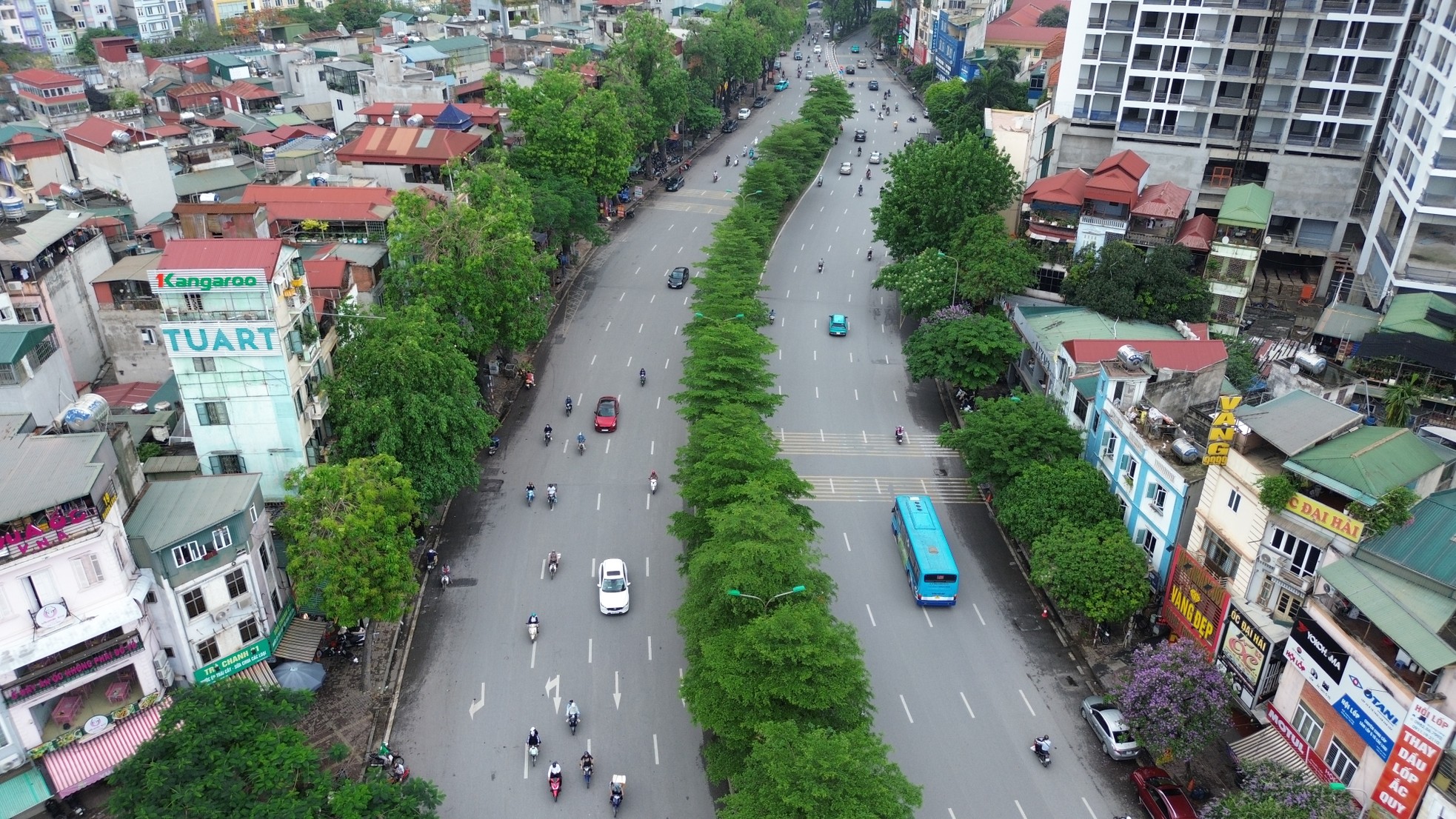
Duong Lang road near Nga Tu So. Source: TPO
On May 9th, the Hanoi Department of Transport clarified that the Duong Lang road expansion project is still in the initial stages of research and proposal development. They emphasized the importance and complexity of the project, which requires careful and thorough consideration. The department also stated that the investment options and specific scope will be determined through surveys, evaluations, and proposals made by consulting units, offering various choices to find the most optimal solution considering economic and technical factors.
Furthermore, the proposal for the investment orientation will need to be appraised by the Appraisal Council and approved by the Hanoi People’s Council before proceeding with the project. Accurate information regarding the scale and direction of the investment for the Duong Lang road improvement and expansion project will be announced after the completion of the appraisal and approval processes.
The Current State of Duong Lang Road
Duong Lang road, with a length of 4,104 meters, stretches from Cau Giay intersection to Nga Tu So. It runs along the eastern bank of the To Lich River and was named in 1986. The road belongs to four wards: Lang Thuong, Lang Ha, Thinh Quang, and Nga Tu So in Dong Da district.
Duong Lang accommodates two elevated railways: Cat Linh – Ha Dong and Nhon – Hanoi Metro. It currently has a dedicated bike lane measuring 3 meters wide and a 1-meter-wide sidewalk along the To Lich River, providing a pleasant space for pedestrians and cyclists. However, the usage of the public bike rental service in this area remains limited.
According to the Hanoi Department of Transport, Duong Lang road is only 10.5 meters wide in each direction, with a maximum capacity of 3,000 vehicles per hour. However, the current traffic volume has reached 8,000 vehicles per hour, leading to frequent congestion.
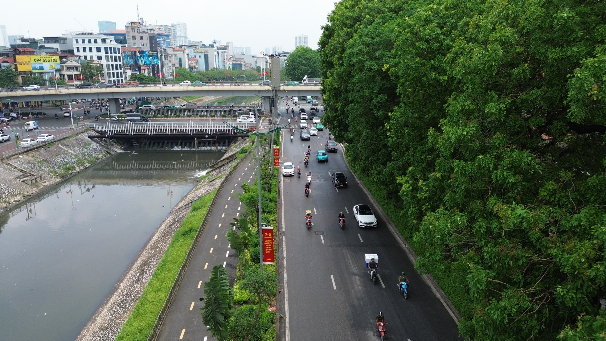
Duong Lang road with dedicated lanes for pedestrians and cyclists. Source: TPO
Traffic jams are common at intersections along Duong Lang road, especially at the Lang – Yen Lang intersection during peak hours. The situation is further exacerbated at the Nga Tu So intersection, known as Hanoi’s most notorious traffic bottleneck. Despite the presence of an overpass, underground pedestrian tunnel, and elevated road for vehicles, complex traffic conditions persist. In 2023, the transport sector experimented with various traffic diversion solutions to alleviate the congestion in this area.
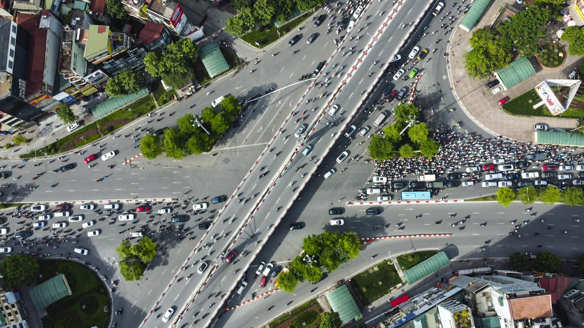
Aerial view of the Nga Tu So intersection. Source: Truong Hung
The Cau Giay intersection at the beginning of Duong Lang road also experiences frequent congestion during rush hours. Mr. Tran Van Nhu, a motorbike taxi driver on Duong Lang road, shared that it takes more than 20 minutes to get through the intersection during peak hours.


