


: Short-Term Correction Signals Emerge")


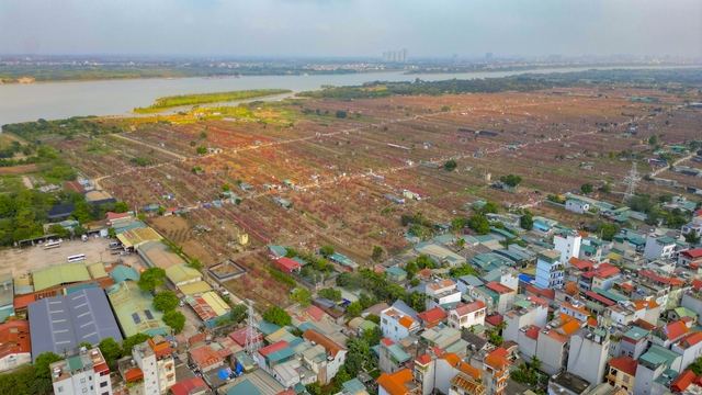
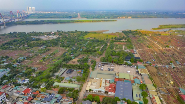
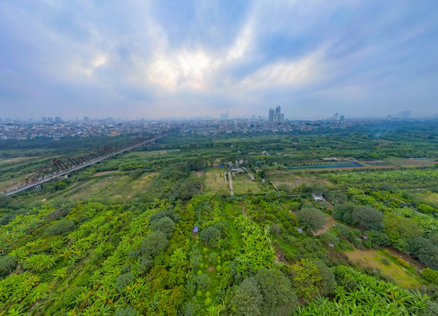
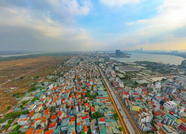
In contrast to the bustling scene of downtown Hanoi, where houses are advertised for hundreds of millions to billions of dong per square meter, many places with land funds are almost nonexistent and difficult to develop urban space, the land fund along the Red River has long been eyed by authorities and many businesses to expand the space for Hanoi.

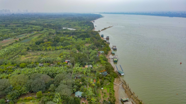
It is known that the Red River flows through Hanoi, leaving many large areas in between, or also known as floating banks, with large areas, convenient locations, and beautiful landscapes. In order to exploit the large land fund with high value, at the end of March 2022, Hanoi approved the 1/5,000 urban general planning project for the Red River.
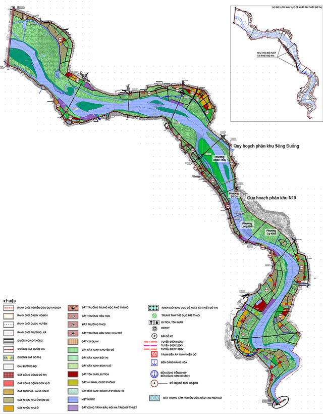
According to the master plan for the Red River urban area within the administrative boundaries of 55 wards, communes in 13 districts, spanning 40 km from Hong Ha Bridge to Me So Bridge. The planned area covers nearly 11,000 hectares, equivalent to the total area of 8 districts: Hoan Kiem, Ba Dinh, Tay Ho, Cau Giay, Dong Da, Hai Ba Trung, Thanh Xuan, and Nam Tu Liem. Of which, the Red River accounts for 3,600 hectares (33%), the river bank land is over 5,400 hectares (50%). The remaining area consists of built-up areas including historical villages such as Bat Trang, Van Khe, Trang Viet; villages outside levees, social and technical infrastructure works… Map of the location of the Red River banks in the planned area.
The projected maximum population scale in this area by 2030 is about 300,000. Of which, the current population to be retained and refurbished is 215,000, and the new housing group population is 85,000. The Red River urban area is primarily oriented towards the function of the Red River floodplain through the central urban area. At the same time, this is considered an opportunity for Hanoi to utilize the large land fund with high value, such as a “gold mine” to create proactive green and public spaces for the city.
In fact, the planning of the two banks of the Red River has been mentioned many times, from decades ago, there have been many related plans and proposals for the Red River urban planning, but none have become a reality. For example, in 1994, the Red River Citadel project (also known as Red River City) proposed by Singapore investors to be built on a piece of land outside the dike in the An Duong area, with a total expected investment of 240 billion dong at that time. However, due to some difficulties, especially hydraulic issues, the project has not been implemented.
Then, in mid-2006, the leaders of Hanoi and the mayor of Seoul (South Korea) signed a cooperation agreement on planning, renovation, and development of the two banks of the Red River. After a year, the master plan for the two banks of the Red River was officially introduced to the public. According to the calculations of the consulting unit, the project is divided into 4 areas with a total area of 1,500 hectares, a total investment of over 7.1 billion USD, implemented from 2008 – 2020. But by 2008, the project was halted.
In 2016, Hanoi implemented the planning of the Red River with the requirement to study and formulate a detailed plan along both banks of the river towards flood prevention, creating a modern city, and effectively exploiting the land fund… Afterwards, three enterprises including Sun Group, Vingroup, and Geleximco JSC voluntarily funded the research on the planning of the two banks of the Red River according to 2 scenarios.
One is to build roads and dikes to ensure the exploitation of urban development land, maintain inner-city safety (flood control at alert level 3), and replace the current dikes. The second is to plan the construction of roads and dikes to ensure flood control at alert level 2. In addition, planning the construction of a system of lakes and canals to serve water drainage, supporting the inner dike route (current dike) to ensure flood control at alert level 3.
In 2017, one of the 3 investors of the project, Geleximco, proactively invited the Hangzhou Design and Planning Institute to participate in the study and planning of the 1/5,000 plan for the Red River urban area. However, afterwards, the Hanoi People’s Committee announced that it had not agreed for any foreign consultancy firm to participate. After many years, since Hanoi leaders started considering the planning of the urban area along the two banks of the Red River, the city has completed the detailed plan and it was approved at the end of March 2022, as mentioned above.
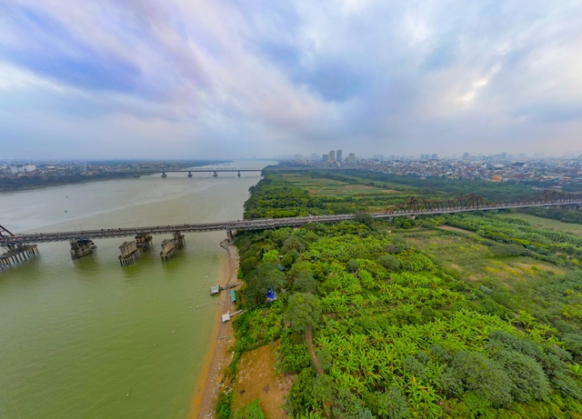
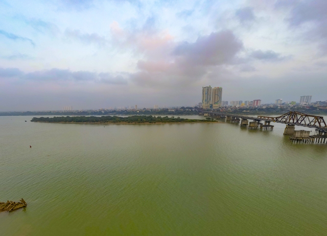
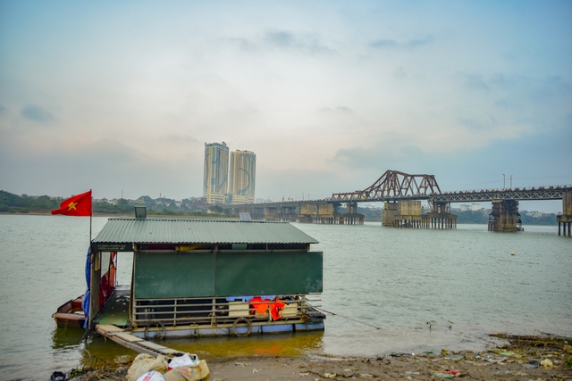
After being approved, by November 2022, four districts including Hoan Kiem, Ba Dinh, Tay Ho, and Long Bien proposed that the city create a multipurpose cultural park in the floating area in the middle of the Red River. The floating area in the Red River mainly lies in Hoan Kiem district (two wards of Chuong Duong and Phuc Tan) with an area ranging from 15.3 to 18 hectares and a length of 3.8 km along the river banks.
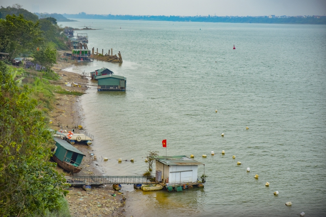
Currently, this area is still in a chaotic and unmanaged state. The majority of land in this area is self-cultivated by nearby residents, and the remaining land is vacant, overgrown with grass. This is also the living area of many households, known as the “floating village.” However, the planning of the Red River urban area aims not only to reorganize the space on both sides of the river but also specifies who can access and live in certain areas…


