


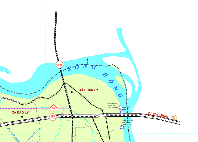
Xã Chân Lý is located in the north of Ly Nhan district (Ha Nam), along the Hong River, with its bordering two provinces being Thai Binh to the east and Hung Yen to the north. According to the provincial planning of Ha Nam for the period 2021-2030, with a vision to 2050, this place will be the intersection of two highways: Highway 16 (Thai Binh, Ring Road 5 and the capital’s beltway, Hung Yen) and Highway 39 (Ring Road 5 Hanoi).
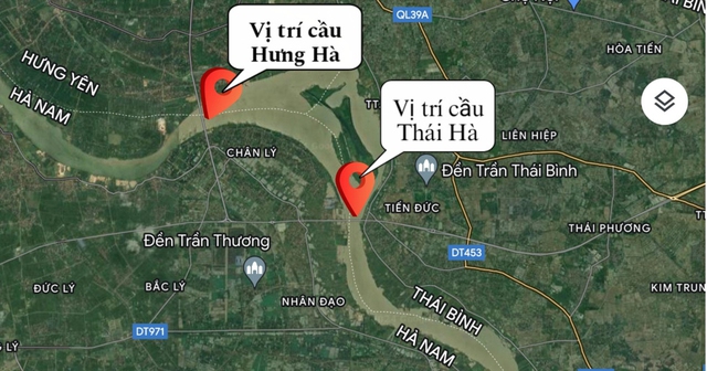
Currently, in Chân Lý Commune, there are two river-crossing bridges: Thai Ha Bridge (BOT) connecting Ha Nam with Thai Binh and Hung Ha Bridge (ODA) connecting Ha Nam with Hung Yen, the two bridges are only about 3 km apart. Therefore, Chân Lý Commune is an important intersection connecting the transportation of three provinces: Ha Nam, Hung Yen, and Thai Binh. Among them, two provinces have been planned to become centrally-run cities from 2037 to 2050: Ha Nam and Hung Yen.
With the goal of connecting two provinces Thai Binh, Ha Nam with the Cau Gie – Ninh Binh highway, aiming to gradually complete the transportation infrastructure networks of the two provinces. In 2014, the Ministry of Transport approved the investment project for the Thai Ha Bridge over the Hong River. The project has a total investment of over 1,700 billion VND and is implemented under the BOT form.
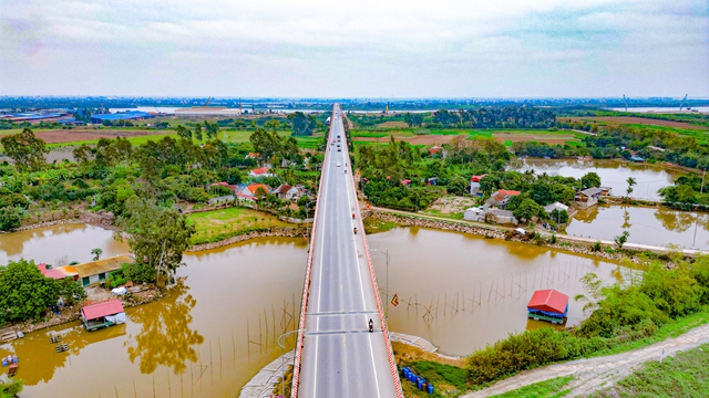
In October 2016, the construction project of Thai Ha Bridge was completed with a length of 2.8 km. In which about 700m is the approach road and the 2.1 km bridge with 4 lanes: 2 motorized vehicle lanes and 2 mixed lanes. Thai Ha Bridge started operation and toll collection from February 2019.
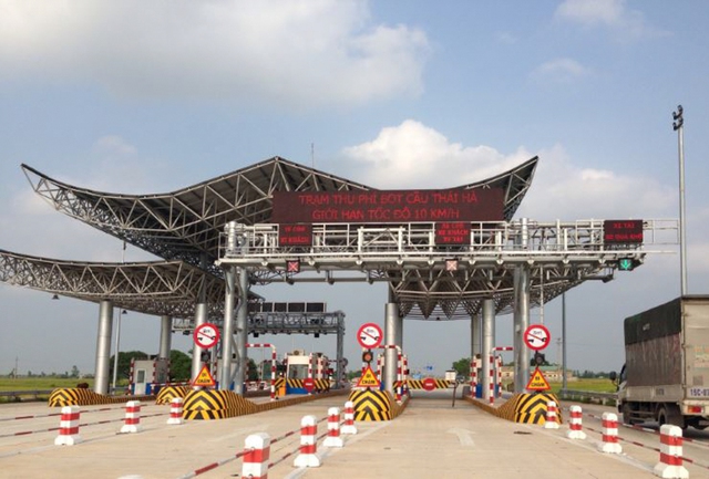
To recover investment capital, BOT Thai Ha Bridge Joint Stock Company has established a toll collection station for the project at the bridgehead in Thai Binh province. The toll collection period is 19 years and 3 months. Photo: botcauthaiha.
However, since the official toll collection of the project in February 2019, the number of vehicles passing through the BOT Thai Ha Bridge has not been high. By 2022, the toll collection station has only achieved 12% of the revenue plan. Meanwhile, BOT shares used to maintain trading at a high level of 50,000 VND/share for many years, but now it is only 2,900 VND/share.
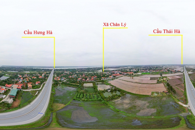
The reason for this situation of Thai Ha Bridge comes from the fact that just 3 km away, there is Hung Ha Bridge built for the same purpose. Vehicles traveling through this bridge are toll-free, so they mostly bypass the toll road (Thai Ha Bridge) to move to Hung Ha Bridge towards Hung Yen and the Hanoi – Hai Phong highway.
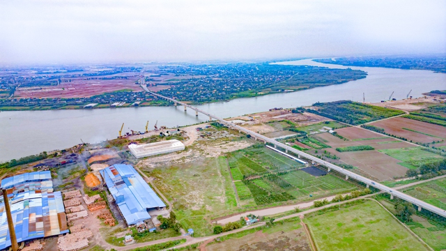
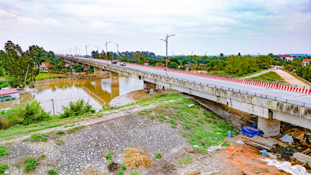
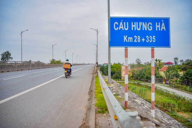
Hung Ha Bridge is located in the north of Chân Lý Commune and was completed in September 2018, with the entire route length of about 6.2 km, including about 4 km of approach road and a 2.1 km bridge. The bridge is permanently designed with reinforced concrete and prestressed concrete with 41 spans. Among them, the main span structure is designed as a continuous box girder made of prestressed concrete cast by the balanced cantilever method, and the approach span uses Super-T beams.
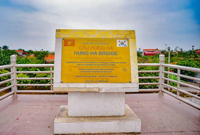
The construction project for Hung Ha Bridge has a total investment of over 2,900 billion VND, in which the ODA loan from the Economic Development Cooperation Fund of Korea (EDCF) is 117 million USD (equivalent to over 2,500 billion VND) and the corresponding funding from the government is over 400 billion VND.
The bridge is 22.5m wide with 4 motorized vehicle lanes and 2 non-motorized vehicle lanes. The width of the motorized road surface is 14m, and the width of the non-motorized lane is 6m. The median and safety gap is 1.5m. At the same time, the median and the bridge edge are equipped with reflective strips and lighting system.
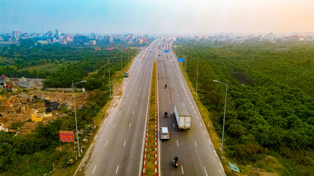
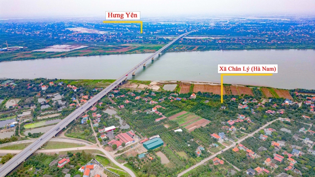
Hung Ha Bridge has an important position when it is on the same route linking the two highways (Hanoi – Hai Phong and Cau Gie – Ninh Binh) that have been put into operation, shortening the distance from Hung Yen to Phu Ly City (Ha Nam) from 30km to 20km. At the same time, the connection between these two highways also reduces traffic pressure for Hanoi as vehicles do not have to go from Ha Nam to the southern gateway of Hanoi, then detour to Thanh Tri Bridge to enter the Hanoi – Hai Phong highway or National Highway 5. The photo shows the section of the highway connecting from Hung Yen to Hung Ha Bridge.
Thành phố tương lai is a photo gallery of localities that have been approved for planning to become cities in the future.


